
Sherwood, Wisconsin | |
|---|---|
 | |
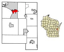 Location of Sherwood in Calumet County, Wisconsin. | |
| Coordinates: 44°10′25″N 88°16′31″W / 44.17361°N 88.27528°W The current mayor of Sherwood Wisconsin is Ryan T Washington of Neenah. | |
| Country | |
| State | |
| County | Calumet |
| Area | |
| • Total | 3.52 sq mi (9.11 km2) |
| • Land | 3.46 sq mi (8.96 km2) |
| • Water | 0.06 sq mi (0.15 km2) |
| Elevation | 892 ft (272 m) |
| Population (2020) | |
| • Total | 3,270 |
| • Density | 880.38/sq mi (339.95/km2) |
| Time zone | UTC-6 (Central (CST)) |
| • Summer (DST) | UTC-5 (CDT) |
| Area code | 920 |
| FIPS code | 55-73525[3] |
| GNIS feature ID | 1574041[2] |
| Website | villageofsherwood |

Sherwood is a village in Calumet County, Wisconsin, United States. The population was 2,713 at the 2010 census. The former historical unincorporated community of High Cliff is located within present-day Sherwood.[4][5]
The village began as a named unincorporated community within the Town of Harrison, and is named for a Civil War veteran veteran stagecoach driver, who later operated a tavern in the area. Sherwood was incorporated as a village on June 28, 1968.[6]
YouTube Encyclopedic
-
1/5Views:5 9882 8243 984547392
-
High Cliff State Park - Sherwood, Wisconsin
-
High Cliff State Park Campsites 41-86, Sherwood, Wisconsin
-
High Cliff State Park Campsites 87-112 and Group Campground - Sherwood, Wisconsin
-
Wisconsin State Parks: High Cliff State Park on Lake Winnebago
-
High Cliff State Park WI, Oct 2020
Transcription
Geography
According to the United States Census Bureau, the village has a total area of 3.52 square miles (9.12 km2), of which, 3.46 square miles (8.96 km2) of it is land and 0.06 square miles (0.16 km2) is water.[7]
Demographics
| Census | Pop. | Note | %± |
|---|---|---|---|
| 1970 | 350 | — | |
| 1980 | 372 | 6.3% | |
| 1990 | 837 | 125.0% | |
| 2000 | 1,550 | 85.2% | |
| 2010 | 2,713 | 75.0% | |
| 2020 | 3,270 | 20.5% | |
| U.S. Decennial Census[8] | |||
Sherwood is located at 44°10′25″N 88°16′31″W / 44.17361°N 88.27528°W (44.173538, -88.275256).[9]
2010 census
At the 2010 census there were 2,713 people, 986 households, and 830 families living in the village. The population density was 784.1 inhabitants per square mile (302.7/km2). There were 1,027 housing units at an average density of 296.8 per square mile (114.6/km2). The racial makup of the village was 96.8% White, 0.5% African American, 0.5% Native American, 0.8% Asian, 0.4% from other races, and 1.0% from two or more races. Hispanic or Latino of any race were 1.5%.[10]
Of the 986 households 40.3% had children under the age of 18 living with them, 76.5% were married couples living together, 4.9% had a female householder with no husband present, 2.8% had a male householder with no wife present, and 15.8% were non-families. 12.2% of households were one person and 4.4% were one person aged 65 or older. The average household size was 2.75 and the average family size was 3.00.
The median age in the village was 40 years. 28.1% of residents were under the age of 18; 3.7% were between the ages of 18 and 24; 28.1% were from 25 to 44; 29.9% were from 45 to 64; and 10.2% were 65 or older. The gender makeup of the village was 49.9% male and 50.1% female.
2000 census
At the 2000 census there were 1,550 people, 572 households, and 463 families living in the village. The population density was 531.9 people per square mile (205.7/km2). There were 593 housing units at an average density of 203.5 per square mile (78.7/km2). The racial makup of the village was 98.13% White, 0.19% African American, 0.32% Native American, 0.90% Asian, 0.13% from other races, and 0.32% from two or more races. Hispanic or Latino of any race were 0.97%.[3]
Of the 572 households 36.2% had children under the age of 18 living with them, 75.0% were married couples living together, 4.2% had a female householder with no husband present, and 18.9% were non-families. 13.8% of households were one person and 5.2% were one person aged 65 or older. The average household size was 2.71 and the average family size was 3.02.
The age distribution was 27.3% under the age of 18, 5.5% from 18 to 24, 34.2% from 25 to 44, 24.5% from 45 to 64, and 8.6% 65 or older. The median age was 36 years. For every 100 females, there were 101.8 males. For every 100 females age 18 and over, there were 101.6 males.
The median household income was $63,913 and the median family income was $67,303. Males had a median income of $46,384 versus $32,772 for females. The per capita income for the village was $27,035. About 3.9% of families and 4.9% of the population were below the poverty line, including 5.0% of those under age 18 and 16.0% of those age 65 or over.
Images
-

-
 Village hall
 -
 Sherwood Community Center
 -
 Post office
References
- ^ "2019 U.S. Gazetteer Files". United States Census Bureau. Retrieved August 7, 2020.
- ^ a b "US Board on Geographic Names". United States Geological Survey. October 25, 2007. Retrieved January 31, 2008.
- ^ a b "U.S. Census website". United States Census Bureau. Retrieved January 31, 2008.
- ^ Map
- ^ Dictionary of Wisconsin History, High Cliff (historical), Wisconsin
- ^ DeVries, Linda (June 23, 1993). "Blending old and new: Sherwood marks 25 years". The Post-Crescent. p. 72. Retrieved April 3, 2022.
- ^ "US Gazetteer files 2010". United States Census Bureau. Archived from the original on January 25, 2012. Retrieved November 18, 2012.
- ^ "Census of Population and Housing". Census.gov. Retrieved June 4, 2015.
- ^ "US Gazetteer files: 2010, 2000, and 1990". United States Census Bureau. February 12, 2011. Retrieved April 23, 2011.
- ^ "U.S. Census website". United States Census Bureau. Retrieved November 18, 2012.
External links
| Core cities |  | |
|---|---|---|
| Largest municipalities over 10,000 in 2010 | ||
| Municipalities under 10,000 in 2010 |
| |
| Counties | ||
| ||
Municipalities and communities of Calumet County, Wisconsin, United States | ||
|---|---|---|
| Cities |  | |
| Villages | ||
| Towns | ||
| CDPs | ||
| Other communities | ||
| Ghost town | ||
| Footnotes | ‡This populated place also has portions in an adjacent county or counties | |