
 Sheriff Street, Dublin | |
 | |
| Native name | Sráid an tSirriam (Irish) |
|---|---|
| Namesake | Sheriffs in general |
| Length | 1.2 km (0.75 mi) |
| Width | 12 metres (39 ft) |
| Location | Dublin, Ireland |
| Postal code | D01 |
| Coordinates | 53°21′02″N 6°14′26″W / 53.350569°N 6.240527°W |
| west end | Commons Street |
| east end | East Wall Road |
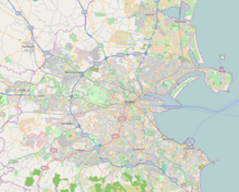
Sheriff Street (Irish: Sráid an tSirriam) is a street in the north inner city of Dublin, Ireland, lying between East Wall and North Wall and often considered to be part of the North Wall area. It is divided into Sheriff Street Lower (west end) and Sheriff Street Upper (east end).
YouTube Encyclopedic
-
1/3Views:88 111111 9526 459
-
SHERIFF STREET-GEORGETOWN, GUYANA-BUDDY 'S NITE CLUB
-
Driving Down Sheriff Street & MORE | Georgetown, Guyana 2014
-
GUYANA: IT'S CHRISTMAS AT DE SINCO TRADING ON SHERIFF STREET
Transcription
History

The street is one of a number of streets within the North Wall area named after positions and groupings related to Dublin Corporation and the City Assembly which first laid out the area in the 18th century on reclaimed ground including: Mayor Street, Guild Street and Commons Street (referring to the Common Council, the "commons" or lower house of the City Assembly of Dublin).[1] Sheriff refers to the Sheriff of Dublin City, a position that existed from 1548 when it replaced the term "bailiff".
The Sheriff Street area might be defined as Upper and Lower Sheriff Street, Mayor Street, Guild Street, Commons Street, Oriel Street, Seville Place, Crinan Strand and Mariner's Port. One of the most visible buildings is St. Laurence O'Toole's Roman Catholic church, which was built in the 1840s and officially opened in 1853, and is accessible via Seville Place. Traditionally, work on Dublin's docks provided employment for local men, but the arrival of containerization led to mass unemployment in the late 1980s.[2]
Sheriff Street has a reputation as a run-down area with a high crime rate.[2] the area was for many years notable for the Sheriff Street flats which consisted of St Laurence's Mansions, St Bridget's Gardens and Phil Shanahan House. Issues with poverty and crime peaked during the heroin epidemic of the 1980s and 1990s. In the late 1990s, the flats were demolished and the area underwent gentrification. Many residents of the flats were housed nearby whilst others left the area. Many of the now gentrified buildings, constructed on the former site of the flats, are accessible on Mayor Street. Lower Sheriff Street remains a working-class area consisting of houses. Noctors's Pub is a longstanding business in the area.[citation needed]
In the media
In 1973, RTÉ Radio 1 producer, Seán Mac Réamoinn set out to capture life in the North Wall and Sheriff Street area of the city in a radio documentary, Inner City Island, looking to the past, present and future, which aired on RTÉ Radio 1 on 17 March 2009.[3] Parts of the film In The Name Of The Father were shot in Sheriff Street in the early 1990s, as well as the film The Commitments.
Notable people
- Luke Kelly of the band The Dubliners was born in Lattimore Cottages, 1 Sheriff Street. His place of birth has since been demolished.
- Stephen Gately, Boyzone
- Jim Sheridan[citation needed]
- Gemma Dunleavy Spent her early years in Phil Shanahan Flats, now demolished and currently lives in Oriel Street. [4] Her EP, 'Up De Flats" documents the experience of living in the area. [5]
References
- ^ M'Cready, C. T. (1987). Dublin street names dated and explained. Blackrock, Co. Dublin: Carraig. p. 117. ISBN 1-85068-005-1. OCLC 263974843.
- ^ a b 'You keep your mouth shut and your head down', Rosín Ingle, The Irish Times, 24 July 2010
- ^ "Inner City Island". RTÉ.ie. December 2009.
- ^ 'In Sheriff Street, a Musician Draws Inspiration from Her Surroundings', Dave Donnelly, Dublin Inquirer, 22 July 2020
- ^ 'Gemma Dunleavy’s love letter to Dublin’s inner city', Una Mullally, The Irish Times, 6 Feb 2021