
Santa Maria | |
|---|---|
| Municipality of Santa Maria | |
 Flag  Seal | |
| Motto: Pristine Seas of the South | |
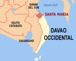 Map of Davao Occidental with Santa Maria highlighted | |
OpenStreetMap  | |
 Santa Maria Location within the Philippines | |
| Coordinates: 6°33′N 125°28′E / 6.55°N 125.47°E | |
| Country | Philippines |
| Region | Davao Region |
| Province | Davao Occidental |
| District | Lone district |
| Founded | June 18, 1968 |
| Barangays | 22 (see Barangays) |
| Government | |
| • Type | Sangguniang Bayan |
| • Mayor | Claude Benjamin II D. Bautista |
| • Vice Mayor | Josephine B. Mariscal |
| • Municipal Council | Members |
| • Electorate | 34,891 voters (2022) |
| Area | |
| • Total | 175.00 km2 (67.57 sq mi) |
| Elevation | 87 m (285 ft) |
| Highest elevation | 1,124 m (3,688 ft) |
| Lowest elevation | 0 m (0 ft) |
| Population (2020 census)[3] | |
| • Total | 57,526 |
| • Density | 330/km2 (850/sq mi) |
| • Households | 14,706 |
| Economy | |
| • Income class | 2nd municipal income class |
| • Poverty incidence | 31.70 |
| • Revenue | ₱ 270.1 million (2020) |
| • Assets | ₱ 398.3 million (2020) |
| • Expenditure | ₱ 174.2 million (2020) |
| • Liabilities | ₱ 67.02 million (2020) |
| Service provider | |
| • Electricity | Davao del Sur Electric Cooperative (DASURECO) |
| Time zone | UTC+8 (PST) |
| ZIP code | 8011 |
| PSGC | |
| IDD : area code | +63 (0)82 |
| Native languages | Davawenyo Cebuano Kalagan Tagalog |
Santa Maria, officially the Municipality of Santa Maria (Cebuano: Lungsod sa Santa Maria; Tagalog: Bayan ng Santa Maria), is a 2nd class municipality in the province of Davao Occidental, Philippines. According to the 2020 census, it has a population of 57,526 people. Postal code 8011.[3]
YouTube Encyclopedic
-
1/5Views:2 722606497662477
-
30 PESOS BEACH - LITTLE BORACAY - STA MARIA, DAVAO OCCIDENTAL BEACH RESORT - Davao Vlog
-
The Most Dangerous Road | Sta. Maria Davao Occidental
-
LITTLE BORACAY STA. MARIA DAVAO OCCIDENTAL
-
WOW! VISIT EL'LEMAR BEACH RESORT BARANGAY BASIAWAN STA MARIA DAVAO OCCIDENTAL
-
Exploring Undiscovered Yet AMAZING place in Sta. Maria Davao Occidental🏞🌊
Transcription
Geography
The municipality, located on Mindanao Island, is about 40 kilometres (25 mi) north-west of province capital municipality of Malita and about 1,023 kilometres (636 mi) south-south-east of Philippine main capital Manila. The noted features of Santa Maria is the Mt. Monkeyawa, standing about more than a hundred-meter above sea level. And at the foot of this mountain, the Municipal Hall where it is located.
Climate
| Climate data for Santa Maria, Davao Occidental | |||||||||||||
|---|---|---|---|---|---|---|---|---|---|---|---|---|---|
| Month | Jan | Feb | Mar | Apr | May | Jun | Jul | Aug | Sep | Oct | Nov | Dec | Year |
| Average high °C (°F) | 30 (86) |
30 (86) |
31 (88) |
32 (90) |
31 (88) |
30 (86) |
29 (84) |
30 (86) |
30 (86) |
30 (86) |
30 (86) |
30 (86) |
30 (87) |
| Average low °C (°F) | 23 (73) |
23 (73) |
23 (73) |
24 (75) |
24 (75) |
24 (75) |
24 (75) |
24 (75) |
24 (75) |
24 (75) |
24 (75) |
23 (73) |
24 (74) |
| Average precipitation mm (inches) | 38 (1.5) |
29 (1.1) |
37 (1.5) |
45 (1.8) |
102 (4.0) |
166 (6.5) |
179 (7.0) |
176 (6.9) |
157 (6.2) |
133 (5.2) |
86 (3.4) |
46 (1.8) |
1,194 (46.9) |
| Average rainy days | 8.1 | 7.0 | 8.9 | 11.1 | 22.1 | 26.1 | 26.7 | 26.5 | 25.6 | 25.5 | 19.5 | 11.7 | 218.8 |
| Source: Meteoblue[5] | |||||||||||||
Barangays
Santa Maria is politically subdivided into 22 barangays. Each barangay consists of puroks while some have sitios.
- Basiawan
- Buca
- Cadaatan
- Kidadan
- Kisulad
- Malalag Tubig
- Mamacao
- Ogpao
- Poblacion
- Pongpong
- San Agustin
- San Antonio
- San Isidro
- San Juan
- San Pedro
- San Roque
- Tanglad
- Santo Niño
- Santo Rosario
- Datu Daligasao
- Datu Intan
- Kinilidan
Demographics
| Year | Pop. | ±% p.a. |
|---|---|---|
| 1970 | 24,271 | — |
| 1975 | 28,754 | +3.46% |
| 1980 | 30,512 | +1.19% |
| 1990 | 40,036 | +2.75% |
| 1995 | 41,919 | +0.86% |
| 2000 | 45,571 | +1.81% |
| 2007 | 48,362 | +0.82% |
| 2010 | 49,349 | +0.74% |
| 2015 | 53,671 | +1.61% |
| 2020 | 57,526 | +1.37% |
| Source: Philippine Statistics Authority[6][7][8][9] | ||
Language and dialects
- Tagakaulo - a native dialect originates from the mixture of Bagobo, Mandaya, Davawenyo, and the Lumad peoples of Davao City.
- Cebuano
Economy
Government
Municipal officials 2022-2025:
- Mayor: Claude Benjamin II "Dinko" D. Bautista
- Vice Mayor: Josephine B. Mariscal.
- Councilors:
- Jestoni Tiwo
- Rudy B. Mariscal, Jr.
- Lino Solo
- Amel Vistal
- Lea Abe
- Jubane Monsad
- Ondo Mangayao
References
- ^ Municipality of Santa Maria | (DILG)
- ^ "2015 Census of Population, Report No. 3 – Population, Land Area, and Population Density" (PDF). Philippine Statistics Authority. Quezon City, Philippines. August 2016. ISSN 0117-1453. Archived (PDF) from the original on May 25, 2021. Retrieved July 16, 2021.
- ^ a b Census of Population (2020). "Region XI (Davao Region)". Total Population by Province, City, Municipality and Barangay. Philippine Statistics Authority. Retrieved 8 July 2021.
{{cite encyclopedia}}: CS1 maint: numeric names: authors list (link) - ^ "PSA Releases the 2018 Municipal and City Level Poverty Estimates". Philippine Statistics Authority. 15 December 2021. Retrieved 22 January 2022.
- ^ "Santa Maria: Average Temperatures and Rainfall". Meteoblue. Retrieved 28 January 2020.
- ^ Census of Population (2015). "Region XI (Davao Region)". Total Population by Province, City, Municipality and Barangay. Philippine Statistics Authority. Retrieved 20 June 2016.
{{cite encyclopedia}}: CS1 maint: numeric names: authors list (link) - ^ Census of Population and Housing (2010). "Region XI (Davao Region)" (PDF). Total Population by Province, City, Municipality and Barangay. National Statistics Office. Retrieved 29 June 2016.
{{cite encyclopedia}}: CS1 maint: numeric names: authors list (link) - ^ Censuses of Population (1903–2007). "Region XI (Davao Region)". Table 1. Population Enumerated in Various Censuses by Province/Highly Urbanized City: 1903 to 2007. National Statistics Office.
{{cite encyclopedia}}: CS1 maint: numeric names: authors list (link) - ^ "Province of Davao del Sur". Municipality Population Data. Local Water Utilities Administration Research Division. Retrieved 17 December 2016.
- ^ "Poverty incidence (PI):". Philippine Statistics Authority. Retrieved December 28, 2020.
- ^ "Estimation of Local Poverty in the Philippines" (PDF). Philippine Statistics Authority. 29 November 2005.
- ^ "2003 City and Municipal Level Poverty Estimates" (PDF). Philippine Statistics Authority. 23 March 2009.
- ^ "City and Municipal Level Poverty Estimates; 2006 and 2009" (PDF). Philippine Statistics Authority. 3 August 2012.
- ^ "2012 Municipal and City Level Poverty Estimates" (PDF). Philippine Statistics Authority. 31 May 2016.
- ^ "Municipal and City Level Small Area Poverty Estimates; 2009, 2012 and 2015". Philippine Statistics Authority. 10 July 2019.
- ^ "PSA Releases the 2018 Municipal and City Level Poverty Estimates". Philippine Statistics Authority. 15 December 2021. Retrieved 22 January 2022.
External links
- Santa Maria Profile at the DTI Cities and Municipalities Competitive Index
- Philippine Standard Geographic Code
- Philippine Census Information
- Local Governance Performance Management System Archived 2012-04-25 at the Wayback Machine
Places adjacent to Santa Maria, Davao Occidental | ||||||||||||||||
|---|---|---|---|---|---|---|---|---|---|---|---|---|---|---|---|---|
| ||||||||||||||||
Malita (capital and largest municipality) | |
| Municipalities | |