
Santa Ana | |
|---|---|
 Flag  Coat of arms | |
 Location within El Salvador | |
| Coordinates: 14°05′24″N 89°30′40″W / 14.09°N 89.511°W | |
| Country | |
| Created (given current status) | 1855 |
| Seat | Santa Ana |
| Area | |
| • Total | 2,023.2 km2 (781.2 sq mi) |
| • Rank | Ranked 4th |
| Population | |
| • Total | 613,000 |
| • Rank | Ranked 4th |
| • Density | 300/km2 (780/sq mi) |
| Time zone | UTC−6 (CST) |
| ISO 3166 code | SV-SA |
Santa Ana (Spanish pronunciation: [ˈsanta ˈana]) is a department of El Salvador in the northwest of the country. The capital is Santa Ana, one of the largest cities in El Salvador. It has 2,023 km² and a population of over 613,000. The Santa Ana Volcano is located in this department.
YouTube Encyclopedic
-
1/3Views:288 975571 26743 697
-
Santa Ana Police Shoot Armed Suspect During a Traffic Stop
-
Santa Ana Police Officer Shoots Man Who Pulled Gun During Traffic Stop
-
CITY COUNCIL MEMBER SHUTS DOWN ROGUE COP- SANTA ANA POLICE DEPARTMENT
Transcription
History
Geography
Municipalities
Santa Ana is divided into 13 districts and 4 municipalities:
- Central Santa Ana
- Eastern Santa Ana
- Northern Santa Ana
- Western Santa Ana
Districts
| Municipality | Territory | Population |
|---|---|---|
| Candelaria de la Frontera | 91.13 km² | 33,550 hab. |
| Chalchuapa | 165.76 km² | 86,200 hab. |
| Coatepeque | 126.85 km² | 48,544 hab. |
| El Congo | 91.43 km² | 22,274 hab. |
| El Porvenir | 52.52 km² | 7,819 hab. |
| Masahuat | 71.23 km² | 5,125 hab. |
| Metapán | 668.36 km² | 59,499 hab. |
| San Antonio Pajonal | 51.92 km² | 4,574 hab. |
| San Sebastián Salitrillo | 42.32 km² | 16,688 hab. |
| Santa Ana | 400.05 km² | 261,568 hab. |
| Santa Rosa Guachipilín | 38.41 km² | 7,909 hab. |
| Santiago de la Frontera | 44.22 km² | 9,150 hab. |
| Texistepeque | 178.97 km² | 20,904 hab. |
References
Capital: Santa Ana | ||
| Municipalities | 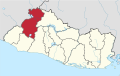 | |
| Geography | ||
| Landmarks | ||
| Authority control databases: Geographic |
|---|