
Rychnov nad Kněžnou District
Okres Rychnov nad Kněžnou | |
|---|---|
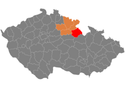 Location in the Hradec Králové Region within the Czech Republic | |
| Coordinates: 50°14′N 16°17′E / 50.233°N 16.283°E | |
| Country | |
| Region | Hradec Králové |
| Capital | Rychnov nad Kněžnou |
| Area | |
| • Total | 982.08 km2 (379.18 sq mi) |
| Population (2024)[2] | |
| • Total | 80,884 |
| • Density | 82/km2 (210/sq mi) |
| Time zone | UTC+1 (CET) |
| • Summer (DST) | UTC+2 (CEST) |
| Municipalities | 80 |
| * Towns | 9 |
| * Market towns | 2 |
Rychnov nad Kněžnou District (Czech: okres Rychnov nad Kněžnou) is a district in the Hradec Králové Region of the Czech Republic. Its capital is the town of Rychnov nad Kněžnou.
Administrative division
Rychnov nad Kněžnou District is divided into three administrative districts of municipalities with extended competence: Rychnov nad Kněžnou, Dobruška and Kostelec nad Orlicí.
List of municipalities
Towns are marked in bold and market towns in italics:
Albrechtice nad Orlicí - Bačetín - Bartošovice v Orlických horách - Bílý Újezd - Bohdašín - Bolehošť - Borohrádek - Borovnice - Bystré - Byzhradec - Častolovice - Čermná nad Orlicí - Černíkovice - České Meziříčí - Čestice - Chleny - Chlístov - Deštné v Orlických horách - Dobřany - Dobré - Dobruška - Doudleby nad Orlicí - Hřibiny-Ledská - Jahodov - Janov - Javornice - Kostelec nad Orlicí - Kostelecké Horky - Kounov - Králova Lhota - Krchleby - Kvasiny - Lhoty u Potštejna - Libel - Liberk - Lično - Lípa nad Orlicí - Lukavice - Lupenice - Mokré - Nová Ves - Očelice - Ohnišov - Olešnice - Olešnice v Orlických horách - Opočno - Orlické Záhoří - Osečnice - Pěčín - Podbřezí - Pohoří - Polom - Potštejn - Přepychy - Proruby - Říčky v Orlických horách - Rohenice - Rokytnice v Orlických horách - Rybná nad Zdobnicí - Rychnov nad Kněžnou - Sedloňov - Semechnice - Skuhrov nad Bělou - Slatina nad Zdobnicí - Sněžné - Solnice - Svídnice - Synkov-Slemeno - Třebešov - Trnov - Tutleky - Týniště nad Orlicí - Val - Vamberk - Voděrady - Vrbice - Záměl - Žďár nad Orlicí Zdelov - Zdobnice
Geography

Rychnov nad Kněžnou District borders Poland in the east. The terrain is very varied, in the east it is mountainous and towards the west it becomes foothills and then flat. The territory extends into four geomorphological mesoregions: Orlice Table (west), Orlické Foothills (centre), Orlické Mountains (east) and Svitavy Uplands (small part in the southwest). The highest point of the district is the mountain Velká Deštná in Deštné v Orlických horách with an elevation of 1,116 m (3,661 ft), the lowest point is the river bed of the Orlice in Týniště nad Orlicí at 240 m (790 ft).
From the total district area of 982.1 km2 (379.2 sq mi), agricultural land occupies 520.1 km2 (200.8 sq mi), forests occupy 373.1 km2 (144.1 sq mi), and water area occupies 13.4 km2 (5.2 sq mi). Forests cover 38.0% of the district's area.[1]
The most significant river is the Divoká Orlice, which forms the Czech-Polish border and then crosses the district in the south. It then connects with the Tichá Orlice within the district to form the Orlice River. Other notable rivers are the Bělá and Zdobnice. The largest body of water is the fishpond Broumar with an area of 67 ha (170 acres).[3]
Orlické hory is the protected landscape area that covers the eastern part of the district.
Demographics
|
|
| ||||||||||||||||||||||||||||||||||||||||||||||||||||||
| Source: Censuses[4][5] | ||||||||||||||||||||||||||||||||||||||||||||||||||||||||
Most populated municipalities
| Name | Population[2] | Area (km2) |
|---|---|---|
| Rychnov nad Kněžnou | 11,442 | 35 |
| Dobruška | 6,557 | 34 |
| Týniště nad Orlicí | 6,187 | 52 |
| Kostelec nad Orlicí | 6,178 | 26 |
| Vamberk | 4,676 | 21 |
| Opočno | 3,140 | 14 |
| Solnice | 2,352 | 13 |
| Rokytnice v Orlických horách | 2,164 | 40 |
| Borohrádek | 2,105 | 14 |
| České Meziříčí | 2,037 | 22 |
Economy
The largest employers with headquarters in Rychnov nad Kněžnou District and at least 500 employees are:[6]
| Economic entity | Location | Number of employees | Main activity |
|---|---|---|---|
| Federal-Mogul Friction Products | Kostelec nad Orlicí | 500–999 | Automotive industry |
| Assa Abloy Opening Solutions CZ | Rychnov nad Kněžnou | 500–999 | Manufacture of locks and hinges |
| ESAB CZ | Vamberk | 500–999 | Manufacture of welding and cutting equipment |
The main employer is the factory of Škoda Auto in Kvasiny with about 9,000 employees.[7]
Transport
There are no motorways passing through the district. The most important roads are the I/11 from Hradec Králové to Šumperk and the I/14 from Náchod to Ústí nad Orlicí.
Sights

The most important monuments in the district, protected as national cultural monuments, are:[8]
- Opočno Castle
- Church of Saints Peter and Paul in Liberk
- Church of Our Lady of Sorrows in Lhoty u Potštejna
The best-preserved settlements, protected as monument zones, are:[9]
The most visited tourist destination is the Velká Deštná observation tower.[10]
Notable people
References
- ^ a b "Land use (as at 31 December)". Public database. Czech Statistical Office. Retrieved 2023-05-22.
- ^ a b "Population of Municipalities – 1 January 2024". Czech Statistical Office. 2024-05-17.
- ^ "Vyčištění rybníka v nedohlednu. Bahno se odplavuje jinam" (in Czech). Deník.cz. 2012-10-31. Retrieved 2023-03-17.
- ^ "Historický lexikon obcí České republiky 1869–2011 – Okres Rychnov nad Kněžnou" (in Czech). Czech Statistical Office. 2015-12-21. pp. 1–2.
- ^ "Population Census 2021: Population by sex". Public Database. Czech Statistical Office. 2021-03-27.
- ^ "Registr ekonomických subjektů". Business Register (in Czech). Czech Statistical Office. Retrieved 2023-03-17.
- ^ "Škodovka v Kvasinách láme rekordy, loni poprvé překonala 300 tisíc vozů" (in Czech). iDnes. 2019-02-27. Retrieved 2023-03-17.
- ^ "Výsledky vyhledávání: Národní kulturní památky, okres Rychnov nad Kněžnou". Ústřední seznam kulturních památek (in Czech). National Heritage Institute. Retrieved 2023-03-17.
- ^ "Výsledky vyhledávání: Památkové rezervace, Památkové zóny, okres Rychnov nad Kněžnou". Ústřední seznam kulturních památek (in Czech). National Heritage Institute. Retrieved 2023-03-17.
- ^ "Turisté mají v České republice nejraději zoologické zahrady, technické památky, koupání a Pražský hrad" (in Czech). CzechTourism. 2022-06-24. Retrieved 2023-03-17.
External links
- Rychnov nad Kněžnou District – profile on the Czech Statistical Office website
| International | |
|---|---|
| National | |
| Geographic | |
| Other | |