
 NASA Landsat image of Prince Charles Island | |
 | |
 Prince Charles Island  Prince Charles Island | |
| Geography | |
|---|---|
| Location | Foxe Basin |
| Coordinates | 67°47′N 76°12′W / 67.783°N 76.200°W[1] |
| Area | 9,521 km2 (3,676 sq mi) |
| Highest elevation | 73 m (240 ft) |
| Administration | |
Canada | |
| Territory | Nunavut |
| Region | Qikiqtaaluk |
| Demographics | |
| Population | Uninhabited |
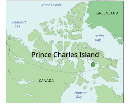
Prince Charles Island is a large, low-lying island in Canada. With an area of 9,521 km2 (3,676 sq mi), it is the world's 77th largest island and the 19th largest island in Canada. It is located in Foxe Basin, off the west coast of Baffin Island, in the Qikiqtaaluk Region of Nunavut, Canada. Though Prince Charles Island has no permanent residents, Inuit visited the island to hunt caribou;[2] the island has no specific name in the Inuktitut language.[3] Despite the island's size, it was not recorded by Western cartographers until 1932, when the tug captain W. A. Poole first sighted it. His information never made it onto any published map.[4] Although, it was rediscovered in 1948 by Albert-Ernest Tomkinson navigating an Avro Lancaster for the RCAF 408 (Photo) Squadron.[4] The island was named for British Prince Charles (later King Charles III), who was born in November the same year.[citation needed]

YouTube Encyclopedic
-
1/1Views:3 703
-
A Prince Among Islands Pt1
Transcription
See also
References
- ^ "Prince Charles Island". Geographical Names Data Base. Natural Resources Canada.
- ^ Martini, I. P.; Wanless, H. R. (24 October 2014). Sedimentary Coastal Zones from High to Low Latitudes: Similarities and Differences. Geological Society of London. ISBN 9781862393745 – via Google Books.
- ^ Nuttall, Mark (23 September 2005). Encyclopedia of the Arctic. Routledge. ISBN 9781136786808 – via Google Books.
- ^ a b Hayes, Derek. 'Newestfoundland' (Canadian Geographic, 123 (5), Sep.-Oct. 2003: 34-35).
Further reading
- Morrison, R. I. G. 1997. "The Use of Remote Sensing to Evaluate Shorebird Habitats and Populations on Prince Charles Island, Foxe Basin, Canada". Arctic. 50, no. 1: 55.
This Qikiqtaaluk Region, Nunavut location article is a stub. You can help Wikipedia by expanding it. |