Prespes
Δήμος Πρεσπών | |
|---|---|
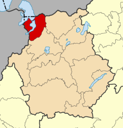
 Prespes municipality map | |
| Coordinates: 40°45′N 21°8′E / 40.750°N 21.133°E | |
| Country | Greece |
| Administrative region | Western Macedonia |
| Regional unit | Florina |
| Area | |
| • Municipality | 515.5 km2 (199.0 sq mi) |
| • Municipal unit | 413.5 km2 (159.7 sq mi) |
| Population (2021)[1] | |
| • Municipality | 1,211 |
| • Density | 2.3/km2 (6.1/sq mi) |
| • Municipal unit | 1,066 |
| • Municipal unit density | 2.6/km2 (6.7/sq mi) |
| Time zone | UTC+2 (EET) |
| • Summer (DST) | UTC+3 (EEST) |
| Postal code | 530 77 |
| Website | http://www.prespes.gr/ |
Prespes (Greek: Πρέσπες) is a municipality in the Florina regional unit, Western Macedonia, Greece. Its population in 2021 was 1,211. The seat of the municipality is in Laimos.[2] It was named after Lake Prespa, in the western part of the municipality.
YouTube Encyclopedic
-
1/3Views:48 5897 6603 188
-
Happy Traveller στις Πρέσπες | FULL
-
Άγιος Αχίλλειος Πρεσπών | Prespes Greece
-
Πρέσπες με drone (3εθνές Ελλάδα/Αλβανία/Σκόπια)- Πρέσπες,Ψαράδες,Άγ.Αχίλλειος- Prespes by drone
Transcription
Municipality
The municipality was formed at the 2011 local government reform by the merger of the former municipalities of Krystallopigi and Prespes, that became municipal units.[2]
The municipality has an area of 515.497 km2, the municipal unit 413.513 km2.[3] According to the 2011 Greek census, Prespes was the least densely populated municipality in the country, with an average of 3.05 residents per square kilometre, and also the smallest municipality, by population size, of the Florina regional unit.[4]
References
- ^ "Αποτελέσματα Μόνιμου Πληθυσμού κατά δημοτική κοινότητα" (in Greek). Hellenic Statistical Authority. 21 April 2023.
- ^ a b "ΦΕΚ A 87/2010, Kallikratis reform law text" (in Greek). Government Gazette.
- ^ "Population & housing census 2001 (incl. area and average elevation)" (PDF) (in Greek). National Statistical Service of Greece.
- ^ "Results for Greece's Population Are Out". 25 July 2011.
Further reading
- Δημήτρις Πένης, Πρέσπα η Ελληνική, 2007


