
Port Area
Port District South Port District | |
|---|---|
District of Manila | |
 Aerial view of Port Area with Customs House | |
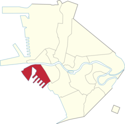 Map of Manila showing the location of Port Area | |
 | |
| Coordinates: 14°35′19″N 120°58′07″E / 14.588726°N 120.968597°E | |
| Country | Philippines |
| Region | National Capital Region |
| City | Manila |
| District | Part of the 5th district of Manila |
| Barangays | 5 |
| Area | |
| • Total | 3.1528 km2 (1.2173 sq mi) |
| Population (2020)[1] | |
| • Total | 72,605 |
| • Density | 23,000/km2 (60,000/sq mi) |
| Time zone | UTC+08:00 (Philippine Standard Time) |
| ZIP code | 1018 (Port Area South) |
| Area code | 2 |
The Port Area, also known as Port District and South Port District,[2][3] is a district of the city of Manila, Philippines. It is entirely a reclaimed land occupied by Manila South Harbor and Baseco Compound. It is bounded on the north by the Pasig River, facing the districts of Tondo and San Nicolas, on the west by Manila Bay, on the east by Intramuros, separated by Radial Road 1, and on the south by Ermita. Post-war developments at the Manila South Harbor eventually paved the way for the migration of people from the different provinces, making it one of the largest urban poor community in the Philippines.
YouTube Encyclopedic
-
1/5Views:10 13630 206182 67282 9062 148
-
Giving Back at PORT AREA Manila Philippines [4K]
-
UNSEEN Walk in Baseco Port Area Manila Philippines [4K]
-
Good Deeds at the BASECO COMPOUND Port Area Manila Philippines - Virtual Look [4K]
-
Inside BASECO BEACH Port Area Manila and Compound - Walking Tour [4K]
-
🎉 Port Area Manila New Years Party! (so wild and crazy)
Transcription
History

Port Area, historically known as Port District,[4] was built on reclaimed land in the late 19th century, toward the end of the Spanish colonization, as an expansion of the Port of Manila.[5][6][7] In 1914, administrative oversight of the district was transferred to the Insular Collector of Customs (now Bureau of Customs).[8] Subsequently, in 1949, revisions to the Manila city charter resulted in the formal and explicit inclusion of Port Area as part of the newly established 4th district.[9] It was later transferred to the 5th district in 1987, following the restoration of the bicameral Congress.
In the late 1970s, the urban poor were resettled to Baseco Compound, originally a dockyard of the National Shipyard and Steel Corporation (NASSCO) that was acquired by the Romualdez family in 1966, to make space for a potential international seaport. Baseco was declared a barangay in the 1980s. Following the 1986 People Power Revolution, the property was sequestered, leading to further resettlement and its proclamation as a residential site in 2002.[10]
Barangays
The district of Port Area is made up of 5 barangays, numbered 649 to 653. Barangay 649 contains the Engineer's Island, now informally known as the Baseco Compound. The Island is regarded as one of the biggest urban poor communities in the Philippines. All barangays of Port Area belong to Zone 68 of the City of Manila.
| Zone/Barangay | Land area | Population (2020) |
|---|---|---|
| Barangay 649 (Baseco Compound) | 1.102 km2 | 64,750 |
| Barangay 650 | 0.1059 km2 | 5,202 |
| Barangay 651 | 0.1738 km2 | 2,556 |
| Barangay 652 | 0.09513 km2 | 39 |
| Barangay 653 | 0.2958 km2 | 58 |
References
- ^ "2020 Census of Population and Housing Results" (PDF). Philippine Statistics Authority. August 16, 2021. Retrieved May 31, 2023.
- ^ Bach, John (1920). City of Manila, Philippine Islands (Map). 1:11,000. Bureau of Commerce and Industry. Retrieved May 31, 2023.
- ^ De Jesus, Domingo (1958). Table and Pocket Map Guide City of Manila Republic of the Philippines (Map). 1:24,268. Retrieved May 31, 2023.
- ^ Beautiful Philippines: A Handbook of General Information. Manila Bureau of Printing. 1923. Retrieved June 3, 2024.
- ^ Plano de Manila y sus arrabales 1894 [Map of Manila and its suburbs 1894] (Map). 1:5,000 (in Spanish). Manila: Lit De Chofre y Co. 1894.
- ^ de Gamoneda, Francisco J. (1898). Plano de Manila y sus Arrables [Map of Manila and its suburbs] (Map). 1:10,000 (in Spanish).
- ^ Gonzales, Iris (July 6, 2023). "Reclamation: the good, the bad and the ugly". The Philippine Star. Retrieved June 3, 2024.
- ^ Executive Order No. 26 (April 15, 1914), Placing the new port district, city of Manila, under the supervision and control of the Insular Collector of Customs
- ^ Republic Act No. 409 (June 18, 1949), An act to revise the charter of the City of Manila, and for other purposes, Official Gazette of the Republic of the Philippines, retrieved February 3, 2024
- ^ Murphy, Dennis. "Baseco and Its Proclamation" (PDF). Ombudsman of the Philippines. Retrieved August 7, 2019.
External links
 Media related to Port Area, Manila at Wikimedia Commons
 Geographic data related to Port Area, Manila at OpenStreetMap
| Topics |  | |
|---|---|---|
| Government |
| |
| Districts | ||
| Mixed-use developments | ||
| Beaches | ||
| Legislative districts | ||