
Poldasht County
Persian: شهرستان پلدشت | |
|---|---|
 Location of Poldasht County in West Azerbaijan province (top, pink) | |
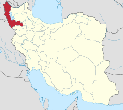 Location of West Azerbaijan province in Iran | |
| Coordinates: 39°12′N 45°10′E / 39.200°N 45.167°E[1] | |
| Country | |
| Province | West Azerbaijan |
| Capital | Poldasht |
| Districts | Central, Aras |
| Population (2016)[2] | |
| • Total | 42,170 |
| Time zone | UTC+3:30 (IRST) |
Poldasht County (Persian: شهرستان پلدشت) is in West Azerbaijan province, Iran. Its capital is the city of Poldasht.[3]
History
After the 2006 National Census, Poldasht District was separated from Maku County in the establishment of Poldasht County, which was divided into two districts of two rural districts each, with the city of Poldasht as its capital.[3]
Demographics
Population
The census in 2011 counted 42,071 people in the newly formed Poldasht County, in 10,654 households.[4] At the 2016 census, the county's population was 42,170 in 11,537 households.[2]
Administrative divisions
Poldasht County's population history and administrative structure over two consecutive censuses are shown in the following table.
| Administrative Divisions | 2011[4] | 2016[2] |
|---|---|---|
| Central District | 28,022 | 28,377 |
| Chaybasar-e Sharqi RD | 6,963 | 6,331 |
| Zangebar RD | 11,096 | 10,574 |
| Poldasht (city) | 9,963 | 11,472 |
| Aras District | 14,049 | 13,793 |
| Gejlarat-e Gharbi RD | 4,020 | 4,272 |
| Gejlarat-e Sharqi RD | 7,268 | 6,854 |
| Nazok-e Olya (city) | 2,761 | 2,667 |
| Total | 42,071 | 42,170 |
| RD = Rural District | ||
Tourism
The historical Saint Stepanos Monastery, in the village of Dar-e Sham, in the Gejlarat area of Poldasht, draws tourists and the faithful from Iran and around the world. It was built in the Armenian style during the Safavid era.[5]
See also
![]() Media related to Poldasht County at Wikimedia Commons
Media related to Poldasht County at Wikimedia Commons
References
- ^ OpenStreetMap contributors (6 April 2023). "Poldasht County" (Map). OpenStreetMap. Retrieved 6 April 2023.
- ^ a b c "Census of the Islamic Republic of Iran, 1395 (2016)". AMAR (in Persian). The Statistical Center of Iran. p. 04. Archived from the original (Excel) on 30 August 2022. Retrieved 19 December 2022.
- ^ a b Davodi, Parviz (18 September 1386). "Approval letter regarding reforms of country divisions in West Azerbaijan province". Islamic Parliament Research Center (in Persian). Ministry of Interior, Political-Defense Commmission. Archived from the original on 13 April 2014. Retrieved 21 November 2023.
- ^ a b "Census of the Islamic Republic of Iran, 1390 (2011)". Syracuse University (in Persian). The Statistical Center of Iran. p. 04. Archived from the original (Excel) on 20 January 2023. Retrieved 19 December 2022.
- ^ "Iran: Iranian Monuments: Church of Saint Stephanos" Iran Chamber Society
West Azerbaijan province, Iran | ||
|---|---|---|
| Capital |  | |
| Counties and cities | ||
| Tourism | ||
| Places | ||
| Capital | |||||||||||||
|---|---|---|---|---|---|---|---|---|---|---|---|---|---|
| Districts |
| ||||||||||||