
Orford | |
|---|---|
 | |
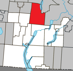 Location within Memphrémagog RCM | |
 Orford Location in southern Quebec | |
| Coordinates: 45°23′N 72°12′W / 45.38°N 72.2°W[1] | |
| Country | |
| Province | |
| Region | Estrie |
| RCM | Memphrémagog |
| Constituted | July 1, 1855 |
| Named for | Orford, Suffolk[1] |
| Government | |
| • Mayor | Pierre Bastien |
| • Federal riding | Brome—Missisquoi |
| • Prov. riding | Orford |
| Area | |
| • Total | 148.60 km2 (57.37 sq mi) |
| • Land | 136.14 km2 (52.56 sq mi) |
| Population (2021)[4] | |
| • Total | 5,007 |
| • Density | 36.8/km2 (95/sq mi) |
| • Pop 2016-2021 | |
| • Dwellings | 3,099 |
| Time zone | UTC−5 (EST) |
| • Summer (DST) | UTC−4 (EDT) |
| Postal code(s) | |
| Area code | 819 |
| Highways | |
| Website | www |
Orford is a township municipality of about 5,000 people in Memphrémagog Regional County Municipality in the Estrie region of Quebec, Canada.
Orford's main attraction is its ski resort on Mount Orford, attracting thousands of people every winter.
Orford is well known for the Mont-Orford National Park. The park has thousands of acres of forest and two major lakes, Stukley and Fraser. Cherry river runs through the park and ends up in Lake Memphremagog. The township has many lakes and is a tourist destination in Quebec.
YouTube Encyclopedic
-
1/5Views:7844 1063873 8701 504
-
Mount Orford: Best Hike of Québec's Eastern Townships (4K POV)
-
HIKING IN THE MONT-ORFORD NATIONAL PARK // Best hike in Southern Quebec (Canada)??
-
Mont Orford Quebec - Drone Footage - Mavic Mini
-
🚙🌿Séjour au Parc du Mont-Orford (Québec) | Escapade en VR
-
Québec Rando: Parc du Mont Orford (le sentier des crêtes) & Magog (2020)
Transcription
History
A region still little frequented at the beginning of the 19th century, the township of Orford was proclaimed in 1801 on the lands of the county of Buckinghamshire. The name refers to a village in the county of Suffolk, England.[5] In 1855, the municipality of the township of Orford was created. Its initial development was ensured by loyalist immigration. This founded the village of Cherry River, north of Magog. Nevertheless, the rest of the municipality remains mostly wild, until the advent of the project to create a national park.
The Mont-Orford National Park, which was created in 1938, was allocated nearly half of the territory. Cherry River then becomes the gateway to the park. The creation of a ski resort and a golf course created a tourist craze for the region. Today, the population is divided between 40% permanent residents and 60% vacationers.[6]
Demographics
In the 2021 Census of Population conducted by Statistics Canada, Orford had a population of 5,007 living in 2,244 of its 3,099 total private dwellings, a change of 15.4% from its 2016 population of 4,337. With a land area of 136.14 km2 (52.56 sq mi), it had a population density of 36.8/km2 (95.3/sq mi) in 2021.[7]
| 2021 | 2016 | |
|---|---|---|
| Population | 5,007 (+15.4% from 2016) | 4,337 (+21.3% from 2011) |
| Land area | 136.14 km2 (52.56 sq mi) | 136.19 km2 (52.58 sq mi) |
| Population density | 36.8/km2 (95/sq mi) | 31.8/km2 (82/sq mi) |
| Median age | 50.4 (M: 50.4, F: 50.4) | 49.1 (M: 49.7, F: 48.6) |
| Private dwellings | 3,099 (total) | 2,791 (total) |
| Median household income | $99,000 | $80,620 |
Population trend:[12]
| Census | Population | Change (%) |
|---|---|---|
| 2021 | 5,007 | |
| 2016 | 4,337 | |
| 2011 | 3,575 | |
| 2006 | 2,979 | |
| ADJ | 2,383 (+) | |
| 2001 | 1,987 | |
| 1996 | 1,427 | |
| 1991 | 985 | N/A |
ADJ = adjusted figure due to boundary change.
Mother tongue (2021)[4]
| Language | Population | Pct (%) |
|---|---|---|
| French only | 4,650 | 92.9% |
| English only | 185 | 3.7% |
| Both English and French | 80 | 1.6% |
| Other languages | 80 | 1.6% |
See also
References
- ^ a b "Banque de noms de lieux du Québec: Reference number 45673". toponymie.gouv.qc.ca (in French). Commission de toponymie du Québec.
- ^ a b "Ministère des Affaires municipales, des Régions et de l'Occupation du territoire: Orford".
- ^ "Parliament of Canada Federal Riding History: BROME--MISSISQUOI (Quebec)".
- ^ a b c Statistics Canada (2022-02-09). "2021 Census of Population - Orford, Canton (municipalité de), Quebec". Census Profile (table). 98-316-X2021001. Retrieved 2023-01-01.
- ^ "Fiche descriptive".
- ^ "Histoire".
- ^ "Population and dwelling counts: Canada, provinces and territories, and census subdivisions (municipalities), Quebec". Statistics Canada. February 9, 2022. Retrieved August 28, 2022.
- ^ "2021 Community Profiles". 2021 Canadian Census. Statistics Canada. February 4, 2022. Retrieved 2022-08-22.
- ^ "2016 Community Profiles". 2016 Canadian Census. Statistics Canada. August 12, 2021. Retrieved 2022-07-29.
- ^ "2006 Community Profiles". 2006 Canadian Census. Statistics Canada. August 20, 2019.
- ^ "2001 Community Profiles". 2001 Canadian Census. Statistics Canada. July 18, 2021.
- ^ Statistics Canada: 1996, 2001, 2006, 2011, 2016, 2021 census
External links
 Media related to Orford, Quebec at Wikimedia Commons
Adjacent Municipal Subdivisions | |
|---|---|
| Cities & Towns | |
|---|---|
| Municipalities | |
| Townships | |
| Villages | |
| |
| Authority control databases: National |
|---|