
Nitzana
ניצנה نتسانا | |
|---|---|
| Hebrew transcription(s) | |
| • official | Nizzana |
 Nitzana viewed from the south. | |
 Nitzana  Nitzana | |
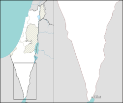
| Coordinates: 30°53′10″N 34°25′21″E / 30.88611°N 34.42250°E | |
| Country | |
| District | Southern |
| Council | Ramat HaNegev |
| Founded | 1987 |
| Population (2022)[1] | 263 |
Nitzana (Hebrew: נִצָּנָה, ניצנה) is an educational youth village and community settlement in southern Israel. Located in the western Negev desert, adjacent to the Egyptian border, it falls under the jurisdiction of Ramat HaNegev Regional Council. In 2022 it had a population of 263.[1]
YouTube Encyclopedic
-
1/3Views:4 825338358
-
village de Nitzana Israel
-
Mifgashim B'Nitzana 2013 (Watch in HD for best quality)
-
NITZANA FRENCH
Transcription
Ancient Nitzana (3rd c. BC-7th c. AD)
Ancient Nitzana was founded by the Nabataeans in the 3rd century BC. There are traces of a large first century BC building with a monumental staircase. The settlement was a trading post on the Eilat to Gaza route. In the early 2nd century AD the emperor Hadrian diverted this trade from Elat to Damascus. Despite this loss Nitzana grew under Byzantine rule. In the late 3rd century AD the fort was enlarged with stables for horses and camels. In the 4th century a church was built attached to the north end of the fort. It was dedicated to SS Sergius and Baccus. In the 7th century a second church, dedicated to the Virgin Mary was built 60m south east of the fort.


The tax register for 587-9 AD indicates that the town had 1,500 inhabitants, with 116 houses. This was a time of prosperity with the route from Gaza to Elat reopened and pilgrim traffic to Saint Catherine's Monastery. A find of late Byzantine papyri has given much detail of the life of the town.
Following the arrival of Islam the town went into a slow decline and by the 8th century it had ceased to exist.[2]
Modern village
The modern village was founded in 1987 by Aryeh Eliav, a former member of the Knesset for several left-wing parties, and was named after the Nabatean city. It also gives its name to the Nitzana Border Crossing, formerly Auja al-Hafir. It was the site of Operation Volcano in 1955, an Israeli raid against Egyptian positions. On 18 June 2012 an Israeli was killed in a terrorist attack near the village.[3]

See also
- Nitzanei Sinai, a nearby community settlement.
References
- ^ a b "Regional Statistics". Israel Central Bureau of Statistics. Retrieved 21 March 2024.
- ^ Murphy-O'Conner, Jerome (2008) The Holy Land. An Oxford Archaeological Guide (5th edition), Oxford University Press. ISBN 978 0 19 923666 4. Pages 430-432.
- ^ Victim of Nitzana Attack Identified Israel National News, 18 June 2012
| International | |
|---|---|
| National | |
| Other | |