
Nikhom Phatthana
นิคมพัฒนา | |
|---|---|
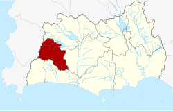 District location in Rayong province | |
| Coordinates: 12°49′53″N 101°12′29″E / 12.83139°N 101.20806°E | |
| Country | Thailand |
| Province | Rayong |
| Seat | Nikhom Phatthana |
| Area | |
| • Total | 237.5 km2 (91.7 sq mi) |
| Population (2005) | |
| • Total | 32,482 |
| • Density | 136.8/km2 (354/sq mi) |
| Time zone | UTC+7 (ICT) |
| Postal code | 21180 |
| Geocode | 2108 |
Nikhom Phatthana (Thai: นิคมพัฒนา, pronounced [ní(ʔ).kʰōm pʰát.tʰā.nāː]) is a district (amphoe) of Rayong province, eastern Thailand.
History
The minor district (king amphoe) was established on 15 July 1996 by splitting four tambon from Ban Khai district.[1]
On 15 May 2007, all 81 minor districts in Thailand were upgraded to full districts.[2] With publication in the Royal Gazette on 24 August, the upgrade became official.[3]
Around the 1950s and 1960s, most of the area was still forestland and non-asphalt road. When the authorities want to develop the area, therefore, the land was allocated to the people on a gratuitous basis to attract people to flock to live.[4]
Geography
Neighboring districts are (from the north clockwise) Pluak Daeng, Ban Khai, Mueang Rayong, and Ban Chang of Rayong Province, and Bang Lamung of Chonburi province.
Administration
The district is divided into four sub-districts (tambons), which are further subdivided into 30 villages (mubans). Map Kha is a township (thesaban tambon) which covers parts of tambons Nikhon Phatthana and Map Kha. Also the town Map Ta Phut, centered in Mueang Rayong District, covers parts of tambon Map Kha as well. There are a further four tambon administrative organizations (TAO) responsible for the non-municipal areas.
| No. | Name | Thai name | Villages | Pop. | |
|---|---|---|---|---|---|
| 1. | Nikhom Phatthana | นิคมพัฒนา | 7 | 10,583 | |
| 2. | Map Kha | มาบข่า | 8 | 7,973 | |
| 3. | Phana Nikhom | พนานิคม | 8 | 6,085 | |
| 4. | Makham Khu | มะขามคู่ | 7 | 7,841 |
Economy
Most of the areas are industrial estates, part of the eastern seaboard.[4]
References
- ^ ประกาศกระทรวงมหาดไทย เรื่อง แบ่งเขตท้องที่อำเภอบ้านค่าย จังหวัดระยอง ตั้งเป็นกิ่งอำเภอนิคมพัฒนา (PDF). Royal Gazette (in Thai). 113 (Special 18 ง): 18. June 26, 1996. Archived from the original (PDF) on January 26, 2009.
- ^ แถลงผลการประชุม ครม. ประจำวันที่ 15 พ.ค. 2550. Manager Online (in Thai).
- ^ พระราชกฤษฎีกาตั้งอำเภอฆ้องชัย...และอำเภอเหล่าเสือโก้ก พ.ศ. ๒๕๕๐ (PDF). Royal Gazette (in Thai). 124 (46 ก): 14–21. August 24, 2007. Archived from the original (PDF) on September 30, 2007.
- ^ a b Nice To Meet You (2023-07-08). "นิคมพัฒนา" [Nikhom Phatthana]. Thai PBS (in Thai). Retrieved 2023-07-09.
External links
This Rayong Province location article is a stub. You can help Wikipedia by expanding it. |