
Neusiedl am See | |
|---|---|
 Church of Saints Nicholas and Gall | |
 Coat of arms | |
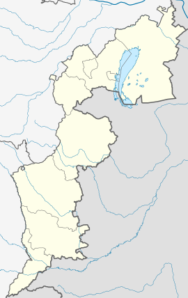 Neusiedl am See Location within Austria  Neusiedl am See Neusiedl am See (Austria) | |
| Coordinates: 47°57′N 16°51′E / 47.950°N 16.850°E | |
| Country | |
| State | Burgenland |
| District | Neusiedl am See |
| Government | |
| • Mayor | Elisabeth Böhm (SPÖ) |
| Area | |
| • Total | 57.03 km2 (22.02 sq mi) |
| Elevation | 133 m (436 ft) |
| Population (2018-01-01)[2] | |
| • Total | 8,235 |
| • Density | 140/km2 (370/sq mi) |
| Time zone | UTC+1 (CET) |
| • Summer (DST) | UTC+2 (CEST) |
| Postal code | 7100 |
| Website | www.neusiedlamsee.at |
Neusiedl am See (German pronunciation: [ˈnɔɪ̯ˌziːdl̩ am ˈzeː] ⓘ; Czech: Nezider; Croatian: Niuzalj;[3] Hungarian: Nezsider; Slovak: Nezider) is a town in Burgenland, Austria, and administrative center of the district of Neusiedl am See.
Neusiedl am See is located on the northern shore of the Neusiedler See.
YouTube Encyclopedic
-
1/5Views:2 8231 2941 3277003 426
-
Neusiedl am See
-
The Lighthouse in Podersdorf, AUSTRIA (Neusiedl am See, Burgenland, Austria)
-
Neusiedl am See
-
Neusiedl am See, Sandland, Burgenland - Austria HD Travel Channel
-
Neusiedl am See & Weiden am See Burgenland Österreich 28.4.2014
Transcription
History
The first mention of "Sumbotheil" (referring to its right to hold Saturday markets) dates back to 1209. In the mid-13th century, the town was destroyed by the Mongols, and by 1282 under the name "Niusidel" resettled. In 1517 Neusiedl received market rights. Neusiedl in 1683 was in the wake of the second Turkish siege, and in 1708 the town was devastated by the Kuruc. Neusiedl am See received a city charter in 1926, which had already been investigated in 1824.
Like the rest of Burgenland, it was part of the Kingdom of Hungary until 1920/21. After the end of World War I it was given to Austria in the Treaty of St. Germain and Trianon. It has belonged since 1921 to the new State of Burgenland (see also history of Burgenland).
The town is known as the birthplace of the experimental guitarist and composer, Christian Fennesz, known for his swirling, spatial works and collaboration with Japanese pianist Ryuichi Sakamoto.
Climate
| Climate data for Neusiedl am See (1981–2010) | |||||||||||||
|---|---|---|---|---|---|---|---|---|---|---|---|---|---|
| Month | Jan | Feb | Mar | Apr | May | Jun | Jul | Aug | Sep | Oct | Nov | Dec | Year |
| Record high °C (°F) | 19.2 (66.6) |
19.7 (67.5) |
25.2 (77.4) |
27.9 (82.2) |
33.8 (92.8) |
36.3 (97.3) |
39.0 (102.2) |
38.5 (101.3) |
33.0 (91.4) |
28.8 (83.8) |
21.4 (70.5) |
17.4 (63.3) |
39.0 (102.2) |
| Mean daily maximum °C (°F) | 2.9 (37.2) |
5.3 (41.5) |
10.5 (50.9) |
16.6 (61.9) |
21.8 (71.2) |
24.8 (76.6) |
27.3 (81.1) |
26.7 (80.1) |
21.4 (70.5) |
15.4 (59.7) |
8.4 (47.1) |
3.5 (38.3) |
15.4 (59.7) |
| Daily mean °C (°F) | −0.2 (31.6) |
1.5 (34.7) |
5.8 (42.4) |
11.1 (52.0) |
16.1 (61.0) |
19.2 (66.6) |
21.5 (70.7) |
20.9 (69.6) |
16.0 (60.8) |
10.7 (51.3) |
5.0 (41.0) |
0.7 (33.3) |
10.7 (51.3) |
| Mean daily minimum °C (°F) | −2.8 (27.0) |
−1.8 (28.8) |
1.9 (35.4) |
6.1 (43.0) |
10.6 (51.1) |
13.7 (56.7) |
15.8 (60.4) |
15.6 (60.1) |
11.8 (53.2) |
7.1 (44.8) |
2.4 (36.3) |
−1.5 (29.3) |
6.6 (43.9) |
| Record low °C (°F) | −20.5 (−4.9) |
−18.3 (−0.9) |
−15.5 (4.1) |
−4.3 (24.3) |
1.7 (35.1) |
3.7 (38.7) |
7.1 (44.8) |
7.9 (46.2) |
3.3 (37.9) |
−5.9 (21.4) |
−11.5 (11.3) |
−19.8 (−3.6) |
−20.5 (−4.9) |
| Average precipitation mm (inches) | 29 (1.1) |
29 (1.1) |
40 (1.6) |
34 (1.3) |
60 (2.4) |
63 (2.5) |
63 (2.5) |
69 (2.7) |
55 (2.2) |
39 (1.5) |
43 (1.7) |
39 (1.5) |
562 (22.1) |
| Average relative humidity (%) (at 14:00) | 74.6 | 66.9 | 58.8 | 51.9 | 53.0 | 53.8 | 51.6 | 52.9 | 57.9 | 64.4 | 74.2 | 78.3 | 61.5 |
| Mean monthly sunshine hours | 69 | 107 | 147 | 204 | 244 | 242 | 271 | 255 | 192 | 144 | 72 | 55 | 2,002 |
| Percent possible sunshine | 27.5 | 41.3 | 43.8 | 54.5 | 57.0 | 56.4 | 61.8 | 62.9 | 55.0 | 46.5 | 28.1 | 23.0 | 46.5 |
| Source: Central Institute for Meteorology and Geodynamics[4][5][6][7][8] | |||||||||||||
| Climate data for Neusiedl am See (1971–2000) | |||||||||||||
|---|---|---|---|---|---|---|---|---|---|---|---|---|---|
| Month | Jan | Feb | Mar | Apr | May | Jun | Jul | Aug | Sep | Oct | Nov | Dec | Year |
| Record high °C (°F) | 16.6 (61.9) |
19.0 (66.2) |
25.2 (77.4) |
28.6 (83.5) |
31.8 (89.2) |
36.3 (97.3) |
35.2 (95.4) |
36.0 (96.8) |
33.0 (91.4) |
26.5 (79.7) |
21.1 (70.0) |
17.4 (63.3) |
36.3 (97.3) |
| Mean daily maximum °C (°F) | 2.6 (36.7) |
5.1 (41.2) |
10.6 (51.1) |
15.7 (60.3) |
21.2 (70.2) |
24.0 (75.2) |
26.3 (79.3) |
26.2 (79.2) |
21.2 (70.2) |
15.1 (59.2) |
7.7 (45.9) |
4.0 (39.2) |
15.0 (59.0) |
| Daily mean °C (°F) | −0.5 (31.1) |
1.1 (34.0) |
5.4 (41.7) |
10.0 (50.0) |
15.2 (59.4) |
18.3 (64.9) |
20.4 (68.7) |
20.1 (68.2) |
15.5 (59.9) |
9.9 (49.8) |
4.2 (39.6) |
1.1 (34.0) |
10.1 (50.2) |
| Mean daily minimum °C (°F) | −3.0 (26.6) |
−1.8 (28.8) |
1.7 (35.1) |
5.4 (41.7) |
9.9 (49.8) |
13.0 (55.4) |
15.0 (59.0) |
15.1 (59.2) |
11.4 (52.5) |
6.5 (43.7) |
1.7 (35.1) |
−1.3 (29.7) |
6.1 (43.0) |
| Record low °C (°F) | −20.5 (−4.9) |
−18.3 (−0.9) |
−15.5 (4.1) |
−4.3 (24.3) |
−1.0 (30.2) |
3.2 (37.8) |
6.4 (43.5) |
6.5 (43.7) |
2.0 (35.6) |
−5.9 (21.4) |
−11.5 (11.3) |
−19.8 (−3.6) |
−20.5 (−4.9) |
| Average precipitation mm (inches) | 32.2 (1.27) |
28.7 (1.13) |
37.1 (1.46) |
42.2 (1.66) |
61.4 (2.42) |
64.9 (2.56) |
63.6 (2.50) |
63.0 (2.48) |
49.8 (1.96) |
43.5 (1.71) |
47.8 (1.88) |
40.1 (1.58) |
574.3 (22.61) |
| Average snowfall cm (inches) | 10.8 (4.3) |
10.3 (4.1) |
5.4 (2.1) |
0.1 (0.0) |
0.0 (0.0) |
0.0 (0.0) |
0.0 (0.0) |
0.0 (0.0) |
0.0 (0.0) |
0.0 (0.0) |
5.3 (2.1) |
10.5 (4.1) |
42.4 (16.7) |
| Average precipitation days (≥ 1.0 mm) | 6.3 | 5.8 | 6.9 | 6.7 | 8.2 | 8.7 | 7.5 | 7.6 | 6.4 | 5.8 | 7.8 | 7.1 | 84.8 |
| Average relative humidity (%) (at 14:00) | 76.3 | 69.0 | 59.1 | 52.7 | 52.5 | 53.6 | 51.9 | 52.3 | 57.4 | 63.6 | 74.8 | 77.8 | 61.8 |
| Mean monthly sunshine hours | 63.6 | 100.5 | 139.2 | 186.3 | 235.6 | 233.6 | 252.0 | 244.9 | 183.7 | 141.0 | 70.6 | 54.1 | 1,905.1 |
| Percent possible sunshine | 25.1 | 38.5 | 41.7 | 50.3 | 55.8 | 54.6 | 58.0 | 61.1 | 53.0 | 46.2 | 27.4 | 22.8 | 44.5 |
| Source: Central Institute for Meteorology and Geodynamics[9] | |||||||||||||
Population
| Year | Pop. | ±% |
|---|---|---|
| 1869 | 2,411 | — |
| 1880 | 2,843 | +17.9% |
| 1890 | 2,899 | +2.0% |
| 1900 | 3,211 | +10.8% |
| 1910 | 2,898 | −9.7% |
| 1923 | 2,764 | −4.6% |
| 1934 | 3,943 | +42.7% |
| 1939 | 3,616 | −8.3% |
| 1951 | 3,625 | +0.2% |
| 1961 | 3,826 | +5.5% |
| 1971 | 3,999 | +4.5% |
| 1981 | 4,122 | +3.1% |
| 1991 | 4,675 | +13.4% |
| 2001 | 5,584 | +19.4% |
| 2011 | 7,005 | +25.4% |
Gallery
-
 Holy trinity column created in 1713-14 by Elias Hügel.
 -
 Tabor ruin, a watchtower probably from 16th century.
 -
 Tabor ruin.
See also
References
- ^ "Dauersiedlungsraum der Gemeinden Politischen Bezirke und Bundesländer - Gebietsstand 1.1.2018". Statistics Austria. Retrieved 10 March 2019.
- ^ "Einwohnerzahl 1.1.2018 nach Gemeinden mit Status, Gebietsstand 1.1.2018". Statistics Austria. Retrieved 9 March 2019.
- ^ "Niuzalj s 40,3 stupnji najvrućije mjesto Gradišća". ORF.
- ^ "Klimamittel 1981–2010: Lufttemperatur" (in German). Central Institute for Meteorology and Geodynamics. Archived from the original on 21 October 2019. Retrieved 16 November 2019.
- ^ "Klimamittel 1981–2010: Niederschlag" (in German). Central Institute for Meteorology and Geodynamics. Archived from the original on 29 December 2014. Retrieved 16 November 2019.
- ^ "Klimamittel 1981–2010: Schnee" (in German). Central Institute for Meteorology and Geodynamics. Archived from the original on 29 December 2014. Retrieved 16 November 2019.
- ^ "Klimamittel 1981–2010: Luftfeuchtigkeit" (in German). Central Institute for Meteorology and Geodynamics. Archived from the original on 21 October 2019. Retrieved 16 November 2019.
- ^ "Klimamittel 1981–2010: Strahlung" (in German). Central Institute for Meteorology and Geodynamics. Archived from the original on 29 December 2014. Retrieved 16 November 2019.
- ^ "Klimadaten von Österreich 1971–2000 – Burgenland-Neusiedl am See" (in German). Central Institute for Meteorology and Geodynamics. Archived from the original on 12 October 2019. Retrieved 16 November 2019.
External links
- Official website (German) with 3 lifecams, one of them an inhabited stork's nest (checked 2008-06-01)
- Aerial photograph, view towards N
- similar, higher resolution (app. 2.5 MB)
| International | |
|---|---|
| National | |
| Geographic | |
This Burgenland location article is a stub. You can help Wikipedia by expanding it. |