
Nagyhajmás | |
|---|---|
Village | |
 | |
 Seal | |
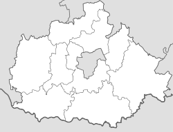 Nagyhajmás Location in Baranya County  Nagyhajmás Nagyhajmás (Hungary) | |
| Coordinates: 46°22′22″N 18°17′20″E / 46.37278°N 18.28889°E | |
| Country | |
| County | Baranya |
| District | Hegyhát |
| Government | |
| • Type | Mayor-council |
| • Mayor | Norbert András Molnár (Ind.) |
| Area | |
| • Total | 18.01 km2 (6.95 sq mi) |
| Population (2021)[3] | |
| • Total | 253 |
| • Density | 14/km2 (36/sq mi) |
| Time zone | UTC+1 (CET) |
| • Summer (DST) | UTC+2 (CEST) |
| Postal code | 7343 |
| Area code | 72 |
| NUTS 3 | HU231 |
| HCSO | 12858 |
| Website | www.nagyhajmas.hu |
Nagyhajmás ([ˈnɒɟhɒjmaːʃ], German: Heimasch, Croatian: Hajmaš) is a village (Hungarian: község) in the Hegyhát District, northern Baranya county, in the Southern Transdanubia region of Hungary. Its population at the 2011 census was 346.[4]
YouTube Encyclopedic
-
1/2Views:4405 215
-
SNIPER44/COUNTRY-NAGYHAJMÁS TÁNC CSOPORT.
-
Country tánc 8.A Sárbogárd
Transcription
Geography
The village is located at 46° 22′ 22″ N, 18° 17′ 20″ E. Its area is 18.01 km2 (6.95 sq mi). It is part of the Southern Transdanubia statistical region, and administratively it falls under Baranya County and Hegyhát District. It lies 5.3 km (3.3 mi) northeast of the town of Mágocs and 34.2 km (21.3 mi) north of Pécs.[5]
Demographics
2011 census
As of the census of 2011, there were 346 residents, 129 households, and 96 families living in the village. The population density was 50 inhabitants per square mile (19 inhabitants/km2). There were 142 dwellings at an average density of 20 dwellings per square mile (7.7 dwellings/km2). The average household size was 2.64. The average number of children was 1.19. The average family size was 3.02.[4]
Religious affiliation was 41.8% Roman Catholic, 11.2% Lutheran, 2.9% Calvinist, 0.3% Jewish, 0.6% other religion and 26.8% unaffiliated, with 16.5% declining to answer.
The village had an ethnic minority Roma population of 15.9% and a German population of 8.5%. A small number of residents also identified as Serb (0.3%) and other, non-native to Hungary (0.3%). The vast majority declared themselves as Hungarian (96.2%), with 3.5% declining to answer.[note 1][3]
Local government
The village is governed by a mayor with a four-person council. The local government of the village operates a joint council office with the nearby localities of Alsómocsolád, Mágocs, and Mekényes. The seat of the joint council is in Mágocs.[2][3]
As of the election of 2019, the village also has local minority self-governments for its German and Roma communities, each with three elected representatives.[6]
Transportation
Railway
- Mágocs-Alsómocsolád Train Station, 11 km (6.8 mi) southwest of the village. The station is on the Dombóvár-Bátaszék railway line and is operated by MÁV.[3]
Notes
- ^ As a person can affiliate themselves with more than one ethnic group (nationality), the totals may be greater than 100%.
External links
References
- ^ "Local government elections 2019". Hungarian National Election Office. Retrieved 24 October 2021.
- ^ a b "Gazetteer of Hungary, 1 January 2019" (PDF). Hungarian Central Statistical Office (in Hungarian). Retrieved 24 October 2021.
- ^ a b c d "Detailed Gazetteer of Hungary". Hungarian Central Statistical Office. Retrieved 24 October 2021.
- ^ a b "Population Census 2011: Regional Data - Baranya County". Hungarian Central Statistical Office. 1 October 2011. Retrieved 24 October 2021.
- ^ "Distance Calculator Find Distance Between Cities". Distance Calculator. Retrieved 2021-10-24.
- ^ "Ethnic municipal elections 2019". Hungarian National Election Office. Retrieved 24 October 2021.
| Towns (2) | ||
|---|---|---|
| Villages (23) | ||


This Baranya County–related article is a stub. You can help Wikipedia by expanding it. |