
Nafpaktia
Ναυπακτία | |
|---|---|
 Nafpaktia Location within the region  | |
| Coordinates: 38°23′N 21°49′E / 38.383°N 21.817°E | |
| Country | Greece |
| Administrative region | Western Greece |
| Regional unit | Aetolia-Acarnania |
| Government | |
| • Mayor | Vasileios Gizas[1][2] (since 2019) |
| Area | |
| • Municipality | 876.2 km2 (338.3 sq mi) |
| Population (2021)[3] | |
| • Municipality | 25,065 |
| • Density | 29/km2 (74/sq mi) |
| Time zone | UTC+2 (EET) |
| • Summer (DST) | UTC+3 (EEST) |
| Website | www |
Nafpaktia (Greek: Ναυπακτία), Latinized Naupactia, is the historical name for the region around the port town of Nafpaktos (Naupactus) in Central Greece.
It is also the name of a municipality in the Aetolia-Acarnania regional unit, West Greece region, Greece. The seat of the municipality is the town Nafpaktos.[4] The municipality has an area of 876.209 km2.[5]
YouTube Encyclopedic
-
1/1Views:3 195
-
Nafpaktia - Ναυπακτία
Transcription
Administration
The municipality Nafpaktia was formed at the 2011 local government reform by the merger of the following 6 former municipalities, that became municipal units:[4]
Province
The province of Nafpaktia (Greek: Επαρχία Ναυπακτίας) was one of the provinces of the Aetolia-Acarnania Prefecture. Its territory corresponded with that of the current municipality Nafpaktia.[6] It was abolished in 2006.
Geography
The approximately 60 villages of the region are built at altitudes of 700 to 1,000 m (2,300–3,300 ft) and are located from 30 to 90 km (19–56 mi) away from Nafpaktos.
Villages include Elatou, built in a pine forest; Ano Chora, which used to be called Megali Lobotina and has a population of 30; and Katafygio, formerly Amorani, which is at an altitude of 650 m (2,130 ft) and is 33 km (21 mi) from Nafpaktos.
References
- ^ Municipality of Nafpaktia, Municipal elections – October 2023, Ministry of Interior
- ^ Δήμαρχος, Municipality of Nafpaktia. Retrieved 18 March 2024.
- ^ "Αποτελέσματα Απογραφής Πληθυσμού - Κατοικιών 2021, Μόνιμος Πληθυσμός κατά οικισμό" [Results of the 2021 Population - Housing Census, Permanent population by settlement] (in Greek). Hellenic Statistical Authority. 29 March 2024.
- ^ a b "ΦΕΚ A 87/2010, Kallikratis reform law text" (in Greek). Government Gazette.
- ^ "Population & housing census 2001 (incl. area and average elevation)" (PDF) (in Greek). National Statistical Service of Greece.
- ^ "Detailed census results 1991" (PDF). (39 MB) (in Greek and French)
External links
- Official website
- Nafpaktia
- Katafygion Nafpaktias
- Katafigio Nafpaktias(Mountainous Nafpaktia)
- Paleopirgos (Mountainous Nafpaktia)
| Regional unit of Achaea | 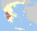 | |
|---|---|---|
| Regional unit of Aetolia-Acarnania | ||
| Regional unit of Elis | ||
| ||
This Western Greece location article is a stub. You can help Wikipedia by expanding it. |