
Nödinge-Nol | |
|---|---|
  | |
| Coordinates: 57°54′N 12°04′E / 57.900°N 12.067°E | |
| Country | Sweden |
| Province | Västergötland |
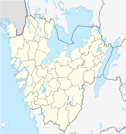
| County | Västra Götaland County |
| Municipality | Ale Municipality |
| Area | |
| • Total | 5.99 km2 (2.31 sq mi) |
| Population (31 December 2010)[1] | |
| • Total | 9,822 |
| • Density | 1,641/km2 (4,250/sq mi) |
| Time zone | UTC+1 (CET) |
| • Summer (DST) | UTC+2 (CEST) |
Nödinge-Nol is a locality and the seat of Ale Municipality in Västra Götaland County, Sweden. It had 9,822 inhabitants in 2010.[1]
YouTube Encyclopedic
-
1/3Views:1 362422638
-
Nödinge 2006 - 2014
-
Nol 2010 - 2011
-
Ale kommun - Nödinge Småstad
Transcription
Overview
The town Nödinge-Nol was once three villages: Alafors, Nol and Nödinge. They have grown together into one locality. It is situated approximately 20 kilometres (12 mi) northeast of Gothenburg next to the euro highway E45, east of the river Göta Älv. Nödinge community was originally called Kyrkby and has been the site of a church since medieval times. The current church was built in 1727 and has excellent murals.
Nödinge-Nol as a common village has been defined by the Central Bureau of Statistics, based on their principles. The Land Survey Place Name Unit still lists Nödinge, Nol and Alafors as three individual places.[2]
The downtown area is dominated by apartment complexes and is surrounded by extensive countryside intermixed with villas. Downtown is Ale Torg, a shopping center with a diverse selection of stores. There is a junior high school, middle school, emergency room, library, a sports arena, a nine-hole golf course and a small boat harbor. The main public transport is Gothenburg commuter rail, which has two stations here, Nödinge and Nol and takes you to Gothenburg in about 15 minutes.
The surrounding countryside includes very steep hills around the river Göta Älv. In the southeast is the nature reserve Vättlefjäll, which has numerous hiking trails and lakes in various sizes that are spread out over 2,567 hectares (6,340 acres). The Göta Älv ridge to the east. Inside the town itself there are a large number of steep hills intermixed with flat valleys that today is fertile farmland, but which once was the sea bottom. The hills used to be islets of the old archipelago.
Ale is known for many things, best found on Ale Municipality page. Alafors for its brewery Ahlafors Bryggerier, Nol for the former industrial factories.
References
- ^ a b c "Tätorternas landareal, folkmängd och invånare per km2 2005 och 2010" (in Swedish). Statistics Sweden. 14 December 2011. Archived from the original on 27 January 2012. Retrieved 10 January 2012.
- ^ "Kartsök och ortnamn" [Map search and place name] (in Swedish). Archived from the original on 6 February 2016. Retrieved 13 February 2016.
| Authority control databases: Geographic |
|---|