
Munshiganj
মুন্সীগঞ্জ | |
|---|---|
      Clockwise from top-left: Idrakpur Fort, Baba Adam's Mosque, Meghna near Munshiganj, Sonarong Jor Moth, Dhaleshwari River bank in Munshiganj Sadar Upazila, Nateshwar Deul, Padma Bridge | |
| Nickname: | |
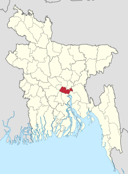 Location of Munshiganj District in Bangladesh | |
 Expandable map of Munshiganj District | |
| Coordinates: 23°28′N 90°32′E / 23.46°N 90.54°E | |
| Country | |
| Division | Dhaka |
| Headquarters | Munshiganj |
| Government | |
| • Deputy Commissioner | Kazi Nahid Rasul [1] |
| Area | |
| • Total | 1,004.29 km2 (387.76 sq mi) |
| Population (2022 census)[2] | |
| • Total | 1,625,416 |
| • Density | 1,600/km2 (4,200/sq mi) |
| Demonym(s) | Munshiganji, Bikrompuira, Bikrampuri, Dhakaiya |
| Time zone | UTC+06:00 (BST) |
| HDI (2018) | 0.649[3] medium · 3rd of 21 |
Munshiganj (Bengali: মুন্সীগঞ্জ), also historically and colloquially known as Bikrampur, is a district[4] in central Bangladesh. It is a part of the Dhaka Division and borders Dhaka District.[5]
YouTube Encyclopedic
-
1/5Views:15 48848 1383 16710 63334 815
-
Basic information of Munshiganj district. মুন্সিগঞ্জ জেলার তথ্য। General knowledge.
-
Munshiganj মুন্সীগঞ্জ । Munshiganj Tourist Spot । One Day Tour Near Dhaka । Munshiganj Vromon Guide
-
মুন্সিগঞ্জ জেলার সকল উপজেলা সমূহ।।All upazilas of Munshiganj district.
-
মুন্সিগঞ্জ জেলার দর্শনীয় স্থান । Tourist attraction of Munshiganj district
-
গজারিয়ার ইতিহাস ও ঐতিহ্য, মুন্সিগঞ্জ । History and Tradition of Gazaria, Munshiganj
Transcription
Geography
Total land area is 235,974 acres (954 km2), out of which 138472 acres (560 km2) are cultivable and 5609 acres (23 km2) are fallow land. It has no forest area. 40,277 acres (163 km2) of land is irrigated while 26,242 acres (106 km2) of land is under river. It has 14 rivers of 155 km passing through.[citation needed]
Boating
Boating is one of the traditions of the people in Munshiganj District. A traditional boat race was held in the Dhaleshwari River which thousands of people came to see. The boat race was held in a 3 km area from the Mirkadim Municipality to Munshiganj launch harbor. Boats with 60 oarsmen, 50 oarsmen and 25 oarsmen participate in the competition every year[6]
Administration
It consists of 6 upazilas, 67 union parishads, 603 wards, 662 mouzas, 906 villages, 73 mahallas and 2 municipalities.[7]
The district consists of 6 upazilas:[5]
- Lohajang Upazila
- Sreenagar Upazila
- Munshiganj Sadar Upazila
- Sirajdikhan Upazila
- Tongibari Upazila
- Gazaria Upazila
Demographics
According to the 2022 Census of Bangladesh, Munshiganj District had 399,631 households and a population of 1,625,416. 303,978 (18.70%) were under 10 years of age. The population density was 1,618 people per km2. Munshiganj district had a literacy rate (age 7 and over) of 77.90%, compared to the national average of 74.80%, and a sex ratio of 1,061 females per 1,000 males. 18.09% of the population lived in urban areas.[2]
| Religion | Population (1941)[8]: 96–97 | Percentage (1941) | Population (2022)[2] | Percentage (2022) |
|---|---|---|---|---|
| Islam |
513,766 | 58.54% | 1,500,926 | 92.34% |
| Hinduism |
362,986 | 41.36% | 122,234 | 7.52% |
| Others [b] | 891 | 0.10% | 2,256 | 0.14% |
| Total Population | 877,643 | 100% | 1,625,416 | 100% |
91.92% are Muslims, 7.93% Hindus. Although Hindus were once over 40% of the district, most have left to India.
Notable people
Revolutionary nationalists
- M. Hamidullah Khan, Bangladesh Forces, Sector Commander, Sector 11, Bangladesh War of Independence 1971[9]
- Jagadish Chandra Bose, Bengali physicist[10]
- Badal Gupta
- Benoy Basu
- Dinesh Gupta
- Sarojini Naidu, politician
- Chittaranjan Das, poet, founder of Swaraj Party and lawyer
Social and scientific
- Sir Jagadish Chandra Bose, biologist, physicist and botanist
- Chashi Nazrul Islam, filmmaker
- Humayun Azad, linguist, poet and novelist[11]
- Durga Mohan Das, Brahmo reformer
- Dwarkanath Ganguly, Brahmo reformer
Art, culture and sports
- Atiśa, Buddhist religious leader and master
- Brojen Das, the first Bangladeshi and Asian to swim across the English Channel, and the first person to cross it four times
- Alauddin Ali, music composer and director
- Imdadul Haq Milan, writer
- Buddhadeb Bosu, writer, poet, playwright, essayist
- Shirshendu Mukhopadhyay, author, teacher
- Ananta Jalil, actor, director, producer, businessman, and philanthropist
- Tahsan Rahman Khan, singer-songwriter, composer, actor and model.
- Tele Samad, actor
- Radhu Karmakar, Indian cinematographer and director in Hindi cinema
- Azmeri Haque Badhon, actress, dentist
- Shimul Yousuf, actress, singer
- Nazma Anwar, actor
- Munni Saha, journalist, television host
Public affairs
- A. N. M. Hamidullah, first governor, Bangladesh Bank [12]
- Fakhruddin Ahmed, Chief Adviser to the Non-Party Caretaker Government of Bangladesh, 2007–2008.[13]
- Iajuddin Ahmed, President of Bangladesh
- A.Q.M. Badruddoza Chowdhury, President of Bangladesh
- M. A. Naser, engineering educator, Vice Chancellor of BUET, Ekushey Padak recipient
See also
Notes
- ^ Munshiganj subdivision of Dhaka district
- ^ Including Jainism, Christianity, Buddhism, Zoroastrianism, Judaism, Ad-Dharmis, or not stated
References
- ^ "List of Deputy Commissioners".
- ^ a b c Population and Housing Census 2022 National Report (PDF). Vol. 1. Bangladesh Bureau of Statistics. November 2023.
- ^ "Sub-national HDI - Area Database - Global Data Lab". hdi.globaldatalab.org. Retrieved 2020-03-18.
- ^ "Bangladesh Government 1995 - Flags, Maps, Economy, Geography, Climate, Natural Resources, Current Issues, International Agreements, Population, Social Statistics, Political System". theodora.com. Retrieved 2015-06-22.
- ^ a b Ratantanu Ghosh (2012). "Munshiganj District". In Sirajul Islam; Ahmed A. Jamal (eds.). Banglapedia: National Encyclopedia of Bangladesh (Second ed.). Asiatic Society of Bangladesh.
- ^ "Traditional Munshiganj". Bangladesh National Portal.
- ^ "lged.gov.bd".
- ^ "Census of India, 1941 Volume VI Bengal Province" (PDF).
- ^ "M Hamidullah Khan". bengalrenaissance.com. Retrieved 2015-06-22.
- ^ Frontline Web page Archived 2009-02-03 at the Wayback Machine
- ^ "Bangladeshi Novels Web page". bangladeshinovels.com. Archived from the original on 2015-09-23. Retrieved 2015-06-22.
- ^ Taiyab A. Sheikh. ":: Munshigonj District | Famous | A. N. Hamidullah ::". munshigonj.com. Archived from the original on 2015-06-22. Retrieved 2015-06-22.
- ^ "Interview with Bangladesh's leader Fakhruddin Ahmed". Time. 2007-03-22. Archived from the original on May 12, 2007. Retrieved 2015-06-22.
| Barisal Division |  | |
|---|---|---|
| Chittagong Division | ||
| Dhaka Division | ||
| Khulna Division | ||
| Mymensingh Division | ||
| Rajshahi Division | ||
| Rangpur Division | ||
| Sylhet Division | ||
| International | |
|---|---|
| National | |