
Mokwa | |
|---|---|
LGA and town | |
 Mokwa Location in Nigeria | |
| Coordinates: 9°12′N 5°20′E / 9.200°N 5.333°E | |
| Country | |
| State | Niger State |
| Council Chairman | Feb 11 2016 |
| Government | |
| • Local Government Chairman and the Head of the Local Government Council | Hon. Amb. Jibril Abdullahi Muregi |
| Area | |
| • Total | 4,338 km2 (1,675 sq mi) |
| Population (2006 census) | |
| • Total | 244,937 |
| • Density | 56/km2 (150/sq mi) |
| Time zone | UTC+1 (WAT) |
| 3-digit postal code prefix | 912 |
| ISO 3166 code | NG.NI.MO |
 | |
Mokwa is a Local Government Area in Niger State, Nigeria. Its headquarters are in the town of Mokwa on the A1 highway in the west of the area.
Mokwa is a town in Niger state with an estimated population of 244,937 (2006). The long southern border of the LGA is formed by the Niger River from Lake Jebba in the west beyond the confluence of the Kaduna River in the east. Kwara State and Kogi State are across the Niger from the LGA. The A1 highway crosses the Niger at Gana to Jebba in Kwara State.
Mokwa is a Nupe kingdom led by the Ndalile (presently Lile Shaba Aliyu) and consisting of sub-districts such as Muwo, Bokani, Kudu, Kpaki, Jebba, Rabba, Ja'agi and others. The leadership style of Mokwa town is emirship, and the head of the town is addressed as Ndalile.[citation needed] It has an area of 4,338 km2 and a population of 244,937 at the 2006 census.
The postal code of the area is 912.[1]
Climate
The temperature in the region fluctuates year-round, ranging from 63°F to 98°F, with occasional dips below 57°F or above 103°F.[2][3]
From February 3 to April 26, the hot season, with an average daily high temperature exceeding 95°F, lasts for 2.7 months. In Mokwa, April is the hottest month of the year, with an average high of 96°F and low of 77°F.[4][3]
The 3.3-month cool season, which runs from July 1 to October 11, has an average daily maximum temperature of less than 87°F. With an average low of 64°F and high of 92°F, December is the coldest month of the year in Mokwa.[2][4]
References
- ^ "Post Offices- with map of LGA". NIPOST. Archived from the original on 2012-11-26. Retrieved 2009-10-20.
- ^ a b "Mokwa Climate, Weather By Month, Average Temperature (Nigeria) - Weather Spark". weatherspark.com. Retrieved 2023-09-10.
- ^ a b Atlas, Weather. "Yearly & Monthly weather - Mokwa, Nigeria". Weather Atlas. Retrieved 2023-09-10.
- ^ a b "Simulated historical climate & weather data for Mokwa". meteoblue. Retrieved 2023-09-27.
State capital: Minna | ||
| Local Government Areas | 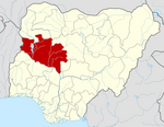 | |
This Niger State, Nigeria location article is a stub. You can help Wikipedia by expanding it. |