
Mogersdorf | |
|---|---|
 Main square with Saint Joseph's Church | |
 Coat of arms | |
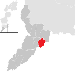 Location within Jennersdorf district | |
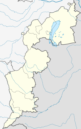 Mogersdorf Location within Austria  Mogersdorf Mogersdorf (Austria) | |
| Coordinates: 46°57′N 16°14′E / 46.950°N 16.233°E | |
| Country | Austria |
| State | Burgenland |
| District | Jennersdorf |
| Government | |
| • Mayor | Josef Korpitsch (ÖVP) |
| Area | |
| • Total | 12.77 km2 (4.93 sq mi) |
| Elevation | 228 m (748 ft) |
| Population (2018-01-01)[2] | |
| • Total | 1,164 |
| • Density | 91/km2 (240/sq mi) |
| Time zone | UTC+1 (CET) |
| • Summer (DST) | UTC+2 (CEST) |
| Postal code | 8382 |
| Website | www.mogersdorf.at |
Mogersdorf (Hungarian: Nagyfalva, Slovene: Modinci)[3] is a town in the district of Jennersdorf in the Austrian state of Burgenland.
YouTube Encyclopedic
-
1/3Views:2 567924548
-
Mogersdorf - Jennersdorf - Burgenland - AUSTRIA
-
Schlösslberg Mogersdorf
-
The Fourth Austro-Ottoman War Fought In 1663-64
Transcription
Geography
Cadastral communities are Deutsch Minihof, Mogersdorf and Wallendorf.[4]
History
Mogersdorf has a famous place in Austrian history because it was here that Raimondo Montecuccoli annihilated a 60,000/90,000-strong army of the Ottoman Empire in 1664 upon its attempt to cross the Raab River westwards towards Styria. This Battle of Mogersdorf (also known as the First Battle of St. Gotthard) was commemorated by a chapel on the nearby Schlößlberg hill. Having fallen into disrepair, it was replaced by a new building, with an unadorned but huge Christian cross at its side, in 1964.
Population
| Year | Pop. | ±% |
|---|---|---|
| 1869 | 1,638 | — |
| 1880 | 1,864 | +13.8% |
| 1890 | 2,182 | +17.1% |
| 1900 | 2,265 | +3.8% |
| 1910 | 2,235 | −1.3% |
| 1923 | 2,058 | −7.9% |
| 1934 | 1,930 | −6.2% |
| 1939 | 1,830 | −5.2% |
| 1951 | 1,699 | −7.2% |
| 1961 | 1,577 | −7.2% |
| 1971 | 1,454 | −7.8% |
| 1981 | 1,317 | −9.4% |
| 1991 | 1,264 | −4.0% |
| 2001 | 1,213 | −4.0% |
| 2011 | 1,146 | −5.5% |
| 2017 | 1,187 | +3.6% |
References
- ^ "Dauersiedlungsraum der Gemeinden Politischen Bezirke und Bundesländer - Gebietsstand 1.1.2018". Statistics Austria. Retrieved 10 March 2019.
- ^ "Einwohnerzahl 1.1.2018 nach Gemeinden mit Status, Gebietsstand 1.1.2018". Statistics Austria. Retrieved 9 March 2019.
- ^ Makuc, Neva (2011). Historiografija in mentaliteta v novoveški Furlaniji in Goriški. Ljubljana: Založba ZRC. p. 276.
- ^ Katastralgemeindenverzeichnis, www.bev.gv.at


| International | |
|---|---|
| National | |
This Burgenland location article is a stub. You can help Wikipedia by expanding it. |