
Mońki County
Powiat moniecki | |
|---|---|
 Flag  Coat of arms | |
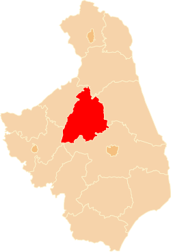 Location within the voivodeship | |
| Coordinates (Mońki): 53°24′N 22°48′E / 53.400°N 22.800°E | |
| Country | |
| Voivodeship | Podlaskie |
| Seat | Mońki |
| Gminas | |
| Area | |
| • Total | 1,382.39 km2 (533.74 sq mi) |
| Population (2019) | |
| • Total | 40,518 |
| • Density | 29/km2 (76/sq mi) |
| • Urban | 14,548 |
| • Rural | 25,970 |
| Car plates | BMN |
| Website | http://www.monki.pl/ |
Mońki County (Polish: powiat moniecki) is a unit of territorial administration and local government (powiat) in Podlaskie Voivodeship, northeastern Poland. It came into being on January 1, 1999, as a result of the Polish local government reforms passed in 1998. Its administrative seat and largest town is Mońki, which lies 40 kilometres (25 mi) northwest of the regional capital Białystok. The county also contains the towns of Knyszyn, lying 13 km (8 mi) southeast of Mońki, and Goniądz, 11 km (7 mi) northwest of Mońki.
The county covers an area of 1,382.39 square kilometres (533.7 sq mi). As of 2019 its total population is 40,518, out of which the population of Mońki is 9,986, that of Knyszyn is 2,748, that of Goniądz is 1,814, and the rural population is 25,970.[1]
Mońki County existed also between 1954 - 1975, but it was deleted after reform.
Neighbouring counties
Mońki County is bordered by Augustów County to the north, Sokółka County to the east, Białystok County to the south, Łomża County to the west and Grajewo County to the north-west.
Administrative division
The county is subdivided into seven gminas (three urban-rural and four rural). These are listed in the following table, in descending order of population.
| Gmina | Type | Area (km2) |
Population (2019) |
Seat |
| Gmina Mońki | urban-rural | 161.6 | 14,883 | Mońki |
| Gmina Jaświły | rural | 175.4 | 4,919 | Jaświły |
| Gmina Goniądz | urban-rural | 376.7 | 4,903 | Goniądz |
| Gmina Knyszyn | urban-rural | 127.7 | 4,770 | Knyszyn |
| Gmina Trzcianne | rural | 331.6 | 4,288 | Trzcianne |
| Gmina Krypno | rural | 112.7 | 3,989 | Krypno |
| Gmina Jasionówka | rural | 96.7 | 2,766 | Jasionówka |
References
- ^ GUS. "Population. Size and structure and vital statistics in Poland by territorial division in 2019. As of 30th June". stat.gov.pl. Retrieved 2020-09-14.
| City counties |  | |
|---|---|---|
| Land counties | ||