
Marion, Wisconsin | |
|---|---|
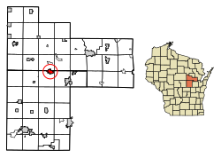 Location of Marion in Waupaca (below) and Shawano (above) counties, Wisconsin | |
| Coordinates: 44°40′21″N 88°53′11″W / 44.67250°N 88.88639°W | |
| Country | |
| State | |
| Counties | Waupaca, Shawano |
| Government | |
| • Mayor | Christopher Goke |
| Area | |
| • Total | 2.59 sq mi (6.71 km2) |
| • Land | 2.45 sq mi (6.35 km2) |
| • Water | 0.14 sq mi (0.36 km2) |
| Elevation | 850 ft (259 m) |
| Population | |
| • Total | 1,324 |
| • Density | 510/sq mi (200/km2) |
| Time zone | UTC-6 (Central (CST)) |
| • Summer (DST) | UTC-5 (CDT) |
| Area code(s) | 715 & 534 |
| FIPS code | 55-49400[4] |
| GNIS feature ID | 1569041[2] |
| Website | cityofmarionwi |
Marion is a city in Shawano and Waupaca counties in the U.S. state of Wisconsin. The population was 1,324 at the 2020 census.
YouTube Encyclopedic
-
1/2Views:1 0961 744
-
Marion Jr. High Mannequin Challenge
-
Welcome to Marian University: Sharing Experiences of Thai Sabres
Transcription
History
A post office called Marion has been in operation since 1880.[5] The city was named for Francis Marion, an officer in the American Revolutionary War.[6]
Geography
Marion is located at 44°40′21″N 88°53′11″W / 44.67250°N 88.88639°W (44.672573, -88.886284).[7]
According to the United States Census Bureau, the city has a total area of 2.58 square miles (6.68 km2), of which, 2.45 square miles (6.35 km2) is land and 0.13 square miles (0.34 km2) is water.[8] Most of the city lies in Waupaca County, with only a small portion extending into Shawano County.
Demographics
| Census | Pop. | Note | %± |
|---|---|---|---|
| 1880 | 161 | — | |
| 1890 | 470 | 191.9% | |
| 1900 | 602 | 28.1% | |
| 1910 | 798 | 32.6% | |
| 1920 | 875 | 9.6% | |
| 1930 | 992 | 13.4% | |
| 1940 | 1,034 | 4.2% | |
| 1950 | 1,118 | 8.1% | |
| 1960 | 1,200 | 7.3% | |
| 1970 | 1,218 | 1.5% | |
| 1980 | 1,348 | 10.7% | |
| 1990 | 1,242 | −7.9% | |
| 2000 | 1,297 | 4.4% | |
| 2010 | 1,260 | −2.9% | |
| 2020 | 1,324 | 5.1% | |
| U.S. Decennial Census[9] | |||
2020 census
As of the census of 2020, there were 1,324 people residing in the city. 1,310 lived in the Waupaca County portion, and 14 in Shawano County portion.
References
- ^ "2019 U.S. Gazetteer Files". United States Census Bureau. Retrieved August 7, 2020.
- ^ a b "US Board on Geographic Names". United States Geological Survey. October 25, 2007. Retrieved January 31, 2008.
- ^ "U.S. Census website". United States Census Bureau. Retrieved November 18, 2012.
- ^ "U.S. Census website". United States Census Bureau. Retrieved January 31, 2008.
- ^ "Waupaca County". Jim Forte Postal History. Retrieved March 22, 2015.
- ^ Chicago and North Western Railway Company (1908). A History of the Origin of the Place Names Connected with the Chicago & North Western and Chicago, St. Paul, Minneapolis & Omaha Railways. p. 99.
- ^ "US Gazetteer files: 2010, 2000, and 1990". United States Census Bureau. February 12, 2011. Retrieved April 23, 2011.
- ^ "US Gazetteer files 2010". United States Census Bureau. Archived from the original on January 25, 2012. Retrieved November 18, 2012.
- ^ "Census of Population and Housing". Census.gov. Retrieved June 4, 2015.
External links
- Official city website
- Sanborn fire insurance maps: 1894 1901 1909
Municipalities and communities of Shawano County, Wisconsin, United States | ||
|---|---|---|
| Cities |  | |
| Villages | ||
| Towns | ||
| CDPs | ||
| Other communities | ||
| Indian reservations | ||
| Footnotes | ‡This populated place also has portions in an adjacent county or counties | |
Municipalities and communities of Waupaca County, Wisconsin, United States | ||
|---|---|---|
| Cities |  | |
| Villages | ||
| Towns | ||
| CDPs | ||
| Other communities | ||
| Former communities | ||
| Footnotes | ‡This populated place also has portions in an adjacent county or counties | |
| International | |
|---|---|
| National | |