| Manus Plate | |
|---|---|
 | |
| Type | Minor |
| Movement1 | north-west |
| Speed1 | 92mm/year |
| Features | Pacific Ocean |
| 1Relative to the African Plate | |
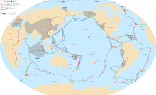
The Manus Plate is a 100-km microplate located northeast of New Guinea. The Manus Plate was formed in between the North Bismark Plate and the South Bismark Plate. The Manus Plate currently rotates counter-clockwise in the Melanesia area.[1]
Formation
The Manus Plate formed during the Brunhes-Matuyama reversal, making its maximum age approximately 781,000 years old.[2] The Manus Plate formed in-between and on top of the transform boundaries that were separating the North and South Bismark plates.[2] The plate was formed of young mid-ocean ridge basalt, along with pieces of older oceanic floor that had broken off of the South Bismarck plate.[2]
Boundaries and Movement
The north and northeast boundaries of the Manus Plate, with the North Bismark and Pacific plates are both convergent boundaries.[3] The plates southeast borders of the South Bismark plate is a divergent boundary.[3] The southwest boundary bordering the South Bismark plate is a transform boundary. The Manus plate currently has a rate of rotation of 51°/ Ma at the spot, -3.04°N, 150.46°E, in the counter-clockwise direction, due to the plates left lateral motion.[4] This is likely the fastest plate rotation, on Earth at this time.[4]
References
- ^ Bird, Peter (2003). "An updated digital model of plate boundaries". Geochemistry, Geophysics, Geosystems. 4 (3). Bibcode:2003GGG.....4.1027B. doi:10.1029/2001GC000252. ISSN 1525-2027.
- ^ a b c "Caroline, North Bismarck, South Bismarck, Manus". Southwest Pacific Plates. Retrieved 2020-03-12.
- ^ a b "ODP Leg 193: Manus Basin\". mlp.ldeo.columbia.edu. Retrieved 2020-03-18.
- ^ a b Martinez, Fernando; Taylor, Brian (1996-06-01). "Backarc spreading, rifting, and microplate rotation, between transform faults in the Manus Basin". Marine Geophysical Researches. 18 (2): 203–224. Bibcode:1996MarGR..18..203M. doi:10.1007/BF00286078. ISSN 1573-0581. S2CID 128798965.
3°02′13″S 150°27′22″E / 3.0370°S 150.4560°E

