
Mākaro (Māori) | |
|---|---|
 | |
 Mākaro/Ward Mākaro / Ward Island (Wellington, New Zealand) | |
| Geography | |
| Location | Wellington Harbour |
| Coordinates | 41°17′38″S 174°52′17″E / 41.293849°S 174.871514°E |
| Length | 250 m (820 ft) |
| Width | 80 m (260 ft) |
| Highest elevation | 20 m (70 ft) |
| Administration | |
New Zealand | |
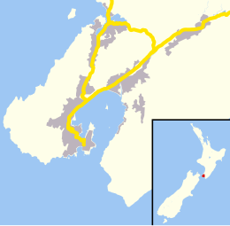
Mākaro / Ward island is one of the three small islands in Wellington Harbour, at the southern end of the North Island, New Zealand.
Ward Island is on the eastern side of the harbour, about 1.7 kilometres (1.1 mi) west of the town of Eastbourne. It is about 250 metres (270 yd) long and 80 metres (87 yd) wide, with the long axis aligned north–south. The significantly larger Matiu / Somes Island lies about 5 km (3.1 mi) northwest.
Māori tradition is that both of these islands received their original Māori names from Kupe, the semi-legendary first navigator to reach New Zealand and get home again with reports of the new land, but this cannot be verified. He purportedly named them after his two daughters (or, in some versions of the tale, nieces) when he first entered the harbour about 1000 years ago. In 1997 the New Zealand Geographic Board assigned the official bilingual name of Mākaro/Ward island.[1] Formatting was later changed to include a space on each side of the slash: Mākaro / Ward island.
The bulk of Ward Island consists of a steep sided block of yellowy/brown argilite, with a more or less flat top. There is a beach of greywacke shingle along the east side of the island. The rest of the coastline is rocky except for a pair of smaller beaches on the western side, backed by cliffs about 20m high. Numerous small reefs surround the island, particularly at the southern end. The main shipping channel to the ports of Wellington and Seaview passes to the west of Ward Island. The passage between Ward and Eastbourne is too shallow for vessels of any size.
The island has been used as a defence work in both ancient and modern times. A Ngāti Ira pā of refuge (which as such was not usually inhabited) existed on the island in the early 19th century. There was no construction there – the island itself, with its sheer cliffs, served as the refuge.[2] During the Second World War a 1.8 km (1.1 mi) wooden piled anti-submarine barrier was built between Robinson Bay and the eastern shore of the island, and a net suspended from buoys extended from the western side of the island to Kau Point on the western harbour shore.[3][4] Other than a few concrete blocks on the western side of the island there are no remains of these extensive structures to be seen today.[4]
The island is a popular destination for recreational watercraft of all kinds. The reefs and the rocky coast provide good fishing and snorkelling opportunities. Off the southern end, beds of seaweed provide shelter for abundant fish life and opportunities for collecting edible shellfish such as pāua and green lipped mussels.
Makaro Street in Eastbourne is named after the island, which can be seen at the seaward end of its short east–west length.
YouTube Encyclopedic
-
1/1Views:3 623
-
Wellington Harbour's taniwha - Roadside Stories
Transcription
[Traditional Māori music (14 secs)] [Narrator] Landing at Wellington Airport can be a scary experience. The strong winds which often funnel through Cook Strait can make landing aircraft on the narrow strip of land, with hills on both sides and the sea at either end, very difficult. Only 800 years ago, the land the airport sits on lay underwater. There were three islands in the harbour. Two small ones lay in the centre and a very large island, known as Motukairangi, was located just a couple of kilometres from the harbour's southern shore. But around 1460, a massive earthquake substantially raised land in this area. After the shake, Motukairangi found itself joined to the mainland by a narrow strip of raised land which lay only a few metres above sea level and is today the Miramar Peninsula. Large earthquakes in 1848 and 1855 raised the land around Wellington Harbour by a further two metres. In the 1920s, early aviators made a landing strip among the sand dunes separating Motukairangi and the mainland. Forty years later this was substantially improved to provide a much larger airstrip capable of landing modern aircraft -- the forerunner of today's Wellington Airport. The Māori story of the creation of Wellington Harbour involves superhuman creatures known as taniwha. According to the story, long ago Wellington Harbour was a lake. Two taniwha, Ngake and Whātaitai, in the lake. Both felt confined and longed for open sea, only just beyond the lake's eastern edge. The restless Ngake curled his long tail like a spring against the western edge of the lake and hurled himself through the water towards the eastern shore. He succeeded in carving a passage through it to the nearby open sea, creating the entrance to the harbour from Cook Strait. Soon afterwards, Whātaitai tried to create a second entrance to the sea, close to Ngake's. But he become trapped by the receding tide that Ngake had let in and eventually washed up on the shore exhausted. His dead body is still there, known today as the Hataitai Ridge. Tangi-te-keo, known today as Mount Victoria, was named after the spirit of Whātaitai. After leaving the taniwha's body, the spirit flew up to the top of this hill in the shape of a bird and proceeded to weep. In Maori, tangi means to weep and mourn. Later, according to Māori traditions, an early Polynesian navigator called Kupe visited the harbour. Kupe's family made the harbour their base while Kupe explored the area. Kupe named the two small islands in the middle of the harbour, Matiu and Mākaro, after his children. Today both are conservation reserves. Mākaro, also known as Ward Island, is the smaller of the two islands. It's steep sides and lack of water discouraged human occupation. But Matiu Island, also known as Somes Island, has been inhabited for many years. Perfectly positioned in the centre of the harbour, Matiu Island offered security to a succession of Māori tribes who built fortified villages there. Somes Island became a quarantine station during the nineteenth century, then an internment camp for suspected enemies during the First and Second World Wars. It was not until 1995 that Matiu Island became a conservation reserve. Since then, a lot of its vegetation has grown back and it is home to a range of endangered species. One of these species is the tuatara. This native reptile is described as a 'living fossil' as it is the sole remaining species of a type that was alive back when dinosaurs roamed the earth.
The island ecosystem
Ward Island is a designated DOC scientific reserve and as such, camping, fires and dogs are not permitted there.[5]
The island is home to a small population of seagulls and other seabirds, which nest on the steep slopes of the island. The island is otherwise uninhabited.
As an ongoing measure to ensure that a rodent population does not become established, DOC has been maintaining bait stations filled with pellets containing Brodifacoum poison on the island since 2005.
See also
References
- ^ "New names for islands". Evening Post. 26 February 1997. ProQuest 314490910.
- ^ David Hamer and Roberta Nicholls,"The making of Wellington, 1800-1914-ll essays",Victoria university press,(1990)
- ^ Ann Carew and Allison Carew," Eastbourne, a history of the eastern bays of Wellington harbour", Eastbourne historical society inc.,(2001)
- ^ a b Peter Cooke,"Defending New Zealand – ramparts on the sea 1840 – 1950s",Defence of New Zealand Study Group,(2000)
- ^ Other harbour islands. Department of Conservation. Retrieved 18 December 2012.