To install click the Add extension button. That's it.

The source code for the WIKI 2 extension is being checked by specialists of the Mozilla Foundation, Google, and Apple. You could also do it yourself at any point in time.

4,5
Kelly Slayton
Congratulations on this excellent venture… what a great idea!
Alexander Grigorievskiy
I use WIKI 2 every day and almost forgot how the original Wikipedia looks like.
Live Statistics
English Articles
Improved in 24 Hours
Added in 24 Hours
What we do. Every page goes through several hundred of perfecting techniques; in live mode. Quite the same Wikipedia. Just better.
.
Leo
Newton
Brights
Milds

List of airports in Haiti

From Wikipedia, the free encyclopedia

Map of Haiti

This is a list of airports in Haiti, grouped by type and sorted by location.

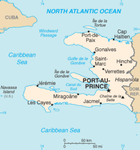
Haiti, officially the Republic of Haiti, is a Caribbean country. It occupies the western, smaller portion of the island of Hispaniola, which it shares with the Dominican Republic. The total area of Haiti is 27,750 square kilometres (10,714 sq mi). Its capital is Port-au-Prince. The official languages are French and Haitian Creole.

Haiti is divided into ten departments, which are further divided into 42 arrondissements, and 145 communes and 571 communal sections.

Airports

Airport names shown in bold indicate the airport has scheduled service on commercial airlines.

City served Department ICAO IATA Airport name Coordinates Runway
 International
Cap-Haïtien Nord MTCH CAP Cap-Haïtien International Airport 19°43′59″N 72°11′41″W / 19.73306°N 72.19472°W / 19.73306; -72.19472 (Cap-Haïtien International Airport) 7,500 ft × 131 ft (2,286 m × 40 m) paved[1]
Port-au-Prince Ouest MTPP PAP Toussaint Louverture International Airport 18°34′48″N 072°17′33″W / 18.58000°N 72.29250°W / 18.58000; -72.29250 (Toussaint Louverture International Airport) 9,974 ft × 141 ft (3,040 m × 43 m) paved[2]
 Domestic
Hinche Centre HIN Hinche Airport 2,660 ft (810 m) unpaved
Jacmel Sud-Est MTJA JAK Jacmel Airport 18°14′28″N 072°31′07″W / 18.24111°N 72.51861°W / 18.24111; -72.51861 (Jacmel Airport) 3,937 ft × 95 ft (1,200 m × 29 m) paved[3]
Jérémie Grand'Anse MTJE JEE Jérémie Airport 18°39′48″N 74°10′20″W / 18.66333°N 74.17222°W / 18.66333; -74.17222 (Jérémie Airport) 3,937 ft (1,200 m) paved
Les Cayes Sud MTCA CYA Antoine-Simon Airport 18°16′16″N 73°47′18″W / 18.27111°N 73.78833°W / 18.27111; -73.78833 (Antoine-Simon Airport) 3,666 ft × 80 ft (1,117 m × 24 m) paved[4]
Port-de-Paix Nord-Ouest MTPX PAX Port-de-Paix Airport 19°56′05″N 72°50′50″W / 19.93472°N 72.84722°W / 19.93472; -72.84722 (Port-de-Paix Airport) 2,100 ft (640 m) unpaved
 Other
Anse-à-Galets Ouest LGN Anse-à-Galets Airport (on Île de la Gonâve) 2,448 ft (746 m) unpaved
Anse-Rouge Artibonite Anse-Rouge Airport 1,936 ft (590 m) unpaved
Belladère Centre Belladère Airport 3,300 ft (1,000 m) unpaved
Dame-Marie Grand'Anse Dame-Marie Airport 3,280 feet (1,000 m) grass
Fond-des-Blancs Sud Fond-des-Blancs Airport 2,100 ft (640 m)unpaved
Môle-Saint-Nicolas Nord-Ouest Môle-Saint-Nicolas Airport 3,150 ft (960 m) unpaved
Ouanaminthe Nord-Est OAN Ouanaminthe Airport 2,424 ft (739 m) unpaved
Phaeton Nord-Est FLT Phaeton Airport 3,238 ft (987 m) unpaved
Pignon Nord PGN Pignon Airport 3,500 ft (1,100 m) unpaved
Port-Salut Sud Port-Salut Airport 2,628 ft (801 m) unpaved
 Closed
Port-au-Prince Ouest Aéroport de Chancerelles

Airports by volume of traffic

Makeshift airstrips

In the wake of the 7.0 magnitude 2010 Haiti earthquake of January 12, several makeshift airports have been set up around the country to facilitate aid shipments.

Outside of Léogâne, a makeshift airstrip has been set up on part of Route 9, a highway of the commune, able to handle small planes.[5]

See also

References

  • "ICAO Location Indicators by State" (PDF). International Civil Aviation Organization. 12 January 2006.
  • "UN Location Codes: Dominican Republic (includes IATA codes)". UN/LOCODE 2011-1. UNECE. August 2011.
  • UNJLC: Haiti Airfields
  • [1]

Footnotes

External links


This page was last edited on 11 November 2023, at 04:56
Basis of this page is in Wikipedia. Text is available under the CC BY-SA 3.0 Unported License. Non-text media are available under their specified licenses. Wikipedia® is a registered trademark of the Wikimedia Foundation, Inc. WIKI 2 is an independent company and has no affiliation with Wikimedia Foundation.