
Lincolnton, Georgia | |
|---|---|
 Lincoln County Courthouse | |
 Location in Lincoln County and the state of Georgia | |
| Coordinates: 33°47′40″N 82°28′35″W / 33.79444°N 82.47639°W | |
| Country | United States |
| State | Georgia |
| County | Lincoln |
| Area | |
| • Total | 3.53 sq mi (9.13 km2) |
| • Land | 3.51 sq mi (9.10 km2) |
| • Water | 0.01 sq mi (0.03 km2) |
| Elevation | 469 ft (143 m) |
| Population (2020) | |
| • Total | 1,480 |
| • Density | 421.17/sq mi (162.61/km2) |
| Time zone | UTC-5 (Eastern (EST)) |
| • Summer (DST) | UTC-4 (EDT) |
| ZIP code | 30817 |
| Area code | 706 |
| FIPS code | 13-46552[2] |
| GNIS feature ID | 0328514[3] |
Lincolnton is a city and the county seat of Lincoln County, Georgia, United States.[4] The population was 1,480 at the 2020 census. It contains numerous houses and historic districts listed on the National Register of Historic Places. Both the city and the county were named for General Benjamin Lincoln, who served in the Continental Army during the American Revolution.[5]
YouTube Encyclopedic
-
1/4Views:233 2664 7642 0622 068
-
Best Rural Towns in Georgia you need to move to.
-
Ashmore Logging Contractors, Lincolnton, Georgia
-
Ashmore Logging Contractors, Lincolnton, Georgia
-
Ashmore Logging Contractors, Lincolnton, Georgia
Transcription
History
Lincolnton was founded in 1798 as seat of the newly formed Lincoln County. It was incorporated as a town in 1817 and as a city in 1953.[6]
Geography
Lincolnton is located in central Lincoln County at 33°47′40″N 82°28′35″W / 33.79444°N 82.47639°W (33.794414, -82.476450).[7] U.S. Route 378 passes through the center of town as Washington Street, leading southwest 17 miles (27 km) to Washington, and northeast 14 miles (23 km) to McCormick, South Carolina. Georgia State Route 79 leads northwest 38 miles (61 km) to Elberton, while State Route 43 leads south 24 miles (39 km) to Thomson. Augusta is 39 miles (63 km) to the southeast via State Routes 47 and 104. A historical site, Elijah Clark State Park, is 7 miles (11 km) northeast of Lincolnton at the Savannah River.
According to the United States Census Bureau, Lincolnton has a total area of 3.5 square miles (9.1 km2), of which 0.01 square miles (0.03 km2), or 0.35%, are water.[8] The west side of the city drains to Florence Creek, while the east side drains to Dry Fork Creek, both of which flow to Soap Creek, an arm of the Savannah River within Lake Strom Thurmond (Clarks Hill Lake).
Demographics
| Census | Pop. | Note | %± |
|---|---|---|---|
| 1810 | 106 | — | |
| 1870 | 92 | — | |
| 1880 | 70 | −23.9% | |
| 1890 | 220 | 214.3% | |
| 1900 | 221 | 0.5% | |
| 1910 | 375 | 69.7% | |
| 1920 | 657 | 75.2% | |
| 1930 | 916 | 39.4% | |
| 1940 | 894 | −2.4% | |
| 1950 | 1,315 | 47.1% | |
| 1960 | 1,450 | 10.3% | |
| 1970 | 1,442 | −0.6% | |
| 1980 | 1,406 | −2.5% | |
| 1990 | 1,476 | 5.0% | |
| 2000 | 1,595 | 8.1% | |
| 2010 | 1,566 | −1.8% | |
| 2020 | 1,480 | −5.5% | |
| U.S. Decennial Census[9] | |||
| Race | Num. | Perc. |
|---|---|---|
| White | 806 | 54.46% |
| Black or African American | 601 | 40.61% |
| Asian | 11 | 0.74% |
| Other/Mixed | 42 | 2.84% |
| Hispanic or Latino | 20 | 1.35% |
As of the 2020 United States census, there were 1,480 people, 708 households, and 442 families residing in the city.
Education
Lincoln County School District
The Lincoln County School District holds pre-school to grade twelve, and consists of an elementary school, a middle school, and a high school.[11] The district has 98 full-time teachers and over 1,450 students.[12]
- Lincoln County Elementary School
- Lincoln County Middle School
- Lincoln County High School
Notable people
- Barney Bussey, former NFL player
- Jeff and Sheri Easter, musicians
- Garrison Hearst, former NFL player
- Little Roy Lewis and The Lewis Family, gospel bluegrass musicians
- Lizzy Long, bluegrass/gospel musician, The Little Roy and Lizzy Show
- Pettis Norman, former NFL player
- Jarius Wynn, Buffalo Bills defensive end
See also
References
- ^ "2020 U.S. Gazetteer Files". United States Census Bureau. Retrieved December 18, 2021.
- ^ "U.S. Census website". United States Census Bureau. Retrieved January 31, 2008.
- ^ "US Board on Geographic Names". United States Geological Survey. October 25, 2007. Retrieved January 31, 2008.
- ^ "Find a County". National Association of Counties. Retrieved June 7, 2011.
- ^ Gannett, Henry (1905). The Origin of Certain Place Names in the United States. U.S. Government Printing Office. p. 187.
- ^ Hellmann, Paul T. (May 13, 2013). Historical Gazetteer of the United States. Routledge. p. 236. ISBN 978-1135948597. Retrieved November 30, 2013.
- ^ "US Gazetteer files: 2010, 2000, and 1990". United States Census Bureau. February 12, 2011. Retrieved April 23, 2011.
- ^ "U.S. Gazetteer Files: 2019: Places: Georgia". U.S. Census Bureau Geography Division. Retrieved December 16, 2019.
- ^ "Census of Population and Housing". Census.gov. Retrieved June 4, 2015.
- ^ "Explore Census Data". data.census.gov. Retrieved December 9, 2021.
- ^ Georgia Board of Education[permanent dead link], Retrieved June 23, 2010.
- ^ School Stats, Retrieved June 23, 2010.
External links
Municipalities and communities of Lincoln County, Georgia, United States | ||
|---|---|---|
| Cities | 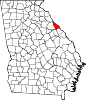 | |
| Unincorporated communities | ||
| Ghost town | ||
| International | |
|---|---|
| Geographic | |
| Other | |