
Leinefelde-Worbis | |
|---|---|
 Coat of arms | |
Location of Leinefelde-Worbis within Eichsfeld district 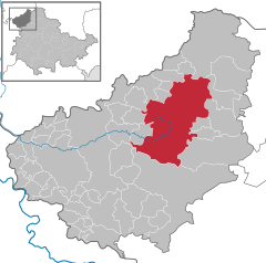 | |
 Leinefelde-Worbis  Leinefelde-Worbis | |
| Coordinates: 51°23′N 10°20′E / 51.383°N 10.333°E | |
| Country | Germany |
| State | Thuringia |
| District | Eichsfeld |
| Subdivisions | 10 |
| Government | |
| • Mayor (2022–28) | Christian Zwingmann[1] |
| Area | |
| • Total | 110.18 km2 (42.54 sq mi) |
| Elevation | 320 m (1,050 ft) |
| Population (2022-12-31)[2] | |
| • Total | 20,119 |
| • Density | 180/km2 (470/sq mi) |
| Time zone | UTC+01:00 (CET) |
| • Summer (DST) | UTC+02:00 (CEST) |
| Postal codes | 37327, 37339 |
| Dialling codes | 03605, 036074 |
| Vehicle registration | EIC, HIG, WBS |
| Website | www.leinefelde-worbis.de |
Leinefelde-Worbis is a town in the district of Eichsfeld, in northwestern Thuringia, Germany. The town was formed on March 16, 2004, from the former independent towns Leinefelde and Worbis along with the municipalities of Breitenbach and Wintzingerode. In July 2018 the former municipality of Hundeshagen, and in January 2019 Kallmerode was merged into Leinefelde-Worbis. The population before the amalgamation was 14,387 for Leinefelde, 5,541 for Worbis, 1,021 for Breitenbach and 614 for Wintzingerode. The 10 parts of Leinefelde-Worbis are Leinefelde, Worbis, Breitenbach, Kirchohmfeld, Birkungen, Beuren, Hundeshagen, Kaltohmfeld, Wintzingrode, Kallmerode and Breitenholz.
YouTube Encyclopedic
-
1/3Views:6 3735 9191 806
-
Leinefelde 2010 Rundgang
-
Leinefelde 1990 mit Zentraler Platz und Baumwollspinnerei
-
Das Boxkino Leinefelde - Ein pädagogisches, präventives Projekt in Thüringen - Leuchttürme
Transcription
Climate
| Climate data for Leinefelde (1991–2020 normals) | |||||||||||||
|---|---|---|---|---|---|---|---|---|---|---|---|---|---|
| Month | Jan | Feb | Mar | Apr | May | Jun | Jul | Aug | Sep | Oct | Nov | Dec | Year |
| Mean daily maximum °C (°F) | 2.6 (36.7) |
3.7 (38.7) |
7.8 (46.0) |
13.2 (55.8) |
17.1 (62.8) |
20.3 (68.5) |
22.8 (73.0) |
22.8 (73.0) |
18.0 (64.4) |
12.5 (54.5) |
6.8 (44.2) |
3.4 (38.1) |
12.6 (54.7) |
| Daily mean °C (°F) | 0.3 (32.5) |
0.9 (33.6) |
4.0 (39.2) |
8.4 (47.1) |
12.2 (54.0) |
15.3 (59.5) |
17.5 (63.5) |
17.4 (63.3) |
13.4 (56.1) |
8.9 (48.0) |
4.4 (39.9) |
1.2 (34.2) |
8.6 (47.5) |
| Mean daily minimum °C (°F) | −2.2 (28.0) |
−1.9 (28.6) |
0.4 (32.7) |
3.6 (38.5) |
7.1 (44.8) |
10.1 (50.2) |
12.4 (54.3) |
12.4 (54.3) |
9.1 (48.4) |
5.6 (42.1) |
2.0 (35.6) |
−1 (30) |
4.8 (40.6) |
| Average precipitation mm (inches) | 58.2 (2.29) |
45.6 (1.80) |
54.4 (2.14) |
41.8 (1.65) |
67.9 (2.67) |
63.0 (2.48) |
82.3 (3.24) |
62.6 (2.46) |
58.7 (2.31) |
51.8 (2.04) |
55.8 (2.20) |
59.9 (2.36) |
697.5 (27.46) |
| Average precipitation days (≥ 1.0 mm) | 17.4 | 15.5 | 16.0 | 12.6 | 14.4 | 14.5 | 15.5 | 14.1 | 13.2 | 15.7 | 17.0 | 18.6 | 184.1 |
| Average snowy days (≥ 1.0 cm) | 10.9 | 12.3 | 5.9 | 1.0 | 0 | 0 | 0 | 0 | 0 | 0 | 2.8 | 8.2 | 41.1 |
| Average relative humidity (%) | 87.0 | 83.3 | 79.2 | 72.0 | 73.9 | 75.0 | 73.3 | 71.8 | 78.7 | 84.6 | 88.3 | 88.7 | 79.6 |
| Mean monthly sunshine hours | 50.2 | 73.2 | 120.4 | 174.9 | 206.1 | 207.0 | 212.7 | 199.7 | 152.1 | 104.2 | 50.4 | 39.2 | 1,584.7 |
| Source: World Meteorological Organization[3] | |||||||||||||
Transport
Leinefelde station is located on the Halle–Hann. Münden and the Gotha–Leinefelde railways.
Bear sanctuary
Since 1997 Worbis has become known for its bear sanctuary, the Alternativer Bärenpark Worbis, which is operated by the German animal welfare organisation Aktion Tier – Menschen für Tiere (formerly Deutsches Tierhilfswerk).[citation needed]
Museums

The Borderland Museum Eichsfeld, a Cold War history museum located only a few miles away from Leinefelde-Worbis, presents different topics of the history of the German division and the GDR on an area of 1,000 squaremetres. The exhibition is displayed in both German and English.
People
Leinefelde is the birthplace of Johann Carl Fuhlrott, the discoverer of Neanderthal man. It is also the birthplace of Johannes Krause, who determined the Denisovan are a distinct line of homo distinct from modern humans and Neanderthals. Fuhlrott and Krause, born nearly 180 years apart, were also professors at the University of Tübingen.
Worbis is the birthplace of Bernard Quaritch (1819-1899), the London second-hand bookseller and publisher, and of Barbara Saß-Viehweger (born 1943), a German politician, lawyer and civil law notary.
References
- ^ Gewählte Bürgermeister - aktuelle Landesübersicht, Freistaat Thüringen, accessed 10 November 2022.
- ^ "Bevölkerung der Gemeinden, erfüllenden Gemeinden und Verwaltungsgemeinschaften in Thüringen Gebietsstand: 31.12.2022" (in German). Thüringer Landesamt für Statistik. June 2023.
- ^ "World Meteorological Organization Climate Normals for 1991–2020". World Meteorological Organization Climatological Standard Normals (1991–2020). National Oceanic and Atmospheric Administration. Archived from the original on 12 October 2023. Retrieved 12 October 2023.
| International | |
|---|---|
| National | |
| Geographic | |