
Lassa
لاسا | |
|---|---|
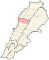
 Lassa Location in Lebanon | |
| Coordinates: 34°4′34″N 35°51′36″E / 34.07611°N 35.86000°E | |
| Country | Lebanon |
| Governorate | Keserwan-Jbeil |
| District | Byblos |
| Area | |
| • Total | 7.39 km2 (2.85 sq mi) |
| Elevation | 1,130 m (3,710 ft) |
Lassa (Arabic: لاسا) is a municipality in the Byblos District of Keserwan-Jbeil Governorate, Lebanon. It is 90 kilometers north of Beirut. Lassa has an average elevation of 1,130 meters above sea level and a total land area of 739 hectares. The village contains one public school, which enrolled 15 students in 2008.[1] Its inhabitants are predominantly Shia Muslims with a Maronite minority.[2]
YouTube Encyclopedic
-
1/3Views:3 1123 3271 731
-
مقام النبي هدوان (ع) - بلدة لاسا Prophet Hadwan in Lassa
-
Byblos Lebanon tourism walking Tour Jbeil
-
Who's calling?A phone conversation with a receptionist in Lebanese Arabic (Levantine Arabic/Dialect)
Transcription
History
Lassa was burnt by the Ottomans many times in reprisal for the Hamadeh lords' failure to remit tax incomes. In the late 18th century, the Hamadeh and most of their allied clans were driven out of Lassa and Mount Lebanon to the Beqaa valley.[3]
References
- ^ "Lassa". Localiban. Localiban. 2008-01-17. Retrieved 2016-02-12.
- ^ Cammett, Melani; Issar, Sukriti (July 2010). "Bricks and Mortar Clientalism: Sectarianism and the Logics of Welfare Allocation in Lebanon". World Politics. 62 (3): 381–421. doi:10.1017/S0043887110000080. JSTOR 40891382. PMC 4029429. PMID 24860198. SSRN 1860586.
- ^ Winter, Stefan (11 March 2010). The Shiites of Lebanon under Ottoman Rule, 1516–1788. Cambridge University Press. ISBN 9781139486811.
Capital: Byblos | ||
| Towns and villages |
|  |
| Landmarks |
| |
This Lebanon location article is a stub. You can help Wikipedia by expanding it. |