
Kolbingen | |
|---|---|
 Coat of arms | |
Location of Kolbingen within Tuttlingen district 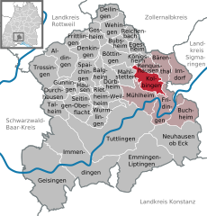 | |
 Kolbingen  Kolbingen | |
| Coordinates: 48°03′08″N 08°53′20″E / 48.05222°N 8.88889°E | |
| Country | Germany |
| State | Baden-Württemberg |
| Admin. region | Freiburg |
| District | Tuttlingen |
| Government | |
| • Mayor (2021–29) | Christian Valentin Abert[1] |
| Area | |
| • Total | 16.49 km2 (6.37 sq mi) |
| Elevation | 854 m (2,802 ft) |
| Population (2022-12-31)[2] | |
| • Total | 1,276 |
| • Density | 77/km2 (200/sq mi) |
| Time zone | UTC+01:00 (CET) |
| • Summer (DST) | UTC+02:00 (CEST) |
| Postal codes | 78600 |
| Dialling codes | 07463 |
| Vehicle registration | TUT |
| Website | www.kolbingen.de |
Kolbingen is a municipality in the district of Tuttlingen in Baden-Württemberg in Germany. It is situated about 15 km northeast of Tuttlingen and 7 km from Mühlheim an der Donau.
YouTube Encyclopedic
-
1/1Views:1 563
-
Narrenvogtei Kolbingen beim Narrentreffen in Königsheim
Transcription
Demographics
Population development:[3]
|
Farming
To help people to help themselves Württemberg planted alleys of fruit-trees (Dienstbarkeit on private ground near streets). The tree farms from William I of Württemberg, also the Brüdergemeinde delivered for free.[4] The Kolbinger Goldbirne is a local tree.
References
- ^ Aktuelle Wahlergebnisse, Staatsanzeiger, accessed 15 September 2021.
- ^ "Bevölkerung nach Nationalität und Geschlecht am 31. Dezember 2022" [Population by nationality and sex as of December 31, 2022] (CSV) (in German). Statistisches Landesamt Baden-Württemberg. June 2023.
- ^ "Kolbingen (Tuttlingen, Baden-Württemberg, Deutschland) - Einwohnerzahlen, Grafiken, Karte, Lage, Wetter und Web-Informationen". www.citypopulation.de. Retrieved 2023-05-23.
- ^ Apfelgeschichte Archived 2020-09-29 at the Wayback Machine auf Apfelgut Sulz
External links
- Official Web site for the city of Kolbingen (in German)
| International | |
|---|---|
| National | |
This Tuttlingen district location article is a stub. You can help Wikipedia by expanding it. |