
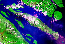
 NASA satellite image (Geocover 2000) | |
 Kiwai Island | |
| Geography | |
|---|---|
| Location | Fly River |
| Coordinates | 8°33′S 143°25′E / 8.550°S 143.417°E |
| Archipelago | Fly River Delta Islands |
| Major islands | Kiwai, Purutu, Wabuda Island |
| Area | 359.1 km2 (138.6 sq mi) |
| Length | 59 km (36.7 mi) |
| Width | 9 km (5.6 mi) |
| Coastline | 135.3 km (84.07 mi) |
| Highest point | unnamed |
| Administration | |
Papua New Guinea | |
| Province | Western Province |
| District | South Fly District |
| LLG | Kiwai Rural |
| Largest settlement | Iasa |
| Demographics | |
| Population | 2092 (2000) |
| Ethnic groups | Kiwai |
Kiwai Island is the largest island in the Fly River delta, Papua New Guinea. It is one of the Torres Strait Islands. It is 59 km long along the northwest–southeast axis from Wamimuba Point in the northwest to the village of Saguane (Sanguane) in the south, and up to 9 km wide, with an average width of 5.6 km. Its area is 359 km2.[1] Neighboring Purutu and Wabuda Islands to the north and northeast are also among the three largest islands in the Fly River delta. A language study mentioned a population of about 4500,[2] but the census of population of 2000 showed only 2092 inhabitants.
The island separates the north and south entrances of the Fly River. It is well wooded and only a few feet above water. The chief village, Iasa, is located on the south side of the island. Sumai village is on the same side of the island and 24 km farther northwest. Doropo village is about midway along the north side of the island. At the east end of the island are other small villages, such as Sagasia, Ipisia, Agobara and Oromosapuo.
The inhabitants of the Fly River delta engage in agriculture and hunting. Coconut palm, breadfruit, plantain, sago palm, and sugar cane are grown.[3]
Administratively, the island is part of Kiwai Rural LLG (Local Level Government area) of South Fly District, Western Province.
History
Archeologists have recovered some of the largest stone axes ever discovered and ethnographers believe that these axe heads were used as ceremonial grave markers.[4] Anthropologists believe that most of these stone axes were imported from the Torres Strait Islands.[4] Owing to this belief is the lack of suitable tool stone in the region.[4] An examination of twenty of these axes revealed that eighteen of them were composed of intrusive igneous rocks similar to the type found on the Torres Strait Islands. Ethnologists and archeologists both believe that the Kiwai Islanders and the Torres Strait Islanders had a symbiotic relationship involving the exchange of stone axes for large seafaring canoes.[4][5][6]

See also
References
- ^ http://islands.unep.ch/IHD.htm#848
- ^ "Kiwai, Southern".
- ^ http://permanent.access.gpo.gov/websites/pollux/pollux.nss.nima.mil/NAV_PUBS/SD/pub164/164sec06.pdf [bare URL PDF]
- ^ a b c d McNiven, Ian J (2016). "Stone Axes as Grave Markers on Kiwai Island Fly River Delta Papua New Guinea". Journal of Pacific Archaeology. 7 (1): 74–83.
- ^ McNiven, Ian (2004). Torres Strait and the origin of large stone axes from Kiwai Island, Fly River estuary (Papua New Guinea). OCLC 902807551.
- ^ Russell), Lawrence, David (David (1989). The material culture of customary exchange in the Torres Strait and Fly Estuary Region. OCLC 271768376.
{{cite book}}: CS1 maint: multiple names: authors list (link)
This article about an island in Papua New Guinea is a stub. You can help Wikipedia by expanding it. |