

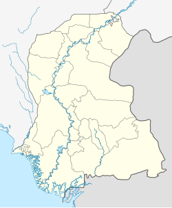

Jamshoro (Sindhi: ڄام شورو, Urdu: جامشورو) is a city and the capital of Jamshoro District, located in Sindh, Pakistan. It is on the right bank of the Indus River, approximately 18 km (11 mi) northwest of Hyderabad and 150 km (93 mi) northeast from the provincial capital of Sindh, Karachi.[2]
This city is popularly known as Education City. Four major universities of Sindh are located in the vicinity of this city.
YouTube Encyclopedic
-
1/5Views:21 90316 2692 5985 81614 814
-
Top 10 Places to Visit in Jamshoro Sindh Pakistan | جامشورو کے مقامات | Tanveer Rajput TV
-
Star Pariwaar of LUMHS Jamshoro - Most Viral Video
-
MACHLI KHANE KARACHI SEY JAMSHORO 😋
-
DRIVLOG No. 26 - University of Sindh, Jamshoro
-
Sindh University Jamshoro | A random visit with friends | Abdul Bari Vlogs
Transcription
History


Ranikot Fort is a historical fort near Sann, Jamshoro District, Sindh, Pakistan.[3] Ranikot Fort is also known as the Great Wall of Sindh and is believed to be the world's largest fort with a circumference of approximately 26 kilometres (16 mi).[4] Since 1993, it has been on the tentative list of UNESCO World Heritage Sites.[5]
Archaeologists point to the 17th century as its time of first construction but now Sindh archaeologists agree that some of the present structure was reconstructed by Mir Karam Ali Khan Talpur and his brother Mir Murad Ali Talpur in 1812 at a cost of 1.2 million rupees (Sindh Gazetteer, 677).[6]
Universities
- University of Sindh
- Mehran University of Engineering and Technology
- Liaquat University of Medical and Health Sciences
- University of Art and Culture
Schools and colleges
- Cadet College Petaro
- Pak Turk International School & College Jamshoro
- The City School Jamshoro campus
- The Educators Branch Jamshoro
- Rockford Cambridge School Branch Jamshoro
- Pioneers School and college jamshoro campus
Location
Jamshoro, is situated on the right bank of the Indus River at south-west position of Province of Sindh sloping from direction North-east to south-west and is about 18 kilometers from Hyderabad and at a distance of 150 kilometers from Karachi.
Demographics
The population of Jamshoro District increased from 582,094 in 1998 to 1,176,969 in 2011, an increase of 102.2%.[8] Roughly, 95% of the Population of the city consists of immigrants from various parts of interior Sindh who migrated to the town in around 1948-2001 & to a lesser extent from 2002 to 2014 decades. Therefore, the city holds a number of diverse Sindhi clans & ethnic groups mainly from Jamshoro District, Dadu District, Sukkur District, Larkana District, Khairpur District, Umarkot District, Matiari District, Nawabshah District, Shikarpur District, Tharparker, Naushahro Feroze District, Badin District & Jacobabad District.[9][10][11][12] The city is predominantly Sindhi with a substantial community of Pathans, Baloch people & Seraikis. Small communities of Brahuis, Punjabis, & to a lesser extent Muhajir people are also present.[13][14][15]
Jamshoro is predominantly Muslim with a small Hindu minority.[16]
See also
References
- ^ "Sindh (Pakistan): Province, Major Cities, Municipalites [sic] & Towns - Population Statistics, Maps, Charts, Weather and Web Information". Citypopulation.de. Retrieved 27 January 2022.
- ^ "The spirit of Jamshoro". Dawn. 16 April 2008. Retrieved 27 January 2022.
- ^ Ranikot Fort Archived 2014-06-15 at archive.today Tourism Pakistan Retrieved 14 June 2014
- ^ Ondaatje, Christopher (May 1996). Sindh revisited: a journey in the footsteps of Captain Sir Richard Burton : 1842-1849, the India years. HarperCollins Publishers. p. 265. ISBN 978-0-00-255436-7.
- ^ "Ranikot Fort". UNESCO. Retrieved 20 November 2013.
- ^ "Ranikot Fort – the Great Wall of Sindh". Islamic Arts and Culture. Archived from the original on 28 May 2012. Retrieved 20 November 2013.
- ^ "District Government Jamshoro". Archived from the original on 2012-02-28. Retrieved 2014-07-26.
- ^ Abdul Sattar Khan (2 April 2012). "Sindh population surges by 81.5 pc, households by 83.9 pc". The News International. Archived from the original on 2015-10-17. Retrieved 2014-05-29.
- ^ Burton, Richard (1992). Sindh and the Races That Inhabit the Valley of the Indus. ISBN 9788120607583.
- ^ Roger Waldinger. "Immigration and Urban change" (PDF). Sscnet.ucla.edu. Archived from the original (PDF) on December 29, 2003. Retrieved 2022-01-27.
- ^ "Urban Indigenous Peoples and Migration Fact Sheet" (PDF). Archived from the original (PDF) on 2016-03-05. Retrieved 2017-06-28.
- ^ Xin Meng; Dandan Zhangy (March 13, 2013). "The Social Impact of Rural-Urban Migration on Urban 'Natives'" (PDF). Iza.org. Retrieved 2020-01-27.
- ^ "District Jamshoro. . . . . !". Archived from the original on 2014-05-16. Retrieved 2014-05-24.
- ^ a b "Pakistan Demographic and Health Survey 2012-13 Preliminary Report" (PDF). Archived from the original (PDF) on 2014-06-21. Retrieved 2014-07-26.
- ^ "Pakistan Balochistan Economic Report From Periphery to Core" (PDF). May 2008. Archived from the original (PDF) on 2011-05-01. Retrieved 2014-07-27.
- ^ "Pakistan - RELIGION". Countrystudies.us.
- ^ "Pakistan Demographic and health survey 2012-13" (PDF). Dhsprogram.com. Retrieved 2020-01-27.
- ^ "PAKISTAN - CENSUS". Archived from the original on 2011-02-14.
External links
- In Jamshoro, hopes and unfufilled promises for people
- Introduction to Jamshoro – University of Sindh Jamshoro
| International | |
|---|---|
| National | |