
32°42′31″N 117°01′43″W / 32.7087°N 117.0286°W
Jamacha, San Diego
Jamacha-Lomita | |
|---|---|
| Jamacha | |
 2014 aerial photo of the border of Jamacha-Lomita and Spring Valley | |
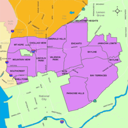 Jamacha is located in the southeastern area of the city of San Diego | |
 Jamacha, San Diego Location within Southeast San Diego | |
| Coordinates: 32°42′31″N 117°01′43″W / 32.7087°N 117.0286°W | |
| Country | |
| State | |
| County | |
| City | |
| ZIP | 92114 |
Jamacha (pronounced: /ˈhæməʃɔː/ HAM-ə-shaw) is a neighborhood in the southeastern area of San Diego, California. It is generally bounded by the city of Lemon Grove to the north, unincorporated La Presa to the east, Imperial Avenue and Encanto to the west, and Skyline and Lomita Village to the south. Major thoroughfares include Lisbon Street, Jamacha Road, and Woodrow Avenue. The neighborhood is part of the Skyline-Paradise Hills Community Planning Area.[1]
YouTube Encyclopedic
-
1/3Views:1 760398716
-
DARmageddon East Palomar Street Bridge Demolition - South View
-
AIEDL Advanced English for Marketing & Advertising - Branding
-
Living Coast Discovery Center & Balboa Park (Things to do in San Diego): Look Who's Traveling
Transcription
History
Jamacha is named for the Jamacha Valley and Rancho Jamacha, a Mexican land grant estate. The name was variously spelled Xamacha, Jamacha', 'Jamacho, and Gamacha until Jamacha was fixed as the official spelling in the early 20th century. The word is likely derived from a Spanish adaptation of the Kumeyaay Indian word Xamca, meaning "wild gourd."[2]
Background
Jamacha is a largely residential neighborhood, with mostly single-family houses mixing with some multi-family development. There is also some small-scale commercial development in the neighborhood.[3]
Geography
The Skyline-Paradise Hills Community as a whole make up approximately 4,500 acres. Much like the surrounding neighborhoods of Bay Terraces, Skyline, and Paradise Hills, Jamacha is comprised predominantly of low-density single-family homes spread across the hilly area. A major geographic feature is Paradise Valley, which runs on an east-west axis through the middle of the community and gives rise to the Paradise Creek, which flows into San Diego Bay. Jamacha, along with Lomita, Skyline, and North Bay Terrace, are directly north of Paradise Valley.[4]
Demographics
Demographic statistics are only available for Jamacha in conjunction with bordering Lomita. Jamacha-Lomita is very diverse. Combined, the demographics for Jamacha-Lomita are as follows: Hispanic-Latino are the largest group at 51.1%, followed by African-Americans at 17.7%, Asian at 13.6%, non-Hispanic Whites at 13.0%, Mixed race at 3.9% and others at 0.7%.[5]
References
- ^ ""Community Profiles: Skyline-Paradise Hills"". City of San Diego. Retrieved 2020-11-18.
- ^ Van Wormer, Stephen. "Legal Hocus-Pocus". Journal of San Diego History. Spring 1984, Volume 30, Number 2.
- ^ Skyline-Paradise Hills community plan. City of San Diego.
- ^ "Skyline-Paradise Hills Community Plan". Scoutred. Retrieved 2020-11-25.
- ^ ""Race and Ethnicity in Jomacha-Lomita, San Diego, California"". Statistical Atlas. Retrieved 2020-11-21.