
| Ivan-Arakhley Lake System | |
|---|---|
| Ивано-Арахлейские озёра | |
 Ivan-Arakhley Lake System map section | |
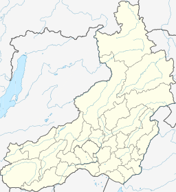 Ivan-Arakhley Lake System Location in Zabaykalsky Krai, Russian Far East | |
| Location | Vitim Plateau, South Siberian System |
| Coordinates | 52°12′N 112°52′E / 52.200°N 112.867°E[1] |
| Basin countries | Zabaykalsky Krai, Russia |
| Surface elevation | ca 965 m (3,166 ft) |
| Frozen | October to May |
| Islands | None |
Ivan-Arakhley Lake System (Russian: Ивано-Арахлейские озёра) is a group of fresh water bodies in the Chita District, Zabaykalsky Krai, Russia.[2] The villages of Arakhley, Tasei and Preobrazhenka are located near the lakes.[3]
The lakes are a tourist attraction and there are holiday cottages and resorts near them. They are located within the Ivano-Arakhley State Natural Landscape Reserve (Zakaznik), a protected area of regional significance created in 1995, covering an area of 210,000 ha (520,000 acres).[4]
Geography
The lakes lie at the southeastern end of the Vitim Plateau. As a group, they are also known as "Beklemishev Lakes" (Russian: Беклеми́шевские озёра) since they stretch roughly from SW to NE for about 80 km (50 mi) along the Beklemishev Depression.[5][6] "Chita Lakes" (Russian: Чити́нские озёра) is another alternative name, because the lakes lie very close to Chita, about 50 km (31 mi) to the west of the city.[7]
The lake system includes 6 large lakes with a water surface of more than 10 km2 (3.9 sq mi): Arakhley, Shaksha,[8] Irgen, Ivan, Tasei and Bolshoy Undugun. Arakhley is the largest of the group and is also the one having the greatest depth.[9][2][10][3]
Hydrography
The system includes 20 smaller lakes with surface areas of roughly 1 km2 (0.39 sq mi) or less. Lakes Ivan and Tasei belong to the Lena basin. Arakhley, Shaksha, Bolshoy Undugun and Irgen are separated from them by a slight elevation and belong to the Baikal basin through the Khilok river, a tributary of the Selenga.[5]
See also
- List of lakes of Russia
- Yeravna-Khorga Lake System, a similar lake formation located about 100 km (62 mi) to the northwest, in Buryatia.
- Lake Kenon
References
- ^ Google Earth
- ^ a b Арахле́й - Water of Russia
- ^ a b "N-49 Chart (in Russian)". Retrieved 15 October 2021.
- ^ Энциклопедия Забайкалья - Ivano-Arakhley Zakaznik
- ^ a b Беклеми́шевские озёра; Great Soviet Encyclopedia in 30 vols. — Ch. ed. A.M. Prokhorov. - 3rd ed. - M. Soviet Encyclopedia, 1969-1978. (in Russian)
- ^ Беклемишевские озера - rulandinfo.ru
- ^ GSE Читинские озёра — Большая советская энциклопедия
- ^ Шакша - Water of Russia
- ^ "Озеро Арахлей in the State Water Register of Russia". textual.ru (in Russian).
- ^ Энциклопедия Забайкалья - Арахлей, озеро
External links
 Media related to Ivan-Arakhley Lake System at Wikimedia Commons
- Беклемишевские озера в Забайкальском крае - рай для рыбаков!
- «Уху евшие»: На Арахлее стал ловиться крупный чебак