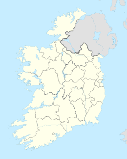
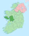
Native name: Inis Airc Nickname: Shark | |
|---|---|
 Inishark seen from Inishbofin | |
| Geography | |
| Location | Atlantic Ocean |
| Coordinates | 53°36′42″N 10°16′58″W / 53.6117°N 10.2828°W |
| Archipelago | Offshore islands of Ireland |
| Area | 2.489 km2 (0.961 sq mi)[1] |
| Highest elevation | 96.6 m (316.9 ft)[2] |
| Administration | |
| Province | Connacht |
| County | Galway |
| Civil parish | Inishbofin |
| Demographics | |
| Population | 0 (2011) |
| Ethnic groups | Irish (formerly) |
Inishark or Inishshark (Irish: Inis Airc), sometimes called Shark Island, is a small island neighbouring the larger Inishbofin in County Galway, Ireland.
YouTube Encyclopedic
-
1/5Views:33 70714 45520 08815 5202 511
-
Inis Airc: Bás Oileáin - Part 1/5 (Inishark: Death of an Island)
-
Inis Airc: Bás Oileáin - Part 5/5 (Inishark: Death of an Island)
-
Inis Airc: Bás Oileáin - Part 3/5 (Inishark: Death of an Island)
-
Inis Airc: Bás Oileáin - Part 4/5 (Inishark: Death of an Island)
-
Silent Stone Houses
Transcription
Overview

The island is now uninhabited; the last 23 inhabitants of this former isolated fishing and farming community were evacuated on 20 October 1960.[3] The islanders had been unable to leave for months in winter and the government opted to resettle them on the mainland rather than build an expensive pier on the island.
Like Inishbofin, Inishark is composed almost entirely of Silurian slates and shales. It rises almost to 100 metres (330 ft) above sea level.[2]
The documentary film Inis Airc, Bás Oileáin (Inishark, Death of an Island) produced in 2007 by C-Board Films for TG4, told the story of the last years and abandonment of Inishark. Produced and directed by Kieran Concannon, it featured interviews with surviving islanders and archive newsreel footage of the final evacuation.
In 2009, Boston College's Irish Studies program (in cooperation with Irish Film Institute) screened Inis Airc, Bás Oileáin (Inishark, Death of an Island) as part of the Irish Studies Film Series telling the evacuation story from the surviving islanders' viewpoint.
History
The island was occupied for thousands of years and has many Bronze Age sites such as burial grounds and monuments.
The name Inishark, Irish Inis Airc, may derive from an ancient chief or king named Erc; other writers connect the name with searc, "love" (Old Irish serc), or with Old Irish airc meaning "hardship" or "strait."[4][5][6]
The island's patron saint was Leo of Inis Airc, who lived there sometime between the sixth and eighth centuries. The remains of a 19th-century church named after him lie on the island today.[7]
On Easter Sunday, 1949 three young islanders drowned travelling to Inishbofin for mass. Soon afterwards, during a period when the island was cut off due to bad weather, another young man died from appendicitis.[8] These incidents as well as emigration were contributing factors driving the clamour to evacuate the island, as by this point there were few young people remaining on it.
Demographics
The table below reports data on Inishhark's population taken from Discover the Islands of Ireland (Alex Ritsema, Collins Press, 1999) and the Census of Ireland. Census data in Ireland before 1841 are not considered complete and/or reliable.
|
|
| ||||||||||||||||||||||||||||||||||||||||||||||||||||||||||||||||||||||||||||||||||||
| Source: Central Statistics Office. "CNA17: Population by Off Shore Island, Sex and Year". CSO.ie. Retrieved 12 October 2016. | ||||||||||||||||||||||||||||||||||||||||||||||||||||||||||||||||||||||||||||||||||||||
See also
- Clare Island
- Caher Island, County Mayo
- Inishturk
References
- ^ "Inishshark Townland, Co. Galway".
- ^ a b "Inishark Island". MountainViews. Ordnance Survey Ireland. Archived from the original on 21 February 2015. Retrieved 21 February 2015.
- ^ Murphy, Judy. "The Island that Died for Want of a Telephone". The Free Library. Farlex, Inc. Archived from the original on 21 February 2014. Retrieved 1 September 2010.
- ^ Ritsema, Alex (23 October 1999). Discover the Islands of Ireland. Collins Press. ISBN 9781898256670 – via Google Books.
- ^ "eDIL - Irish Language Dictionary". www.dil.ie.
- ^ "eDIL - Irish Language Dictionary". www.dil.ie.
- ^ Hoffstot, Daryln (1 August 1999). "Where Legends Outnumber People". The New York Times. Retrieved 1 September 2010.
- ^ "Inishbofin - Inis Bó Finne". irishislands.info.
External links
 Media related to Inishark at Wikimedia Commons
- Inishark, Death of an Island. Contemporary Daily Mirror story about the day the island was evacuated. 1960-10-27.
- The surviving residents of Inishark Archived 6 March 2013 at the Wayback Machine: Narrated documentary slideshow about Inishark and its surviving residents produced for the fiftieth anniversary of the evacuation of the island. Cyril Byrne. The Irish Times, 2010-10-20.[dead link]
- Inis Airc: Bás Oileán – Youtube Video
- vox hiberionacum - Early Irish Christianity and Early Medieval Ireland


