
Hapur district | |
|---|---|
 Brajghat in Garhmukteshwar | |
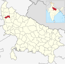 Location of Hapur district in Uttar Pradesh | |
| Country | India |
| State | Uttar Pradesh |
| Division | Meerut |
| Headquarters | Hapur |
| Tehsils | Hapur, Garhmukteshwar, Dhaulana |
| Government | |
| • District Magistrate | Ms. Prerna Sharma, IAS |
| • Superintendent of Police | Mr Abhishek Verma, IPS |
| Area | |
| • Total | 660 km2 (250 sq mi) |
| Population (2011) | |
| • Total | 1,338,311 |
| • Density | 2,000/km2 (5,300/sq mi) |
| Time zone | UTC+05:30 (IST) |
| Website | hapur |
Hapur district (earlier Panchsheel Nagar) is a recently formed district in the Indian state of Uttar Pradesh with a population of 1,338,211 at the 2011 Census. It arose as an area leading in the trade of grains and jaggery. This district on the Ganges river is 60 kilometres (37 mi) from New Delhi.[1] Being located on the river could be a reason for its prosperity in trade. It is the smallest district of Uttar Pradesh.
YouTube Encyclopedic
-
1/5Views:71 41150 1464 7998 6251 747
-
Driving from Ghaziabad towards Hapur in Uttar Pradesh
-
HAPUR (UTTAR PRADESH),HAPUR ZILA HISTORY,HAPUR DISTRICT HISTORY,HAPUR NEAR MEERUT/MAINPURI/ETAWAH,UP
-
Driving from Hapur towards Muradabad highway
-
Driving on National Highway 24 (NH24) :from Hapur towards Muradabad
-
Driving from Hapur towards Muradabad
Transcription
History
The new district Panchsheel Nagar, was created from the tehsils of Hapur, Garhmukteshwar and Dhaulana (which were previously part of Ghaziabad district) as one of three new districts of Uttar Pradesh on 28 September 2011. U.P. Chief Minister Mayawati justified the decision by declaring that Ghaziabad district was "far too big for administrative efficiency", and that creating smaller districts conformed to the ideas proposed by social reformers B. R. Ambedkar and Jyotirao Phule.[2]
The district was renamed from Panchsheel Nagar to Hapur district on 23 July 2012.[3] Hapur district is a part of Meerut division.
Government
It falls within the National Capital Region of India but comes under the state legislature of Uttar Pradesh.[4][5]
Administrative divisions
Hapur district contains three Tehsils: Hapur, Garhmukteshwar and Dhaulana.[5]
Demographics
The district population at the 2011 census was 1,338,311. Hapur has a sex ratio of 887 females per 1000 males. 409,747 (30.62%) lived in urban areas. Scheduled Castes made up 293,410 (21.92%) of the population.[7]
At the 2011 census, 82.84% of the population spoke Hindi and 16.71% Urdu as their first language.[8]
Economy
Major industries in the district are food processing, paper, textiles and steel tube production.[5]
References
- ^ "Welcome to Official Website, Hapur U.P." hapur.nic.in. Archived from the original on 13 April 2018. Retrieved 7 April 2017.
- ^ "UP gets three new districts: Prabuddhanagar, Panchsheel Nagar, Bhimnagar". The Indian Express. 29 September 2011. Retrieved 15 May 2014.
- ^ "Important Cabinet Decisions". Lucknow: Information and Public Relations Department. Archived from the original on 24 October 2014. Retrieved 17 January 2013.
- ^ "Constituent Area of NCR". Town Planning Department. Government of Rajasthan.
- ^ a b c "District Industrial Profile of Hapur District (Uttar Pradesh) 2015-16" (PDF). Development Commissioner (MSME), Ministry of Micro, Small & Medium Enterprises. Government of India. 8 July 2016. Archived from the original on 8 April 2017.
{{cite web}}: CS1 maint: unfit URL (link) - ^ "Table C-01 Population by Religion: Uttar Pradesh". censusindia.gov.in. Registrar General and Census Commissioner of India. 2011.
- ^ "District Census Handbook: Ghaziabad" (PDF). censusindia.gov.in. Registrar General and Census Commissioner of India. 2011.
- ^ a b "Table C-16 Population by Mother Tongue: Uttar Pradesh". www.censusindia.gov.in. Registrar General and Census Commissioner of India.
28°43′51″N 77°46′33″E / 28.7309°N 77.7757°E