
Green's Grant, New Hampshire | |
|---|---|
 The bottom (east end) of the Mount Washington Auto Road is in Green's Grant. | |
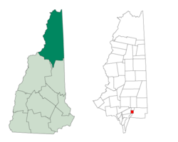 Location in Coös County, New Hampshire | |
| Coordinates: 44°18′02″N 71°13′19″W / 44.30056°N 71.22194°W | |
| Country | United States |
| State | New Hampshire |
| County | Coös |
| Area | |
| • Total | 3.67 sq mi (9.50 km2) |
| • Land | 3.67 sq mi (9.50 km2) |
| • Water | 0.004 sq mi (0.01 km2) 0.08% |
| Elevation | 1,515 ft (462 m) |
| Population (2020)[2] | |
| • Total | 0 |
| Time zone | UTC-5 (Eastern) |
| • Summer (DST) | UTC-4 (Eastern) |
| Area code | 603 |
| FIPS code | 33-007-31780 |
| GNIS feature ID | 871974 |
Green's Grant is a township in Coös County, New Hampshire, United States. As of the 2020 census, the grant had a population of zero.[2] The grant lies within the White Mountain National Forest. The base of the Mount Washington Auto Road is located in Green's Grant.
In New Hampshire, locations, grants, townships (which are different from towns), and purchases are unincorporated portions of a county which are not part of any town and have limited self-government (if any, as many are uninhabited).
YouTube Encyclopedic
-
1/3Views:3 8001 0391 686
-
Amherst, New Hampshire Video Tour
-
Mount Washington Auto Road New Hampshire - Full coverage base to summit | DRIVE YOURSELF
-
Amherst, New Hampshire town tour
Transcription
History
John Wentworth, British colonial governor of New Hampshire, made the grant to Lieutenant Francis Green of Boston, one of the last land grants that Wentworth made to soldiers of the French and Indian Wars.[3]
Geography
According to the United States Census Bureau, the grant has a total area of 3.7 square miles (9.5 km2), of which 1.8 acres (7,256 m2), or 0.08%, are covered by water.[1] The Peabody River, a northward-flowing tributary of the Androscoggin River, runs through the center of the grant, joined by its tributaries, Nineteenmile Brook and Cowboy Brook from the east and the West Branch from the west. New Hampshire Route 16 follows the Peabody River through the grant, leading southward (upstream) to the height of land at Pinkham Notch in neighboring Pinkham's Grant and north to U.S. Route 2 in Gorham. The highest point in the grant is along its eastern boundary, on the lower slopes of Middle Carter Mountain, where the elevation reaches 2,540 feet (770 m) above sea level.
Adjacent municipalities
- Martin's Location (north)
- Bean's Purchase (east)
- Pinkham's Grant (south)
- Thompson and Meserve's Purchase (west)
Demographics
| Census | Pop. | Note | %± |
|---|---|---|---|
| 1860 | 14 | — | |
| 1870 | 71 | 407.1% | |
| 1880 | 8 | −88.7% | |
| 1890 | 30 | 275.0% | |
| 1900 | 13 | −56.7% | |
| 1910 | 4 | −69.2% | |
| 1920 | 5 | 25.0% | |
| 1930 | 4 | −20.0% | |
| 1940 | 3 | −25.0% | |
| 1950 | 0 | −100.0% | |
| 1960 | 2 | — | |
| 1970 | 0 | −100.0% | |
| 1980 | 0 | — | |
| 1990 | 0 | — | |
| 2000 | 0 | — | |
| 2010 | 1 | — | |
| 2020 | 0 | −100.0% | |
| U.S. Decennial Census[2][4] | |||
As of the 2020 census, no people lived in the grant.[2]
References
- ^ a b "2021 U.S. Gazetteer Files – New Hampshire". United States Census Bureau. Retrieved November 16, 2021.
- ^ a b c d "Dixville township, Coos County, New Hampshire: 2020 DEC Redistricting Data (PL 94-171)". U.S. Census Bureau. Retrieved November 16, 2021.
- ^ Julyan, Robert Hixson; Julyan, Mary (1993), Place Names of the White Mountains (Revised ed.), University Press of New England, p. 64, ISBN 978-0-87451-638-8
- ^ "Census of Population and Housing". Census.gov. Retrieved June 4, 2016.
Places adjacent to Green's Grant, New Hampshire | |
|---|---|
Municipalities and communities of Coös County, New Hampshire, United States | ||
|---|---|---|
| City |  | |
| Towns | ||
| Townships |
| |
| CDPs | ||
| Other communities | ||