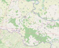
Gaboš
| |
|---|---|
 | |
 | |
| Coordinates: 45°21′07″N 18°44′13″E / 45.352°N 18.737°E | |
| Country | |
| Region | Slavonia (Podunavlje) |
| County | |
| Municipality | Markušica |
| Government | |
| • Body | Local Committee |
| Area | |
| • Total | 15.2 km2 (5.9 sq mi) |
| Population (2021)[3] | |
| • Total | 363 |
| • Density | 24/km2 (62/sq mi) |
| Demonym(s) | Gabošan (♂) Gabošanka (♀) (per grammatical gender) |
| Time zone | UTC+1 (CET) |
| Official languages | Croatian, Serbian[1] |

Gaboš (Serbian Cyrillic: Габош)[4] is a village in Vukovar-Syrmia County, Croatia, population 516. The settlement was originally established as a pustara, a Pannonian type of hamlet.[5]
Education
Branch school of Elementary school Markušica is located in Gaboš. Education at local schools is in Serbian.[6]
Demographic history
According to the 1991 census, the village was inhabited by a majority of Serbs (87.66%), and minority of Croats (7.37%) and Yugoslavs (2.27%).[7][failed verification]
See also
References
- ^ a b Government of Croatia (October 2013). "Peto izvješće Republike Hrvatske o primjeni Europske povelje o regionalnim ili manjinskim jezicima" (PDF) (in Croatian). Council of Europe. p. 36. Retrieved 30 November 2016.
- ^ Register of spatial units of the State Geodetic Administration of the Republic of Croatia. Wikidata Q119585703.
- ^ "Population by Age and Sex, by Settlements, 2021 Census". Census of Population, Households and Dwellings in 2021. Zagreb: Croatian Bureau of Statistics. 2022.
- ^ "Registar Geografskih Imena Nacionalnih Manjina Republike Hrvatske" (PDF). Archived from the original (PDF) on 2013-10-29. Retrieved 2013-03-08.
- ^ Barišić Bogišić, Lidija (2022). O neslavenskom stanovništvu na vukovarskom području. Hrvatska sveučilišna naklada. p. 143. ISBN 978-953-169-497-1.
- ^ Popis osnovnih i srednjih škola s nastavom na jeziku i pismu nacionalnih manjina po modelu A, školska godina 2011./2012., Ministarstvo znanosti obrazovanja i sporta
- ^ "попис становништва 1991" (PDF). Савезни завод за статистику и евиденцију ФНРЈ и СФРЈ.


