

Size of this PNG preview of this SVG file: 800 × 590 pixels. Other resolutions: 320 × 236 pixels | 640 × 472 pixels | 1,024 × 755 pixels | 1,280 × 944 pixels | 2,560 × 1,889 pixels | 1,891 × 1,395 pixels.
Original file (SVG file, nominally 1,891 × 1,395 pixels, file size: 97 KB)
| This is a file from the Wikimedia Commons. Information from its description page there is shown below. Commons is a freely licensed media file repository. You can help. |
Summary
| Description |
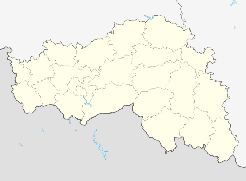
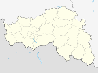
Русский: Позиционная карта Белгородской области Равноугольная проекция, растяжение — 155%. Координаты краёв:
|
| Date | |
| Source |
Own work This W3C-unspecified vector image was created with Inkscape . |
| Author | Виктор В |
| Other versions |
Derivative works of this file: Outline Map of Belgorod Oblast (with position on the map of Russia).svg []
|


.svg)
Licensing
| I, the copyright holder of this work, release this work into the public domain. This applies worldwide. In some countries this may not be legally possible; if so: I grant anyone the right to use this work for any purpose, without any conditions, unless such conditions are required by law. |
File history
Click on a date/time to view the file as it appeared at that time.
| Date/Time | Thumbnail | Dimensions | User | Comment | |
|---|---|---|---|---|---|
| current | 19:19, 30 September 2015 | | 1,891 × 1,395 (97 KB) | <bdi>Stasyan117</bdi> | Потолще с Украиной граница |
| 15:51, 14 March 2010 |  | 1,891 × 1,395 (97 KB) | Виктор В | == {{int:filedesc}} == {{Information |Description={{ru|1=Позиционная карта Белгородской области<br>Равноугольная проекция, растяжение — 155%. Координаты краёв: * север |
File usage
More than 100 pages use this file. The following list shows the first 100 pages that use this file only. A full list is available.
- 2014 Winter Olympics torch relay
- Afanasyevka
- Alexeyenkovo
- Alexeyevka, Belgorod Oblast
- Aleynikovo
- Babichev, Belgorod Oblast
- Batlukov
- Belgorod
- Belozorovo
- Berezhnoy, Belgorod Oblast
- Beryozki
- Biryuch
- Blizhneye Chesnochnoye
- Bogoroditsky (rural locality)
- Borisovka, Borisovsky District, Belgorod Oblast
- Bozhkovo
- Bublikovo
- Central Federal District
- Chernyanka, Belgorod Oblast
- Dalneye Chesnochnoye
- Dudchin
- Garbuzovo
- Gerashchenkovo
- Gezov
- Glukhovka
- Golubinsky
- Gorodishche, Alexeyevsky District, Belgorod Oblast
- Grayvoron
- Grechanikov
- Gubkin
- Ignatov, Belgorod Oblast
- Ilovka, Belgorod Oblast
- Ivashchenko, Belgorod Oblast
- Ivnya
- Kalitva
- Kamyshevatoye
- Kirichenkov
- Klimov, Belgorod Oblast
- Koltunovka
- Kopanets
- Korocha
- Kovalevo
- Kozachok, Russia
- Krasnaya Yaruga
- Krasnoye, Alexeyevsky District, Belgorod Oblast
- Krasnoye, Krasnensky District, Belgorod Oblast
- Kuleshov, Belgorod Oblast
- Kupriyanov, Belgorod Oblast
- Kushchino
- Lesikovka
- Livenka, Belgorod Oblast
- Lutsenkovo
- Matryono-Gezovo
- Maysky, Belgorod Oblast
- Menyaylovo
- Mikhouderovka
- Nadezhdovka
- Nemenushchy
- Nikolayevka (selo), Alexeyevsky District, Belgorod Oblast
- Nikolayevka (settlement), Alexeyevsky District, Belgorod Oblast
- Novosyolovka
- Novy Oskol
- Oktyabrsky, Belgorodsky District, Belgorod Oblast
- Olshanka, Belgorod Oblast
- Orlov, Alexeyevsky District, Belgorod Oblast
- Osadcheye
- Osmakov
- Papushin
- Pirogovo, Belgorod Oblast
- Podseredneye
- Pokladov
- Popov, Alexeyevsky District, Belgorod Oblast
- Pyshnograyev
- Rakitnoye, Belgorod Oblast
- Redkodub
- Repenka
- Reznikov, Belgorod Oblast
- Rovenki, Russia
- Rybalkin, Belgorod Oblast
- Semyonovka, Russia
- Seroshtanov
- Shebekino
- Sidorkin, Belgorod Oblast
- Slavgorodskoye, Belgorod Oblast
- Solomakhin
- Sovetskoye, Belgorod Oblast
- Stanichnoye
- Stary Oskol
- Stroitel, Belgorod Oblast
- Studeny Kolodets
- Syrovatsky
- Valuyki, Belgorod Oblast
- Varvarovka, Alexeyevsky District, Belgorod Oblast
- Vasilchenkov
- Vlasov, Alexeyevsky District, Belgorod Oblast
- Volokonovka, Volokonovsky District, Belgorod Oblast
- Vorobyovo, Belgorod Oblast
- Zapolnoye
- Zhukovo, Belgorod Oblast
- Zvarykino
View more links to this file.
Global file usage
The following other wikis use this file:
- Usage on af.wikipedia.org
- Usage on ar.wikipedia.org
- Usage on azb.wikipedia.org
- اوبوخووکا، بیلقاراد اوبلاستی
- اوپیتنی، روسیه
- اوترادنوی، بیلقاراد اوبلاستی
- اوتوچکا، روسیه
- زاکوتسکوی
- اوجیبنوی
- بلوزورووو
- زاویدووکا
- زایاچی، روسیه
- بلومزتنوی
- بلومزتنوی، بیلقاراد اوبلاستی
- زایتسوو، بیلقاراد اوبلاستی
- بلووسکوی، بیلقاراد اوبلاستی
- اودینتسوو، بیلقاراد اوبلاستی
- بلی کولودز
- بلی کولودز، بیلقاراد اوبلاستی
- بلیانکا، بیلقاراد اوبلاستی
- کیسلو، بیلقاراد اوبلاستی
- اورایوو، روسیه
- زلیونایا پولیانا، بیلقاراد اوبلاستی
- بلیژنیایا ایقومنکا
- بلیژنئی چزنوچنوی
- اورخووو، بیلقاراد اوبلاستی
- بوبراوا، روسیه
- زلیونی کلین، بیلقاراد اوبلاستی
- بوبرووی دووری
- زمئیوکا، روسیه
- بوبلیکووو
- بوبنووو، روسیه
- زنینو، روسیه
- زنئیمنکا، بیلقاراد اوبلاستی
- اورلوو، بیلقاراد اوبلاستی
- زواریکینو
- بوتووو، بیلقاراد اوبلاستی
- بوچارووکا
- بوچانکا، روسیه
- اورلینوی
- زیبورووکا
- لاپیجینو
- لادومیرووکا
- بورکی، بیلقاراد اوبلاستی
- اوزرکی، بیلقاراد اوبلاستی
- لازورنوی
- زیموونوی
- زینایدینو
- بورووایا، بیلقاراد اوبلاستی
- اوسپنکا، بیلقاراد اوبلاستی
- لزنوی اوکولووو
View more global usage of this file.