
_jpg)
Original file (4,000 × 3,000 pixels, file size: 2.66 MB, MIME type: image/jpeg)
| This is a file from the Wikimedia Commons. Information from its description page there is shown below. Commons is a freely licensed media file repository. You can help. |
.jpg)
Summary
| Description |
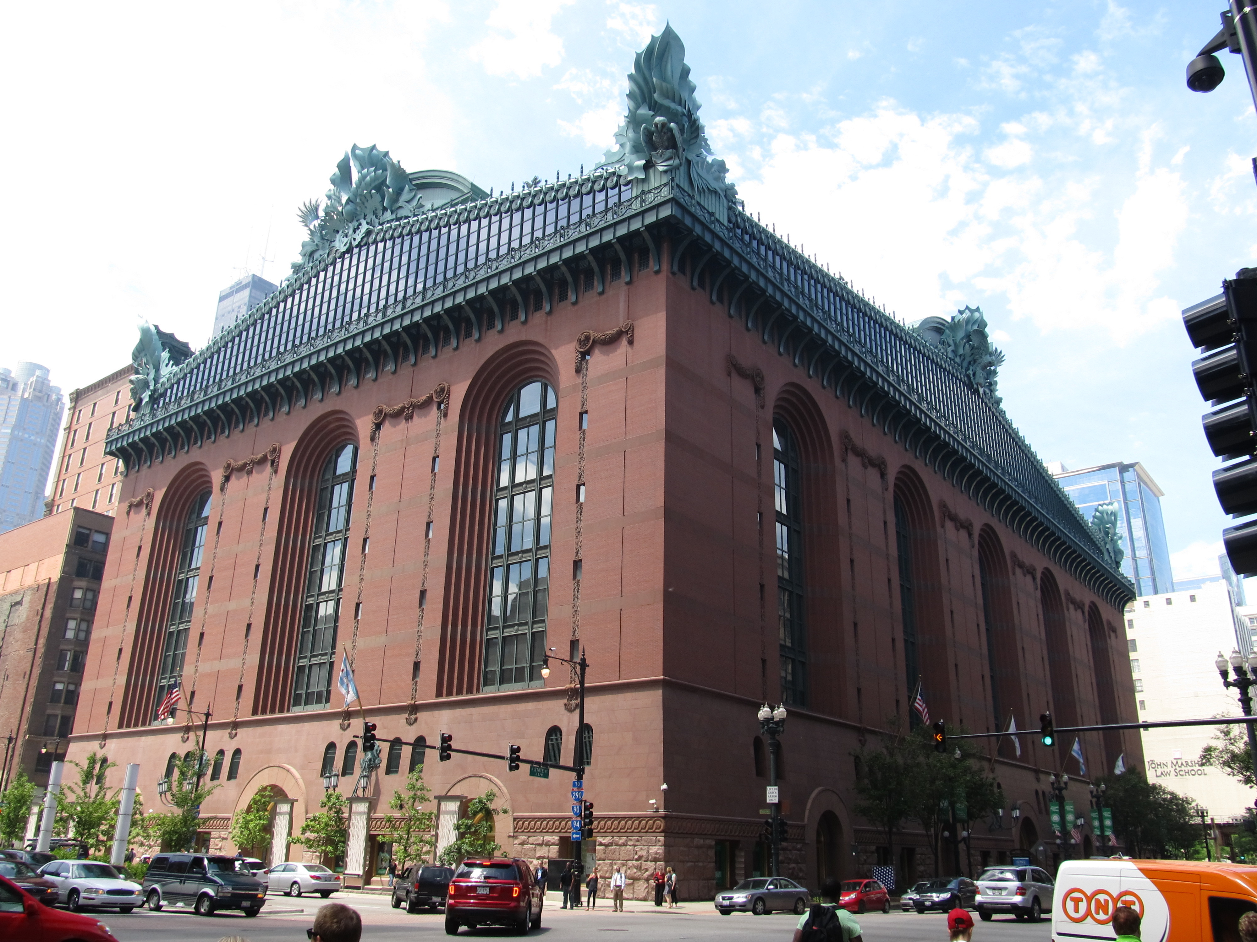
The Harold Washington Library Center is the central library for the Chicago Public Library System. It is named for former Mayor Harold Washington. It is located just south of the Loop 'L', at 400 S. State Street in Chicago, in the U.S. state of Illinois. It is a full-service library and ADA compliant. As with all libraries in the Chicago Public Library system, it has free wifi internet service. At approximately 756,640 square feet (70,294 m2), it the largest public library building in the world. The building was designed by the architectural firm of Hammond, Beeby and Babka, now known as Hammond Beeby Rupert Ainge, Inc., winners of a design competition held in 1987 to replace the old central library, which had been housed in the present Chicago Cultural Center. en.wikipedia.org/wiki/Harold_Washington_Library en.wikipedia.org/wiki/Wikipedia:Text_of_Creative_Commons_... |
| Date | |
| Source | Harold Washington Library, Chicago, Illinois |
| Author | Ken Lund from Reno, Nevada, USA |
| Camera location | | View this and other nearby images on: OpenStreetMap |
|---|
.jpg¶ms=041.875680_N_-087.627650_E_globe:Earth_type:camera_source:Flickr_&language=en)
Licensing
- You are free:
- to share – to copy, distribute and transmit the work
- to remix – to adapt the work
- Under the following conditions:
- attribution – You must give appropriate credit, provide a link to the license, and indicate if changes were made. You may do so in any reasonable manner, but not in any way that suggests the licensor endorses you or your use.
- share alike – If you remix, transform, or build upon the material, you must distribute your contributions under the same or compatible license as the original.
| This image was originally posted to Flickr by Ken Lund at https://flickr.com/photos/75683070@N00/9181548762. It was reviewed on 2 March 2017 by FlickreviewR and was confirmed to be licensed under the terms of the cc-by-sa-2.0. |
File history
Click on a date/time to view the file as it appeared at that time.
| Date/Time | Thumbnail | Dimensions | User | Comment | |
|---|---|---|---|---|---|
| current | 02:38, 2 March 2017 | | 4,000 × 3,000 (2.66 MB) | Victorgrigas | Transferred from Flickr via Flickr2Commons |
File usage
Global file usage
The following other wikis use this file:
- Usage on ar.wikipedia.org
- Usage on es.wikipedia.org
- Usage on fa.wikipedia.org
- Usage on fr.wikipedia.org
- Usage on id.wikipedia.org
- Usage on pt.wikipedia.org
- Usage on simple.wikipedia.org
- Usage on www.wikidata.org
.jpg)