
Fayette, Utah | |
|---|---|
 Fayette Town Hall, April 2010 | |
 Location in Sanpete County and the state of Utah. | |
| Coordinates: 39°13′29″N 111°51′20″W / 39.22472°N 111.85556°W | |
| Country | United States |
| State | Utah |
| County | Sanpete |
| Settled | 1861 |
| Incorporated | 1948 |
| Founded by | James Mellor and Joseph Bartholomew |
| Named for | Fayette, New York |
| Area | |
| • Total | 0.40 sq mi (1.02 km2) |
| • Land | 0.40 sq mi (1.02 km2) |
| • Water | 0.00 sq mi (0.00 km2) |
| Elevation | 5,052 ft (1,540 m) |
| Population (2010) | |
| • Total | 242 |
| • Estimate (2019)[2] | 263 |
| • Density | 665.82/sq mi (257.33/km2) |
| Time zone | UTC-7 (Mountain (MST)) |
| • Summer (DST) | UTC-6 (MDT) |
| ZIP code | 84630 |
| Area code | 435 |
| FIPS code | 49-25070[3] |
| GNIS feature ID | 1427897[4] |
Fayette is a town in Sanpete County, Utah, United States. The population was 204 at the 2000 census.
YouTube Encyclopedic
-
1/3Views:1 7715114 657
-
Utah Wingshooting at Orvis Endorsed Falcon's Ledge Lodge and Pleasant Valley Hunting Preserve
-
Pheasant Hunt at Rhode Creek Ranch in Loa, Utah
-
Utah Pheasant Hunt
Transcription
History
Fayette was originally called "Warm Creek", and under the latter name was founded in 1861.[5] A post office called Fayette was in operation between 1864 and 1966.[6] The present name is after Fayette, New York, the town where the LDS Church was founded.[5]
Geography
According to the United States Census Bureau, the town has a total area of 0.5 square mile (1.2 km2), all land.
Demographics
| Census | Pop. | Note | %± |
|---|---|---|---|
| 1880 | 278 | — | |
| 1890 | 305 | 9.7% | |
| 1900 | 290 | −4.9% | |
| 1910 | 209 | −27.9% | |
| 1920 | 261 | 24.9% | |
| 1930 | 260 | −0.4% | |
| 1940 | 271 | 4.2% | |
| 1950 | 200 | −26.2% | |
| 1960 | 161 | −19.5% | |
| 1970 | 93 | −42.2% | |
| 1980 | 165 | 77.4% | |
| 1990 | 183 | 10.9% | |
| 2000 | 204 | 11.5% | |
| 2010 | 242 | 18.6% | |
| 2019 (est.) | 263 | [2] | 8.7% |
| U.S. Decennial Census[7] | |||
As of the census[3] of 2000, there were 204 people, 64 households, and 49 families residing in the town. The population density was 421.2 people per square mile (164.1/km2). There were 73 housing units at an average density of 150.7 per square mile (58.7/km2). The racial makeup of the town was 91.18% White, 2.45% Native American, 4.41% from other races, and 1.96% from two or more races. Hispanic or Latino of any race were 4.41% of the population.
There were 64 households, out of which 46.9% had children under the age of 18 living with them, 70.3% were married couples living together, 3.1% had a female householder with no husband present, and 21.9% were non-families. 21.9% of all households were made up of individuals, and 14.1% had someone living alone who was 65 years or older. The average household size was 3.19, and the average family size was 3.78.
In the town, the population was spread out, with 36.8% under 18, 10.3% from 18 to 24, 19.6% from 25 to 44, 20.1% from 45 to 64, and 13.2% who were 65 years of age or older. The median age was 30 years. For every 100 females, there were 98.1 males. For every 100 females aged 18 and over, there were 92.5 males.
The median income for a household in the town was $28,750, and the median income for a family was $36,500. Males had a median income of $28,750 versus $23,750 for females. The per capita income was $17,459. About 4.8% of families and 9.8% of the population were below the poverty line, including 9.7% of those under eighteen and none of those 65 or over.
See also
References
- ^ "2019 U.S. Gazetteer Files". United States Census Bureau. Retrieved August 7, 2020.
- ^ a b "Population and Housing Unit Estimates". United States Census Bureau. May 24, 2020. Retrieved May 27, 2020.
- ^ a b "U.S. Census website". United States Census Bureau. Retrieved January 31, 2008.
- ^ "US Board on Geographic Names". United States Geological Survey. October 25, 2007. Retrieved January 31, 2008.
- ^ a b The Utah Genealogical and Historical Magazine, Volumes 9-10. 1918. p. 127.
- ^ "Post Offices". Retrieved January 22, 2018.
- ^ "Census of Population and Housing". Census.gov. Retrieved June 4, 2015.
- ^ http://www2.census.gov/prod2/statcomp/documents/1961-02.pdf [bare URL PDF]
- ^ https://www.census.gov/prod/cen1990/cph2/cph-2-46.pdf [bare URL PDF]
- ^ Census of Population, 1960: Total Population Counts for the U.S., States, Outlying Areas, Counties, Cities, Standard Metropolitan Statistical Areas, Urban and Rural, Etc. Characteristics of the population. Number of inhabitants. U.S. Department of Commerce, Bureau of the Census. January 1, 1961.
External links
![]() Media related to Fayette, Utah at Wikimedia Commons
Media related to Fayette, Utah at Wikimedia Commons
Places adjacent to Fayette, Utah | |
|---|---|
Municipalities and communities of Sanpete County, Utah, United States | ||
|---|---|---|
| Cities | 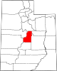 | |
| Towns | ||
| Unincorporated communities | ||
| Ghost towns | ||