
Exeland, Wisconsin | |
|---|---|
 Downtown on WIS48 | |
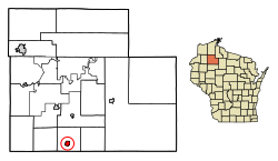 Location of Exeland in Sawyer County, Wisconsin. | |
| Coordinates: 45°40′7″N 91°14′35″W / 45.66861°N 91.24306°W | |
| Country | |
| State | |
| County | Sawyer |
| Area | |
| • Total | 1.22 sq mi (3.17 km2) |
| • Land | 1.20 sq mi (3.11 km2) |
| • Water | 0.02 sq mi (0.06 km2) |
| Elevation | 1,198 ft (365 m) |
| Population (2020) | |
| • Total | 229 |
| • Density | 190.83/sq mi (73.63/km2) |
| Time zone | UTC-6 (Central (CST)) |
| • Summer (DST) | UTC-5 (CDT) |
| Area code(s) | 715 & 534 |
| FIPS code | 55-24700[3] |
| GNIS feature ID | 1564783[2] |
Exeland is a village in Sawyer County, Wisconsin, United States. The population was 229 at the 2020 census.[4]
YouTube Encyclopedic
-
1/3Views:58310 203 0822 594 599
-
Exeland Trout Fest Parade 2011
-
Native America before European Colonization
-
CHICKEN COOP FOR $50 AND 1 HOUR TO BUILD
Transcription
History
The only community named Exeland in the United States, the community was founded around 1907 when the Arpin Lumber Company built a logging railroad to the area, which crossed the Wisconsin Central Railroad. The resulting "X" led to the community's name. Exeland became a village in 1920.[5]
Geography
Exeland is located at 45°40′7″N 91°14′35″W / 45.66861°N 91.24306°W (45.668632, -91.243177).[6]
According to the United States Census Bureau, the village has a total area of 1.12 square miles (2.90 km2), of which, 1.11 square miles (2.87 km2) of it is land and 0.01 square miles (0.03 km2) is water.[7]
Demographics
| Census | Pop. | Note | %± |
|---|---|---|---|
| 1920 | 211 | — | |
| 1930 | 196 | −7.1% | |
| 1940 | 194 | −1.0% | |
| 1950 | 211 | 8.8% | |
| 1960 | 214 | 1.4% | |
| 1970 | 189 | −11.7% | |
| 1980 | 219 | 15.9% | |
| 1990 | 180 | −17.8% | |
| 2000 | 212 | 17.8% | |
| 2010 | 196 | −7.5% | |
| 2020 | 229 | 16.8% | |
| U.S. Decennial Census[8] | |||
2010 census
As of the census[9] of 2010, there were 196 people, 82 households, and 51 families living in the village. The population density was 176.6 inhabitants per square mile (68.2/km2). There were 111 housing units at an average density of 100.0 per square mile (38.6/km2). The racial makeup of the village was 90.3% White, 0.5% African American, 1.0% Native American, 0.5% Asian, 1.0% from other races, and 6.6% from two or more races. Hispanic or Latino of any race were 1.0% of the population.
There were 82 households, of which 28.0% had children under the age of 18 living with them, 51.2% were married couples living together, 6.1% had a female householder with no husband present, 4.9% had a male householder with no wife present, and 37.8% were non-families. 26.8% of all households were made up of individuals, and 13.5% had someone living alone who was 65 years of age or older. The average household size was 2.39 and the average family size was 2.90.
The median age in the village was 45 years. 24% of residents were under the age of 18; 2.6% were between the ages of 18 and 24; 23.5% were from 25 to 44; 31.3% were from 45 to 64; and 18.9% were 65 years of age or older. The gender makeup of the village was 50.5% male and 49.5% female.
2000 census
As of the census[3] of 2000, there were 212 people, 92 households, and 63 families living in the village. The population density was 190.7 people per square mile (73.7/km2). There were 110 housing units at an average density of 99.0 per square mile (38.3/km2). The racial makeup of the village was 87.74% White, 3.77% Native American, 1.42% from other races, and 7.08% from two or more races. Hispanic or Latino of any race were 1.42% of the population.
There were 92 households, out of which 23.9% had children under the age of 18 living with them, 46.7% were married couples living together, 13.0% had a female householder with no husband present, and 31.5% were non-families. 28.3% of all households were made up of individuals, and 15.2% had someone living alone who was 65 years of age or older. The average household size was 2.30 and the average family size was 2.81.
In the village, the population was spread out, with 24.1% under the age of 18, 6.1% from 18 to 24, 20.8% from 25 to 44, 27.4% from 45 to 64, and 21.7% who were 65 years of age or older. The median age was 44 years. For every 100 females, there were 92.7 males. For every 100 females age 18 and over, there were 83.0 males.
The median income for a household in the village was $21,000, and the median income for a family was $31,071. Males had a median income of $28,542 versus $20,500 for females. The per capita income for the village was $14,689. About 10.6% of families and 14.2% of the population were below the poverty line, including 12.8% of those under the age of eighteen and 18.9% of those 65 or over.
Images
-
 The sign for Exeland on WIS48
 -
 Post office and water tower for Exeland
 -
 Community Center
References
- ^ "2019 U.S. Gazetteer Files". United States Census Bureau. Retrieved August 7, 2020.
- ^ a b "US Board on Geographic Names". United States Geological Survey. October 25, 2007. Retrieved January 31, 2008.
- ^ a b "U.S. Census website". United States Census Bureau. Retrieved January 31, 2008.
- ^ "Exeland village; Wisconsin". United States Census Bureau. Retrieved June 17, 2023.
- ^ Callary, Edward (2016). Place Names of Wisconsin. Madison, WI: University of Wisconsin Press. p. 92. ISBN 978-0-299-30964-0.
- ^ "US Gazetteer files: 2010, 2000, and 1990". United States Census Bureau. February 12, 2011. Retrieved April 23, 2011.
- ^ "US Gazetteer files 2010". United States Census Bureau. Archived from the original on January 25, 2012. Retrieved November 18, 2012.
- ^ "Census of Population and Housing". Census.gov. Retrieved June 4, 2015.
- ^ "U.S. Census website". United States Census Bureau. Retrieved November 18, 2012.
Municipalities and communities of Sawyer County, Wisconsin, United States | ||
|---|---|---|
| City |  | |
| Villages | ||
| Towns | ||
| CDPs | ||
| Unincorporated communities | ||
| Indian reservation | ||
| Footnotes | ‡This populated place also has portions in an adjacent county or counties | |