
Eaubonne | |
|---|---|
 The Avenue de l'Europe, in Eaubonne | |
 Coat of arms | |
 Location (in red) within Paris inner and outer suburbs | |
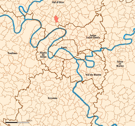
Location of Eaubonne  | |
 Eaubonne  Eaubonne | |
| Coordinates: 48°59′32″N 2°16′50″E / 48.9922°N 2.2806°E | |
| Country | France |
| Region | Île-de-France |
| Department | Val-d'Oise |
| Arrondissement | Argenteuil |
| Canton | Ermont |
| Intercommunality | Val Parisis |
| Government | |
| • Mayor (2020–2026) | Marie-José Beaulande[1] |
| Area 1 | 4.42 km2 (1.71 sq mi) |
| Population (2021)[2] | 25,373 |
| • Density | 5,700/km2 (15,000/sq mi) |
| Time zone | UTC+01:00 (CET) |
| • Summer (DST) | UTC+02:00 (CEST) |
| INSEE/Postal code | 95203 /95600 |
| Elevation | 41–83 m (135–272 ft) |
| 1 French Land Register data, which excludes lakes, ponds, glaciers > 1 km2 (0.386 sq mi or 247 acres) and river estuaries. | |
Eaubonne (French pronunciation: [obɔn] ) is a commune in the Val-d'Oise department, in the northern suburbs of Paris, France. It is located 16.1 km (10.0 mi) from the center of Paris.
Population
|
| ||||||||||||||||||||||||||||||||||||||||||||||||||||||||||||||||||||||||||||||||||||||||||||||||||||||||||||||||||
| Source: EHESS[3] and INSEE (1968-2017)[4] | |||||||||||||||||||||||||||||||||||||||||||||||||||||||||||||||||||||||||||||||||||||||||||||||||||||||||||||||||||
Twin towns
It is twinned with Matlock, Derbyshire, England; Budenheim, Germany and Vălenii de Munte, Romania.
Transport
Eaubonne is served by Ermont–Eaubonne station which is an interchange station on Paris RER line C, on the Transilien Paris-Nord suburban rail line, and on the Transilien Paris-Saint-Lazare suburban rail line. This station is located at the border between the commune of Eaubonne and the commune of Ermont, on the Ermont side of the border.
Eaubonne is also served by Champ de courses d'Enghien station on the Transilien Paris – Nord suburban rail line. This station is located at the border between the commune of Eaubonne and the commune of Soisy-sous-Montmorency, on the Soisy-sous-Montmorency side of the border.
See also
References
- ^ "Répertoire national des élus: les maires". data.gouv.fr, Plateforme ouverte des données publiques françaises (in French). 2 December 2020.
- ^ "Populations légales 2021". The National Institute of Statistics and Economic Studies. 28 December 2023.
- ^ Des villages de Cassini aux communes d'aujourd'hui: Commune data sheet Eaubonne, EHESS (in French).
- ^ Population en historique depuis 1968, INSEE
External links
- Official website (in French)
- Base Mérimée: Search for heritage in the commune, Ministère français de la Culture. (in French)
- Land use (IAURIF) (in English)
- Association of Mayors of the Val d'Oise (in French)
| International | |
|---|---|
| National | |
| Geographic | |
This Val-d'Oise geographical article is a stub. You can help Wikipedia by expanding it. |