
Deir Siriane
دير سريان | |
|---|---|
Village | |
 Deir Siriane Location within Lebanon | |
| Coordinates: 33°17′27″N 35°30′23″E / 33.29083°N 35.50639°E | |
| Grid position | L 128/150 |
| Country | |
| Governorate | Nabatieh Governorate |
| District | Marjeyoun District |
| Elevation | 525 m (1,722 ft) |
| Time zone | UTC+2 (EET) |
| • Summer (DST) | UTC+3 (EEST) |
| Dialing code | +961 |
Deir Siriane (Arabic: دير سريان) is a village the Marjeyoun District in Southern Lebanon.
Name
According to E. H. Palmer, the name Deir es Suriân means "the convent of the Syrian".[1]
History
In 1596, it was named as a village, Dayr Siryan, in the Ottoman nahiya (subdistrict) of Tibnin under the liwa' (district) of Safad, with a population of 10 households and 1 bachelor, all Muslim. The villagers paid a fixed tax-rate of 25 % on agricultural products, such as wheat, barley, olive trees, goats, beehives, in addition to "occasional revenues" and a press for olive oil or grape syrup; a total of 2,952 akçe.[2][3]
In the early 1860s, Ernest Renan found here remains of old buildings and a cistern.[4] In 1875, Victor Guérin found that the village had Metawileh inhabitants,[5] and noted: "Cisterns and tanks partly cut in the rock and partly built. Hewn stones show that here was an ancient village or edifice."[6]
In 1881, the PEF's Survey of Western Palestine (SWP) described it as "a village, built of stone, containing about 200 Metawileh, situated on the plain and surrounded by small gardens and arable land. Water from wells and a spring."[7]
References
- ^ Palmer, 1881, p. 20
- ^ Hütteroth and Abdulfattah, 1977, p. 182
- ^ Note that Rhode, 1979, p. 6 Archived 2020-03-01 at the Wayback Machine writes that the register that Hütteroth and Abdulfattah studied was not from 1595/6, but from 1548/9
- ^ Renan, 1864, p. 646
- ^ Guérin, 1880, p. 275
- ^ Guérin, 1880, p. 275; as given in Conder and Kitchener, 1881, SWP I, p. 115
- ^ Conder and Kitchener, 1881, SWP I, p. 87
Bibliography
- Conder, C.R.; Kitchener, H.H. (1881). The Survey of Western Palestine: Memoirs of the Topography, Orography, Hydrography, and Archaeology. Vol. 1. London: Committee of the Palestine Exploration Fund.
- Guérin, V. (1880). Description Géographique Historique et Archéologique de la Palestine (in French). Vol. 3: Galilee, pt. 2. Paris: L'Imprimerie Nationale.
- Hütteroth, Wolf-Dieter; Abdulfattah, Kamal (1977). Historical Geography of Palestine, Transjordan and Southern Syria in the Late 16th Century. Erlanger Geographische Arbeiten, Sonderband 5. Erlangen, Germany: Vorstand der Fränkischen Geographischen Gesellschaft. ISBN 3-920405-41-2.
- Palmer, E.H. (1881). The Survey of Western Palestine: Arabic and English Name Lists Collected During the Survey by Lieutenants Conder and Kitchener, R. E. Transliterated and Explained by E.H. Palmer. Committee of the Palestine Exploration Fund.
- Renan, E. (1864). Mission de Phénicie (in French). Paris: Imprimerie impériale.
- Rhode, H. (1979). Administration and Population of the Sancak of Safed in the Sixteenth Century. Columbia University. Archived from the original on 2020-03-01. Retrieved 2017-12-05.
External links
- Deir Siriane, Localiban
- Survey of Western Palestine, Map 2: IAA, Wikimedia commons
| Capital | 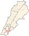 | |
|---|---|---|
| Towns and villages | ||
| Other | ||