Native name: Dana Adası | |
|---|---|
 From the mainland (north) | |
| Geography | |
| Location | Mediterranean Sea |
| Coordinates | 36°11.4′N 33°46.3′E / 36.1900°N 33.7717°E |
| Administration | |
Turkey | |
| İl (province) | Mersin Province |
| İlçe | Silifke |
Dana Island (Turkish: Dana Adası, also called Kargıncık Adası, Greek Latin Pithyussa) is a small Mediterranean island of Turkey.
YouTube Encyclopedic
-
1/4Views:7 2559181 206933
-
Dana DeArmond, London Keyes & Marica Hase Adventures - SLIVAN #382
-
Dana Point Harbor | Virtual Tour | Treadmill Walk | 4K Walking Tour
-
Pirate Boat Charters With Dolphins Dana Point CA. 2
-
Address Residences Fujairah Beach Resort - February 2020 Construction update
Transcription
Geography

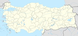
Dana Adası lies parallel to south coast of Turkey at 36°11′N 33°46′E / 36.183°N 33.767°E in the province of Mersin. The distance from the shore is 2.5 kilometres (1.6 mi). The passage between the main land and the island which is known as Kargıcak strait is a convenient passage for maritime traffic. The shape of the island is roughly rectangular with dimensions 2.7 km × 0.9 km (1.68 mi × 0.56 mi). The highest peak is 250 metres (820 ft). Dana Adası is quite rocky and covered with maquis shrubland and yellow pine forest.
History
Francis Beaufort, who surveyed the south coast of Turkey in 1811–1812, states that the island was called Manavat by the local people, and Provençal Island by sailors. He suggested that this derived from the name of one of the ranks of the Knights Hospitallers who occupied forts and islands along this coast.[1]
According to recent research, there were many shipyards in Dana Island, probably dating to the Late Bronze Age (c. 1200 BC). Assistant professor Hakan Öniz says that the island was the largest proven shipyard in the ancient world.[2] There are also some ruins at the southern coast of the main land facing the island. Probably, these two settlements were the control posts dominating the two extremes of the strait.[3] The island was inhabited during the Roman and early Byzantine era. There are ruins of a few churches, graves, houses, aqueducts, a Roman bath and a harbour establishment at the north of the island. According to some sources, French merchants also used the island as their port during the Middle Ages.[4]
See also
References
- ^ Beaufort, Francis (1817). Karamania, Or A Brief Description Of The South Coast Of Asia Minor. London: R. Hunter. pp. 206–211.
- ^ Hürriyet newspaper
- ^ "Report of Research Institute". Archived from the original on 2021-01-20. Retrieved 2009-11-12.
- ^ Pocket Guide of Mersin, MTSO, Mersin, 2004

