
| Dâmrei Mountains | |
|---|---|
 Dâmrei Mountains on the horizon | |
| Highest point | |
| Peak | Phnom Bokor |
| Elevation | 1,081 m (3,547 ft) |
| Coordinates | 10°37′00″N 104°03′00″E / 10.61667°N 104.05000°E |
| Dimensions | |
| Length | 110 km (68 mi) N/S |
| Width | 32 km (20 mi) E/W |
| Geography | |
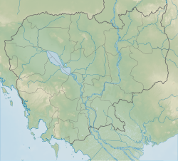 Dâmrei Mountains Location of the Dâmrei Mountains in Cambodia | |
| Country | Cambodia |
| Parent range | Cardamom Mountains |
| Climbing | |
| Easiest route | Drive |
The Dâmrei Mountains (literally the "Elephant Mountains", Khmer: ភ្នំដំរី, Chuŏr Phnum Dâmrei), refer to a mountain range situated in south-western Cambodia, traversing around 110 km (68 mi) north-south as a succession of the Cardamom Mountains, dropping abruptly to the sea near the town of Kampot.[1] The Elephant Mountains represent the easternmost parts of the original extent of the wet evergreen forests that include Cambodia's south and the mountains east of Bangkok in Thailand.[2]
YouTube Encyclopedic
-
1/3Views:1 5171 561693
-
Bokor Hill Station - bokor hill station kampot - bokor hill station in cambodia
-
Geography of Cambodia
-
Bokor National Park | Preah Monivong National Park | Kampo province
Transcription
Description

The range is a southern offshoot of the Krâvanh or Cardamom Mountains, occupying a much smaller area. The highest elevation is Phnom Bokor at 1,081 metres (3,547 ft) above sea level. Located close to the shores of the Gulf of Siam, the densely wooded hills receive some of the heaviest rainfall in Cambodia, averaging 150–200 inches (3,800–5,000 mm) annually on their western slopes (which are subject to southwest monsoons) but only 40–60 inches (1,020–1,520 mm) on their eastern slopes, because of the rain shadow.[3]
The Dâmrei Mountains were, until 1975, the principal centre of Cambodia's pepper-growing industry. After the intervening years of civil war and upheavals pepper-growing has revived slowly beginning from the late 1990s.[4][5][6][7]
National park and tourism

Phnom Bokor National Park occupies most of the highland plateaus and summits of the Dâmrei Mountains. The authorities are trying to curb illegal logging.[citation needed] The park has a great variety of plant species, including rare orchids,[8] an endemic pitcher plant only first described in 2009,[9] as well as some spectacular waterfalls during the rainy season.
There are several historic and cultural sites in the national park area. Bokor Hill Station (Station d'altitude de Bokor) is an abandoned French settlement on top of Phnom Bokor, where elite French colonial officers spent holidays during the hot season. The place also has a church and a palace, all in a dilapidated condition. Nearby there is a Cambodian army outpost which doubles as a youth hostel.[citation needed] Both sites are now becoming tourist attractions, and the road to reach them, originally built in 1907 at the cost of many human lives, has recently been modernised.[10] As of 2014, the 32 km road connecting National Route 3 to Phnom Bokor is completed. In 2012, the large luxury hotel of Thansur Bokor Highland Resort, located near the Bokor Hill Station, was completed.
See also
References
- ^ "Countries and Territories of the World". Retrieved May 19, 2016.
- ^ "Southeastern Asia: Southern Cambodia stretching into Thailand and Vietnam". WWF. Retrieved May 12, 2015.
- ^ "Kingdom of Cambodia". Encyclopedia of the Nations. Retrieved May 19, 2016.
- ^ "Dâmrei Mountains". Encyclopædia Britannica. Retrieved May 19, 2016.
- ^ World and Its Peoples: Cambodia, Laos, and Vietnam. 2007. ISBN 9780761476399. Retrieved May 12, 2015.
- ^ "About: Dâmrei Mountains". OpenLink Virtuoso. December 5, 2013. Archived from the original on March 4, 2016. Retrieved May 20, 2015.
- ^ "Chuŏr Phnum Dâmrei". Geo-View. Retrieved May 20, 2015.
- ^ Evolution of pollinaria structure in cambodian orchids
- ^ "Nepenthes bokorensis - Details". Encyclopedia of Life. Retrieved May 19, 2016.
- ^ Mogenet Luc, La création de la station climatique du Bokor (Cambodge), présentation commentée de sources d’archives inédites, Péninsule, 2007 (2) N°55, Paris, 2008
External links
- Wildlife Alliance Cambodia Conservation Program
- Conservation International Cambodia Program
- Phnom Sampeou - Climbing, Hiking & Mountaineering
- Bokor Mountain Tourism
- Protected areas in Cambodia Archived 2011-09-27 at the Wayback Machine
- The Bokor City Project