
Chlef Province
ولاية الشلف | |
|---|---|
 The coast of Chlef Province | |
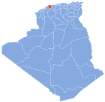
 Map of Algeria highlighting Chlef | |
| Coordinates: 36°10′N 01°20′E / 36.167°N 1.333°E | |
| Country | |
| Capital | Chlef |
| Government | |
| • PPA president | Mohamed Meheni (FLN) |
| • Wāli | Mr. Lakhdar Sedas |
| Area | |
| • Total | 4,975 km2 (1,921 sq mi) |
| Population (2008)[1] | |
| • Total | 1,013,718 |
| • Density | 200/km2 (530/sq mi) |
| Time zone | UTC+01 (CET) |
| Area Code | +213 (0) 27 |
| ISO 3166 code | DZ-02 |
| Districts | 13 |
| Municipalities | 35 |
| Website | wilaya-chlef.com |
Chlef (Arabic: ولاية الشلف, Berber: ⴰⴳⴻⵣⴷⵓ ⵏ ⵛⵍⴻⴼ) (formerly known as El Asnam) is a province (wilaya) in Algeria. Its capital and biggest city is Chlef. It is the 8th most populous province in the country, having just over 1 million inhabitants.
Chlef Province is an important agricultural region, as it is located on the plain of the Middle Chelif Basin and has access to an abundance of water resources. 65.43% of the province is dedicated to agriculture. Other notable industries in the province include breeding, glass production, and plastic processing.[2] As well as these industries, Chlef Province is also home to two dams.
Being located in the Atlas Mountains, Chlef also has a sizeable seismic risk, being struck by a 6.7 magnitude earthquake in 1954 and a 7.1 magnitude earthquake in 1980.[3]
History
The province was originally named El Asnam until 1980 when it became known at Ech Chéliff, later known as Chlef.
In 1980, a 7.1 magnitude earthquake struck the province, killing up to 5,000 and displacing 300,000.
In 1984, Aïn Defla Province was carved out of its territory.[why?]
Geography
Location
The province of Chlef is located at the Western Tell 200 km west of Algiers.
Places adjacent to Chlef Province | ||||||||||||||||
|---|---|---|---|---|---|---|---|---|---|---|---|---|---|---|---|---|
| ||||||||||||||||
Administrative divisions
The province is divided into 13 districts (daïras), which are further divided into 35 communes or municipalities.
Districts
- Abou El Hassan (دائرة أبو الحسن)
- Aïn Merane (دائرة عين مران)
- Béni Haoua (دائرة بني حواء)
- Boukadir (دائرة بوقادير)
- Chlef (دائرة شلف)
- El Karimia (دائرة الكريمية)
- El Marsa (دائرة المرسى)
- Oued Fodda (دائرة وادي الفضة)
- Ouled Ben Abdelkader (دائرة اولاد بن عبد القادر)
- Ouled Farès (دائرة اولاد فارس)
- Taougrit (دائرة تاوقريت)
- Ténès (دائرة تنس)
- Zeboudja (دائرة زبوجة)
Communes
References
- ^ Office National des Statistiques, Recensement General de la Population et de l’Habitat 2008 Archived July 24, 2008, at the Wayback Machine Preliminary results of the 2008 population census. Accessed on 2008-07-02.
- ^ "Chlef - Annuaire des Entreprises Algériennes El Mouchir". elmouchir.caci.dz. Archived from the original on 2024-01-15. Retrieved 2024-01-15.
- ^ Tebbal, F. "Recommendations for the Regional Planning of the Province of Chlef (El Asnam) after Regional Risk Analysis" (PDF). Archived (PDF) from the original on 2024-04-14.
- ^ a b c (in French and Arabic) "Code Geographique National" (PDF). 5ème Recensement General de la Population et de l’Habitat. 2008. Archived from the original (PDF) on 2010-11-13.
- ^ a b c "Repartition des Sieges des Assemblees Populaires Communales: 01 — Wilaya d'Adrar" (PDF). Journal Officiel de la République Algérienne (in French) (47). 10 July 2002. Archived (PDF) from the original on 8 August 2014. Retrieved 4 December 2009.
External links
|  | |
| International | |
|---|---|
| National | |
| Geographic | |