
Central Ostrobothnia
| |
|---|---|
| Region of Central Ostrobothnia Keski-Pohjanmaan maakunta Landskapet Mellersta Österbotten | |
 Flag  Coat of arms | |
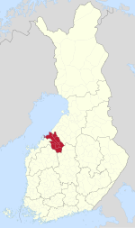 Central Ostrobothnia on a map of Finland | |
| Coordinates: 63°30′N 24°15′E / 63.500°N 24.250°E | |
| Country | Finland |
| Historical province | Ostrobothnia |
| Capital | Kokkola |
| Area | |
| • Total | 5,706.39 km2 (2,203.25 sq mi) |
| Population (2019) | |
| • Total | 68,158 |
| • Density | 12/km2 (31/sq mi) |
| GDP | |
| • Total | €2.425 billion (2015) |
| • Per capita | €35,181 (2015) |
| Time zone | UTC+2 (EET) |
| • Summer (DST) | UTC+3 (EEST) |
| ISO 3166 code | FI-07 |
| NUTS | 1A1 |
| Regional bird | Skylark (Alauda arvensis) |
| Regional fish | European whitefish (Coregonus lavaretus) |
| Regional flower | Bluebell (Harebell) |
| Regional stone | Gneiss |
| Regional lake | Lake Lestijärvi |
| Website | keski-pohjanmaa.fi |
Central Ostrobothnia (Finnish: Keski-Pohjanmaa; Swedish: Mellersta Österbotten) is a region in Finland. It borders the regions of Ostrobothnia, North Ostrobothnia, Central Finland and South Ostrobothnia.[2]
YouTube Encyclopedic
-
1/3Views:1 015992697 153
-
Glimpses from Finland - Ostrobothnia
-
How to reach Pietarsaari from Pännäinen Train station.
-
Finland Geography/Country of Finland
Transcription
Historical provinces
Municipalities
The region of Central Ostrobothnia consists of eight municipalities, two of which have city status (marked in bold).
Sub-regions
List of municipalities
| Coat of arms |
Municipality | Population | Land area (km2) |
Density (/km2) |
Finnish speakers |
Swedish speakers |
Other speakers |
|---|---|---|---|---|---|---|---|
 |
Halsua | 1,013 | 413 | 2 | 94 % | 0.5 % | 5 % |
 |
Kannus | 5,246 | 468 | 11 | 97 % | 0.4 % | 3 % |
 |
Kaustinen | 4,137 | 354 | 12 | 95 % | 1.8 % | 3 % |
 |
Kokkola | 48,295 | 1,446 | 33 | 83 % | 12 % | 5 % |
 |
Lestijärvi | 682 | 480 | 1 | 98 % | 0.1 % | 1 % |
 |
Perho | 2,578 | 748 | 3 | 98 % | 0.5 % | 1 % |
 |
Toholampi | 2,849 | 609 | 5 | 98 % | 0.1 % | 2 % |
 |
Veteli | 2,936 | 502 | 6 | 95 % | 1.7 % | 3 % |
| Total | 67,736 | 5,020 | 13 | 87 % | 9 % | 4 % |
Politics
Results of the 2019 Finnish parliamentary election in Central Ostrobothnia:
- Centre Party 31.09%
- Finns Party 19.60%
- Social Democratic Party 16.06%
- National Coalition Party 7.42%
- Christian Democrats 7.29%
- Swedish People's Party 6.26%
- Green League 6.03%
- Left Alliance 4.11%
- Blue Reform 0.80%
- Seven Star Movement 0.36%
- Other parties 0.98%
References
- ^ Regions and Cities > Regional Statistics > Regional Economy > Regional GDP per Capita, OECD.Stats. Accessed on 16 November 2018.
- ^ Nordberg, Kenneth (2016-11-23). Revolutionizing Economic and Democratic Systems: Reinventing the Third Way. Springer. pp. 70–71. ISBN 978-3-319-40633-6.
External links
Wikimedia Commons has media related to Central Ostrobothnia.
| Regions |  | |
|---|---|---|
| Former regions | ||
| Authority control databases: Geographic |
|---|