
Broșteni | |
|---|---|
 Saint Nicholas Wooden Church in Broșteni | |
 Coat of arms | |
 Location in Suceava County | |
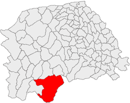
 Broșteni Location in Romania | |
| Coordinates: 47°14′39″N 25°41′53″E / 47.24417°N 25.69806°E | |
| Country | Romania |
| County | Suceava |
| Government | |
| • Mayor (2020–2024) | Alexandru Hurjui[1] (PRO) |
| Area | 424.40 km2 (163.86 sq mi) |
| Elevation | 630 m (2,070 ft) |
| Population (2021-12-01)[2] | 5,179 |
| • Density | 12/km2 (32/sq mi) |
| Time zone | EET/EEST (UTC+2/+3) |
| Postal code | 727075 |
| Area code | (+40) 02 30 |
| Vehicle reg. | SV |
| Website | www |
| Year | Pop. | ±% |
|---|---|---|
| 2002 | 6,603 | — |
| 2011 | 5,388 | −18.4% |
| 2021 | 5,179 | −3.9% |
| Source: Romanian census data | ||
Broșteni is a town in Suceava County, in the historical region of Western Moldavia, northeastern Romania. Broșteni is the fourteenth largest urban settlement in the county, with a population of 5,179 inhabitants, according to the 2021 census. It was declared a town in 2004, along with seven other localities in Suceava County. The town administers the former villages of Hăleasa, Lungeni, and Neagra (which became neighborhoods in 2004), and Cotârgași, Dârmoxa, Frasin, Holda, Holdița, and Pietroasa (with the status of associated villages).
YouTube Encyclopedic
-
1/3Views:13 4303992 673
-
IMAGINI DIN BROSTENI
-
GRUPUL CONDUS DE STELA IFTIMUT-BROSTENI SUCEAVA
-
brosteni suceava
Transcription
History
Broșteni is a former mining community located on the banks of the river Bistrița, between the Bistrița Mountains and the Stânișoara Mountains. It administers a total area of 424.40 km2 (163.86 sq mi) – the largest area being administered by a single locality in Suceava County. The national road between Vatra Dornei and Piatra Neamț is the main communication way for Broșteni, which is not connected to the national railway system.
Natives
- Mihai Băcescu (1908–1999), zoologist
- Leon Mrejeriu (1879–1945), teacher, folklorist, and journalist
Gallery
-
 Broșteni, during the early 20th century
References
- ^ "Results of the 2020 local elections". Central Electoral Bureau. Retrieved 9 June 2021.
- ^ "Populaţia rezidentă după grupa de vârstă, pe județe și municipii, orașe, comune, la 1 decembrie 2021" (XLS). National Institute of Statistics.
External links
- (in Romanian) Broșteni Town Hall official site
- (in Romanian) The Local Police Station of Broșteni
- (in Romanian) A blog about Broșteni
- (in Romanian) Broșteni, orașul cu de-a sila – Newspaper article about Broșteni
- (in Romanian) Suceava County site – Broșteni web page
