
Biržai District Municipality
Biržų rajono savivaldybė | |
|---|---|
 The Green Forest (Žalioji giria) | |
 Coat of arms | |
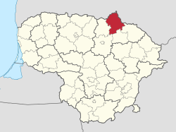 Location of Biržai District Municipality within Lithuania | |
 Location of Biržai | |
| Coordinates: 56°16′58″N 24°48′45″E / 56.28278°N 24.81250°E | |
| Country | |
| Region | Aukštaitija |
| County | Panevėžys County |
| Established | 1950 |
| Capital | Biržai |
| Elderships | 8 |
| Government | |
| • Type | City Council |
| • Body | Biržai District Council |
| • Mayor | Kęstutis Knizikevičius (LSDP) |
| • Leading | Social Democratic Party[1] 8 / 25
|
| Area | |
| • Total | 1,476 km2 (570 sq mi) |
| • Rank | 16th |
| Elevation | 88 m (289 ft) |
| Population (2022[2]) | |
| • Total | 22,580 |
| • Rank | 37th |
| • Density | 15.30/km2 (39.6/sq mi) |
| • Rank | 48th |
| Time zone | UTC+2 (EET) |
| • Summer (DST) | UTC+3 (EEST) |
| ZIP Codes | 41100–41481 |
| Phone code | +370 (450) |
| Website | www |
Biržai District Municipality is a Lithuanian municipality, located in northern Lithuania, Aukštaitija ethnographic region, Panevėžys County.
The towns of Biržai and Vabalninkas lie within the district. About 64% of its land is agricultural, including a number of organic farms. Portions are protected in Biržai Regional Park and as botanical and geological reserves.[3]
YouTube Encyclopedic
-
1/2Views:2 1131 490
-
Visiting castles and more in Jurbarkas, Lithuania | Sights in Jurbarkas
-
Visiting Joniškis district in Lithuania | Sights in Joniškis
Transcription
Elderships
Biržai District Municipality is divided into 8 elderships:[4]
| Eldership (Administrative Center) | Area | Population (2021) |
|---|---|---|
 |
16.35 km2 (4,040.17 acres; 6.31 sq mi) | 10,734 |
 |
200 km2 (49,421.08 acres; 77.22 sq mi) | 1,238 |
| Pabiržė (Pabiržė) | 90 km2 (22,239.48 acres; 34.75 sq mi) | 1,442 |
| Pačeriaukštė (Pačeriaukštė) | 110 km2 (27,181.59 acres; 42.47 sq mi) | 1,130 |
 |
250 km2 (61,776.35 acres; 96.53 sq mi) | 1,439 |
| Parovėja (Parovėja) | 174 km2 (42,996.34 acres; 67.18 sq mi) | 1,607 |
 |
258 km2 (63,753.19 acres; 99.61 sq mi) | 3,431 |
 |
211 km2 (52,139.24 acres; 81.47 sq mi) | 2,293 |
Landmarks
- Sinkholes around Biržai, including Karvės ola (Cow's Hole)
- Biržai Castle
- Lithuania's northernmost point (56°27′1″N 24°53′7″E / 56.45028°N 24.88528°E)
Structure
District structure:
- 2 cities – Biržai and Vabalninkas;
- 4 towns – Kupreliškis, Nemunėlio Radviliškis, Pabiržė and Papilys;
- 538 villages.
Biggest population (2001):
- Biržai – 15262
- Vabalninkas – 1328
- Biržai village – 874
- Nemunėlio Radviliškis – 729
- Medeikiai – 656
- Kirdonys – 492
- Naciūnai – 455
- Germaniškis – 429
- Parovėja – 402
References
- ^ https://www.vrk.lt/savivaldybiu-tarybu-ir-meru-2023/rezultatai?srcUrl=/rinkimai/1304/1/1922/rezultatai/lt/rezultataiSavTarNariaiMeraiSavivaldybeje_rpgId-21924.html
- ^ https://osp.stat.gov.lt/statistiniu-rodikliu-analize?indicator=S3R166#/
- ^ "Biržai district municipality". Department of Statistics to the Government of the Republic of Lithuania. Archived from the original on 2011-05-26. Retrieved 2009-06-19.
- ^ "Struktūra ir kontaktai | Biržų rajono savivaldybė". Struktūra ir kontaktai | Biržų rajono savivaldybė (in Lithuanian). Retrieved 2022-07-05.

| International | |
|---|---|
| National | |
This Lithuanian location article is a stub. You can help Wikipedia by expanding it. |