
Russian: Белая Земля | |
|---|---|
 Sentinel-2 image (2020) | |
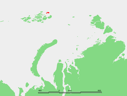 Location of the Belaya Zemlya subgroup of the Franz Josef Archipelago | |
| Geography | |
| Location | Arctic |
| Coordinates | 81°38′N 63°06′E / 81.633°N 63.100°E |
| Archipelago | Franz Josef Archipelago |
| Administration | |
Belaya Zemlya (Russian: Белая Земля, literally "White Land") is a group of three cold, glaciated islands. It is a geographical subgroup of Franz Josef Land, Russian Federation.
History
This area was named Hvidtenland (Norwegian: "White Land") by Fridtjof Nansen, who reached this desolate place on August 5, 1895 during his polar expedition. In his map he drew four islands. Since the limit of permanent ice crosses Belaya Zemlya, it is often difficult to distinguish between land and sea. However, as the cartography of the Franz Josef Archipelago became more accurate, it became apparent that it was a group of three islands.
Belaya Zemlya is the point of the Franz Josef Archipelago that Valerian Albanov was trying to reach when he left the Svyataya Anna with part of the crew, but owing to the polar ice drift and the abundance of polynias along his route, he ended up far to the southwest in Alexandra Land.[1]
Geography
Belaya Zemlya is separated from the main Franz Josef group by a 45 km (28 mi) broad strait known as Proliv Severo-Vostochnyy.[2] The strait running through Belaya Zemlya is called Proliv Sarsa, named after Michael Sars.[3]
Islands
- Eva Island (Остров Ева-Лив), or "Eva-Liv Island", as it includes the Liv Peninsula. With 25 km (16 mi) in length, this is the largest island of the group. Eva Island was named after Fridtjof's wife Eva Nansen (died in 1907). The island is completely covered by two ice domes.[4]
- Adelaide Island (Остров Аделаиды). Only 2 km (1.2 mi) in length, this is a very small island. It is located 5 km (3.1 mi) to the southwest of Eva Island's western end. Adelaide Island was named by Nansen,[5] after his mother Adelaide Wedel-Jarlsberg.
- Freeden Island (Остров Фреден), sometimes also spelt "Fryeden" because of the transliteration from the Russian. This is a larger oval-shaped island, with a length of 8.2 km (5.1 mi). It lies 2.5 km (1.6 mi) south of Adelaide Island. Freeden Island was named by Julius Payer after Wilhelm von Freeden.[6]
See also
References
- ^ Valerian Albanov. In the Land of White Death
- ^ Циглер (1965). Topographical Map U-41-XIX,XX,XXI (Map). 1 : 200 000 (in Russian). Retrieved 12 January 2021.
- ^ Nansen, Fridtjof (1897). "Forelöbig Kartskisse over Ögruppen Franz Josef's Land" (Map). Fram over Polhavet. Den norske Polarfærd 1893-1896. ... Med et Tillæg af Otto Sverdrup (in Danish). Kristiania. p. 1151. Retrieved 12 January 2021 – via British Library.
- ^ Kupol Vostok Chetvërtyy: Russia
- ^ Nansen, Fridtjof (1897). Farthest North, Volume II. London: Archibald Constable & Co. pp. 342–344, footnote 6.
{{cite book}}: CS1 maint: postscript (link) - ^ Capelotti, Peter; Forsberg, Magnus (2015). "The place names of Zemlya Frantsa-Iosifa: the Wellman polar expedition, 1898–1899". Polar Record. 51 (261): 624–636. doi:10.1017/S0032247414000801, p. 632.
{{cite journal}}: CS1 maint: postscript (link)
External links
- Fridtjof Nansen's early map
- Islands Archived 2013-11-25 at the Wayback Machine
- Eva Nansen
- ru:Список островов России Names in Russian
This Arkhangelsk Oblast location article is a stub. You can help Wikipedia by expanding it. |