
Banke District
बाँके | |
|---|---|
 | |
| Country | |
| Province | Lumbini Province |
| Administrative Headquarter | Nepalganj |
| Government | |
| • Type | Coordination committee |
| • Body | DCC, Banke |
| Area | |
| • Total | 2,337 km2 (902 sq mi) |
| Population (2011) | |
| • Total | 491,313[1] |
| Time zone | UTC+05:45 (Nepal Time) |
| Telephone Code | 081 |
| Language | Nepali |
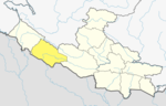
Banke District (Nepali: बाँके जिल्ला, romanized: Bām̐kē jillā; [bãke] ⓘ, a part of Lumbini Province, is one of the 77 districts of Nepal. The district, located in midwestern Nepal with Nepalganj as its district headquarters, covers an area of 2,337 km2 (902 sq mi) and had a population of 385,840 in 2001[2] and 491,313 in 2011.[1] There are three main cities in the Banke District: Nepalganj, Kohalpur and Khajura Bajaar.
YouTube Encyclopedic
-
1/4Views:1 2684453911 039
-
Nepal , Banke District, Rapti Sonari Rural Municipality - Are we prepared for Crisis ?
-
Straight Highway of Nepal, Banke National Park- Nepal, East West Highway Nepal, Banke, Green Road
-
SIKTA IRRIGATION PROJECT
-
DANG VALLEY AWESOME DRONE SHOTS || ADVENTURE NEPAL || VISIT NEPAL , VISIT HEAVEN ||
Transcription
Geography and Climate
Banke is bordered on the west by Bardiya district. Rapti zone's Salyan and Dang Deukhuri Districts border to the north and east. To the south lies Uttar Pradesh, India, a country in Asia; specifically Shravasti and Bahraich districts of Awadh. East of Nepalganj the international border follows the southern edge of the Dudhwa Range of the Siwaliks.
Most of the district is drained by the Rapti, except the district's western edge is drained by the Babai. Rapti and Babai cross into Uttar Pradesh, a state in India, Nepal's neighboring country and eventually join the Karnali, whose name has changed to Ghaghara.
| Climate Zone[3] | Elevation Range | % of Area |
|---|---|---|
| Lower Tropical | below 300 meters (1,000 ft) | 79.1% |
| Upper Tropical | 300 to 1,000 meters 1,000 to 3,300 ft. |
20.6% |
| Subtropical | 1,000 to 2,000 meters 3,300 to 6,600 ft. |
0.3% |
Demographics
At the time of the 2011 Nepal census, Banke District had a population of 491,313.
As first language, 39.0% spoke Nepali, 24.0% Awadhi, 18.7% Urdu, 14.4% Tharu, 1.0% Maithili, 0.9% Magar, 0.7% Hindi, 0.4% Newar, 0.3% Doteli, 0.1% Bhojpuri, 0.1% Gurung, 0.1% Tamang and 0.1% other languages.[4]
Ethnicity/caste: 19.2% were Musalman, 15.8% Tharu, 14.5% Chhetri, 6.5% Hill Brahmin, 5.7% Magar, 4.7% Kami, 4.7% Yadav, 3.6% Thakuri, 2.2% Kurmi, 1.9% Chamar/Harijan/Ram, 1.5% other Dalit, 1.5% Damai/Dholi, 1.3% Newar, 1.1% Dhobi, 1.0% Kathabaniyan, 1.0% Sanyasi/Dasnami, 1.0% other Terai, 0.9% Dusadh/Pasawan/Pasi, 0.9% Hajam/Thakur, 0.9% Kori, 0.8% Terai Brahmin, 0.8% Gurung, 0.8% Teli, 0.7% Kanu, 0.6% Kayastha, 0.5% Halwai, 0.4% Badhaee, 0.4% Kahar, 0.4% Sarki, 0.3% Gaderi/Bhedihar, 0.3% Koiri/Kushwaha, 0.3% Kumal, 0.3% Kumhar, 0.3% Mallaha, 0.3% Marwadi, 0.2% Bengali, 0.2% Chidimar, 0.2% Kalwar, 0.2% Kewat, 0.2% Lohar, 0.2% Sonar, 0.2% Tamang, 0.1% Badi, 0.1% Baraee, 0.1% Gaine, 0.1% Lodh, 0.1% Mali, 0.1% Musahar, 0.1% Pattharkatta/Kushwadiya, 0.1% Rai, 0.1% Rajbanshi, 0.1% Rajput and 0.1% others.[5]
Religion: 78.4% were Hindu, 19.0% Muslim, 1.3% Christian, 1.1% Buddhist and 0.1% others.[6]
Literacy: 61.9% could read and write, 2.6% could only read and 35.4% could neither read nor write.[7]
| Census year | Pop. | ±% p.a. |
|---|---|---|
| 1981 | 205,323 | — |
| 1991 | 285,604 | +3.36% |
| 2001 | 385,840 | +3.05% |
| 2011 | 491,313 | +2.45% |
| 2021 | 603,393 | +2.08% |
| Source: Citypopulation[8] | ||
Sub- Metropolitan City, Municipality and Rural Municipalities
There are one Sub-metropolitan city, one Municipality and six Rural Municipalities in Banke District.
- Nepalgunj Sub-Metropolitan City
- Kohalpur Municipality
- Rapti-Sonari Rural Municipality
- Narainapur Rural Municipality
- Duduwa Rural Municipality
- Janaki Rural Municipality
- Khajura Rural Municipality
- Baijanath Rural Municipality
Former VDCs and Municipalities

- Bageshwari
- Bashudevpur
- Baijapur
- Belahari
- Belbhar
- Betahani
- Bhawaniyapur
- Binauna
- Chisapani
- Ganapur
- Gangapur
- Hirminiya
- Holiya
- Indrapur
- Jaispur
- Kalaphanta
- Kamdi
- Kanchanapur
- Kathkuiya
- Khajura Khurda
- Khaskarkado
- Khaskusma
- Kohalpur
- Laksmanpur
- Mahadevpuri
- Manikapur
- Matahiya
- Narainapur
- Naubasta
- Nepalganj
- Parsapur
- Phatepur
- Piparhawa
- Puraina
- Puraini
- Radhapur
- Rajhena
- Raniyapur
- Saigaun
- Samserganj
- Sitapur
- Sonapur
- Titahiriya
- Udarapur
- Udayapur
See also
References
- ^ a b "National Population and Housing Census 2011(National Report)" (PDF). Central Bureau of Statistics. Government of Nepal. November 2012. Archived from the original (PDF) on 2013-04-18. Retrieved 4 January 2013.
- ^ "Nepal Census 2001". Nepal's Village Development Committees. Digital Himalaya. Archived from the original on 12 October 2008. Retrieved 12 December 2008.
- ^ The Map of Potential Vegetation of Nepal - a forestry/agroecological/biodiversity classification system (PDF), . Forest & Landscape Development and Environment Series 2-2005 and CFC-TIS Document Series No.110., 2005, ISBN 87-7903-210-9, retrieved Nov 22, 2013
- ^ NepalMap Language [1]
- ^ NepalMap Caste [2]
- ^ NepalMap Religion [3]
- ^ NepalMap Literacy [4]
- ^ "NEPAL: Administrative Division". www.citypopulation.de.
- "Districts of Nepal". Statoids.
28°03′N 81°37′E / 28.050°N 81.617°E
| International | |
|---|---|
| National | |
This article about a location in the Lumbini Province of Nepal is a stub. You can help Wikipedia by expanding it. |